Ulster County, NY Reflections

Being back east is always a trip- both in the actual day long travel by air, as well as driving hours into the real wilds of an old New England woodland. While back east, I had the wonderful opportunity to visit some friends who bought land near New Paltz, NY. They finally got their house built and were able to host me for a few precious days of good reunion. Whenever I am in a landscape, my vision of what is and what was comes to life. This place has a long history of colonial influence and change, with little left of the original landscape to go by. Even in what is now a rural part of upstate New York, the evidence of human induced ecological genocide is all around. Thankfully, land can heal, will heal, with or without people helping, and it’s important to remember this whenever you encounter degradation. What might look like a typical hard wood forest, it a legacy of over-harvest, erosion, and chaos at the hands of early Dutch settlers trying to make a home in a place far from what they knew back in The Netherlands.

We have to first acknowledge the original people of the area, like all parts of America, First Nation’s were here before colonial invasion. The Haudenosaunee people, known as The Iroquois Confederacy, call what is now New York State, and much of the area around it, home. These tribes are still alive and present, both in their native lands, and in communities around The Country. Though we European late comers rarely see these people around, and often think they are gone, the tribes are active and aware, still seeking to be recognized and respected as the original tenders of this space, place, and time. Let us speak these tribes back onto the land, and carry their original instructions of land stewardship and community in our hearts as we stand now in the places they call home.

New Netherlands was New England’s big brother in the rush to settle The New World. Newness has a ripe quality of untouched, unspoiled- words of industrial opportunity and willed aggression. There’s enough out there about this struggle of European dominion over wilderness, played out in The Old World and still felt there today. I’ve written often of the environmental cost of colonial industrial resource extraction and how it plays out in our world today, and this post is no exception. See it.

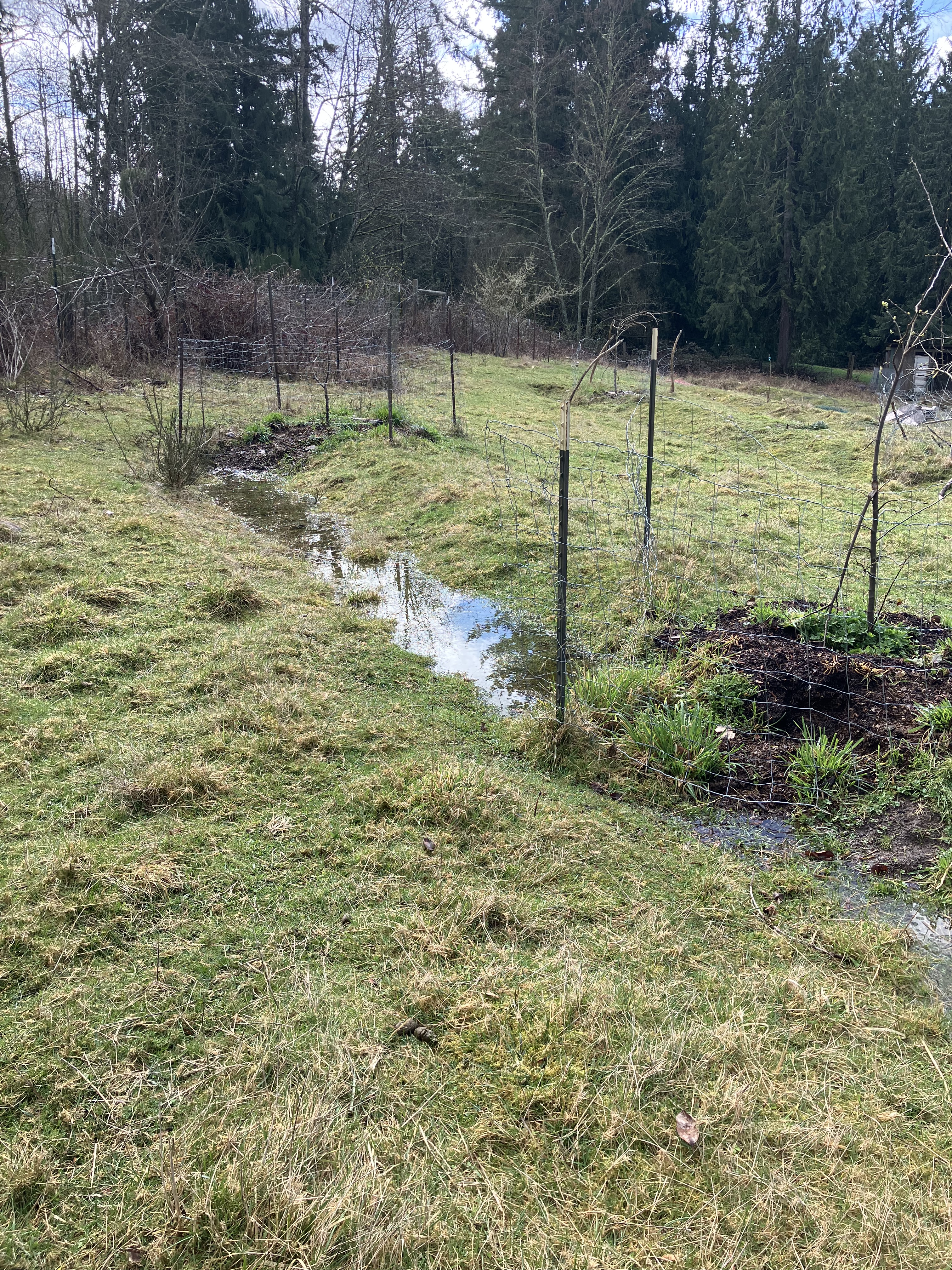
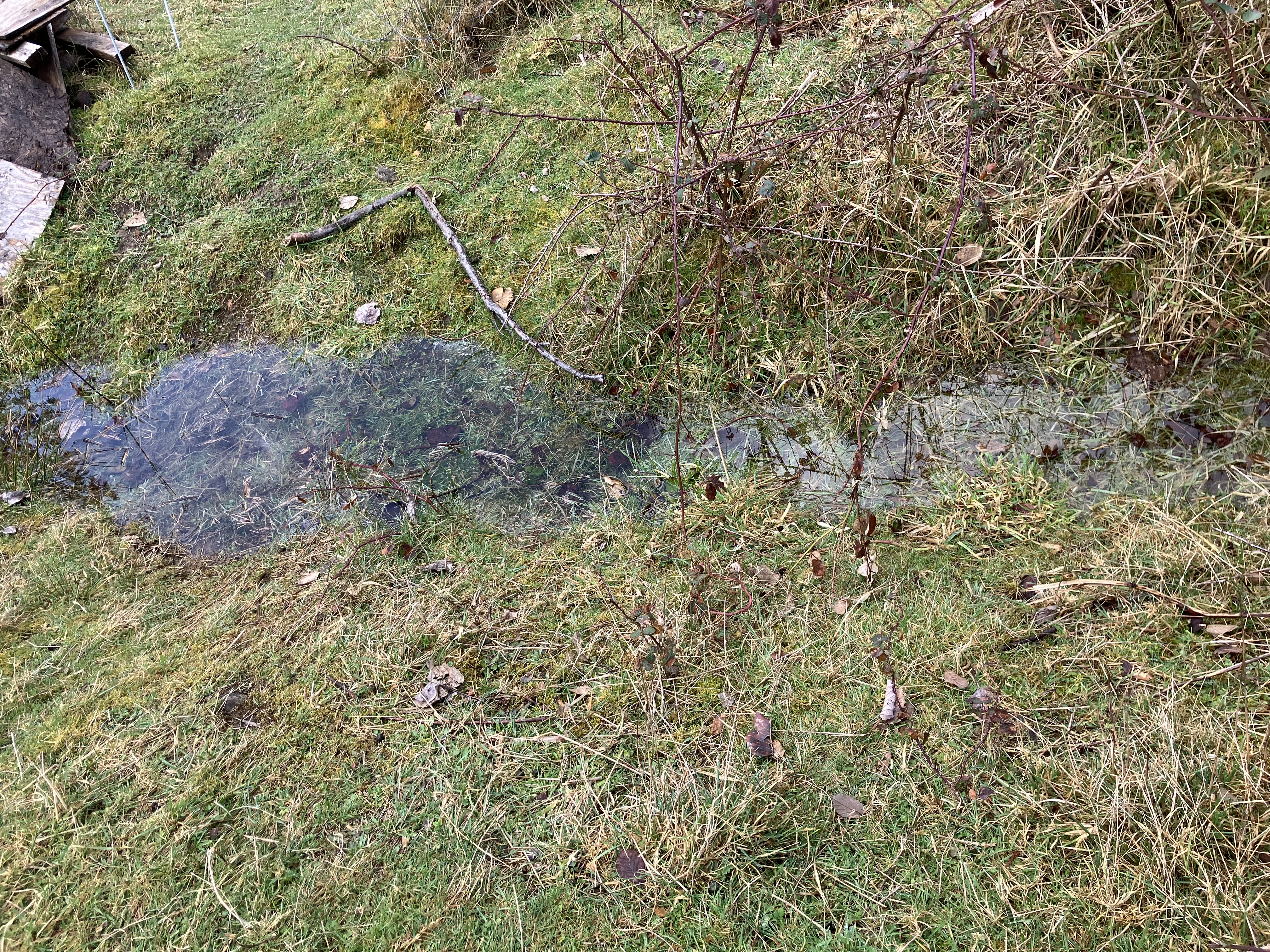
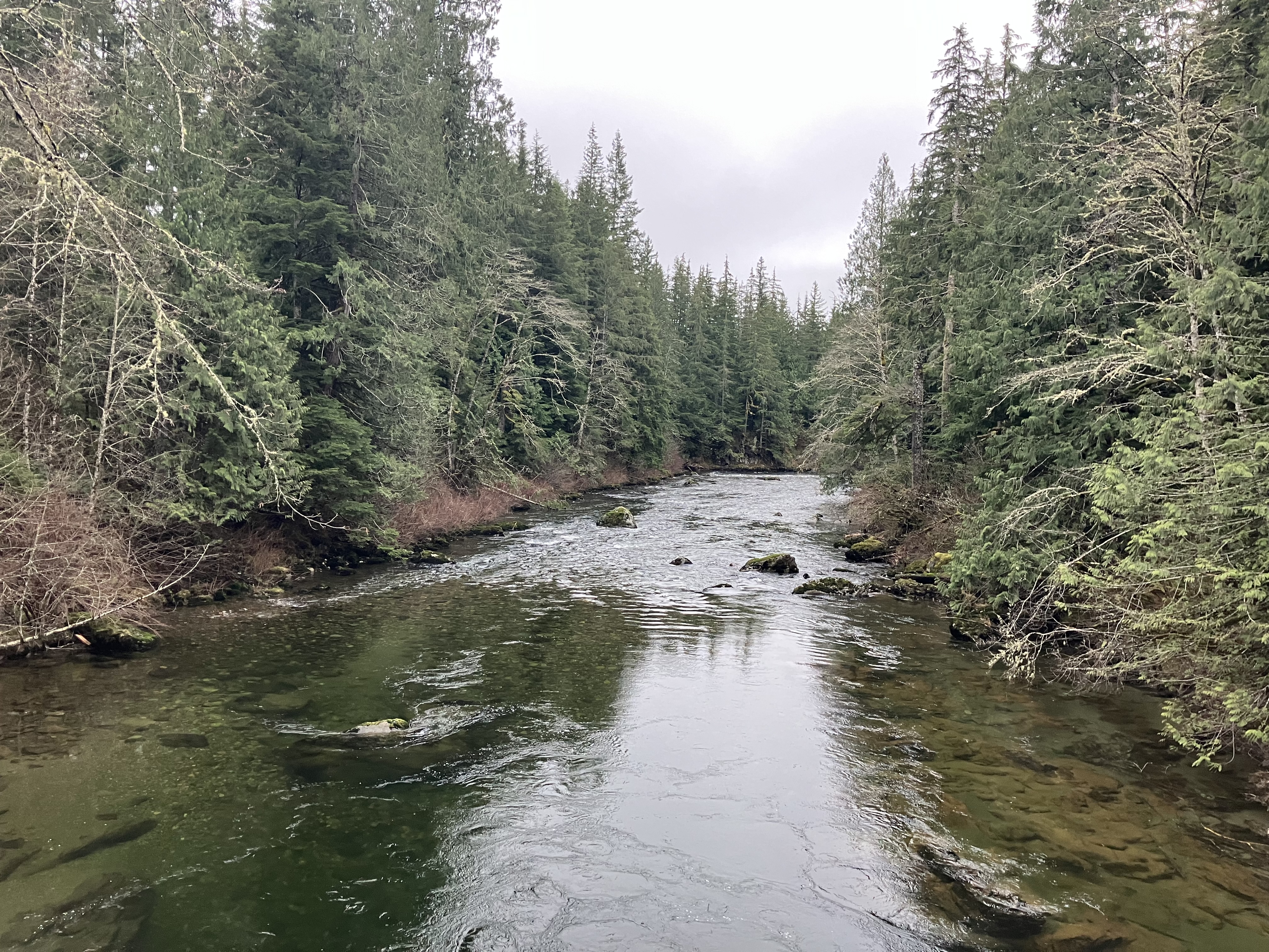
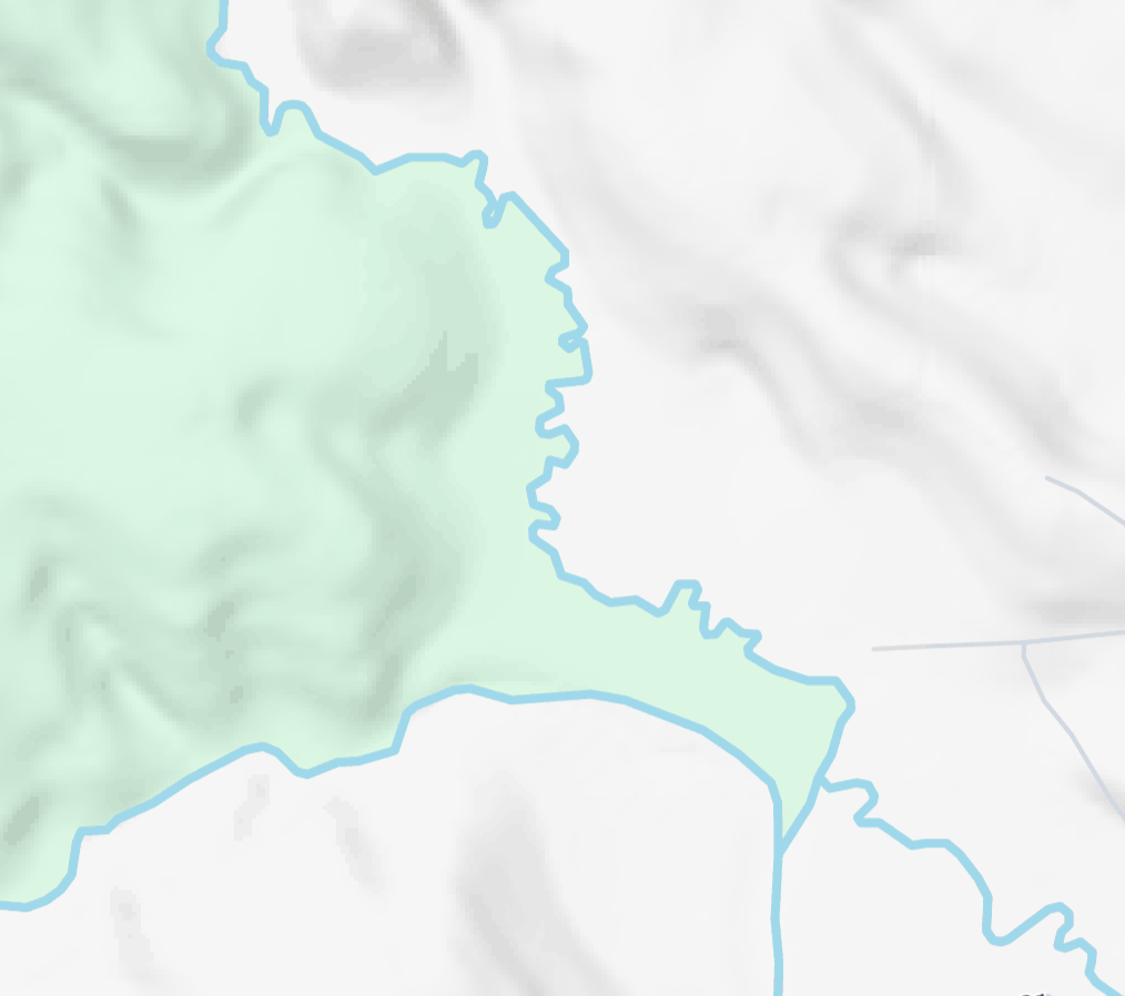
I stood looking down the sharp slopes, off the ridge that drops dramatically down to the creek below. Erosion hit this place hard after the initial clear cutting of the woods. It’s been cut at least twice, with no sign left of the old growth stumps. Such relics were burned, pulled, or slowly ground down under the hooves of overcrowded livestock. After the trees were removed, rains and melting snow came roaring down the gullies, carrying off rich topsoil and the seeds that would have germinated into new forests. In this particular landscape, now parceled into several properties of a few acres each. The Dutch grave stones tell of one family’s attempt to settle and manage a cherry orchard, shipping the fruit along the canal established in the 1800s, which connected to The Hudson River from Pennsylvania, and offered a direct water rout to New York City, once New Amsterdam. The building materials, coal, and agricultural products that left this landscape for the big city took quite a toll on the living world, but people made a lot of money, and progress was made. The farmers here were encouraged by the profitable markets, and set about straightening the creek and draining this marsh to create more arable land for production. Below you can see the creek and its unnatural straightness. I’ll also share a terrain map to see this creek compared to it’s untouched sister over the next ridge.

The family that settled here came from an ancestry of lowland dwellers; sandy bogs, tidal marshes, and expansive fens bordering the ruthless North Sea back in Europe. They were industrious farmers that reclaimed land by draining it, and that’s what they did here, even though it’s a far cry from tidal shore. Still, there is good soil in wetlands- peat moss and layers of rich organic material that can grow anything. Once drained, the land could be tilled and planted, or turned into good pasture for animals. Dairy was huge in this area of Ulster County, and with the advent of pasteurization, milk could be shipped by train. The area was booming economically, and maximizing anything off your land was paramount. I can only imagine the mud and muck labor that went into digging out these wetlands and establishing the cherry orchard.

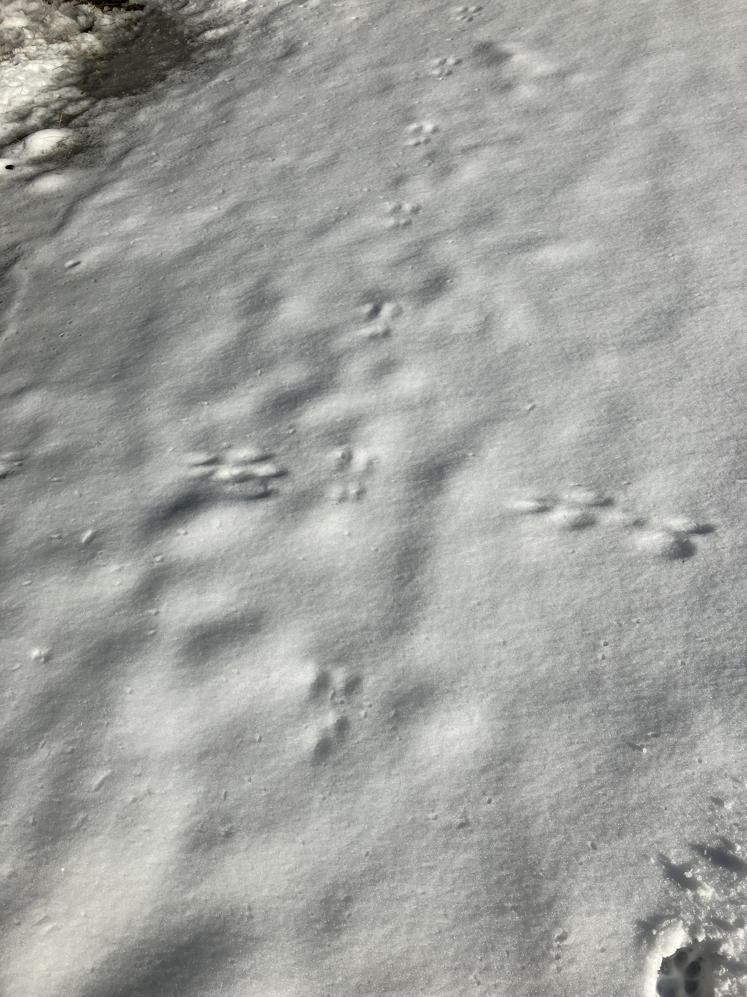
By then, most of the American Chestnuts were killed off by blight, and the entire forest makeup shifted. Millions of animals would have starved to death without that crucial abundant nut source, and what was left by the mid 1800s was shot and trapped for meat and the dying fur trade. I say dying because fur trapping had already wiped out the prized fur bearing species like otter and beaver, fox and martin. Without the balance of predators, forest habitat, and healthy genetics from a thriving population, wildlife in the area. crashed, and what we see today is a shadow of what once was. What there is a lot of now, is ticks. I was constantly pulling them off me, shaking them out of my cloths, and checking everything that felt like the tickle of squirming insects on my skin. The ticks carry Lyme disease, and you don’t want it, trust me.

Another imbalance in this wrecked ecology is the age of the trees. There are no young seedlings or saplings in this landscape, well, a few beaches and crabapples, but no pines between germinated two inch seedlings and still maturing 80 year trees. I’ve encountered an ancient Eastern White Pine on the corner of a property in NH once, its diameter was 8 feet at the base. The branches of that majestic old growth pine are the size of the current mature stock in these woods. It’s hard to see what is not there, but young pines are a huge missing piece in this woodland, along with other young trees like oak and cherry. I tried to capture the amount of germinated stock that is present, as well as where it’s missing all together. On a drive through the area, I was able to see younger pines along the roadside in some places, so they should be present in our woods, but they are not. I hazard a guess they’re being eaten each winter by rodents under the snow, but that’s just a guess.

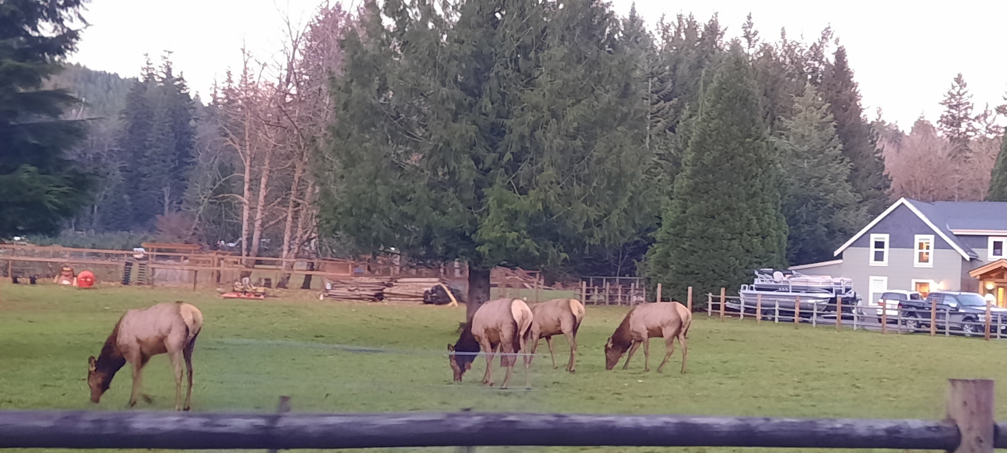
The leaf littler is slowly building up again, covering the ground to protect it from erosion, but there is still damage being done, and ruts of lost soil are growing every year. At the same time, there is attempted healing, as the erosion pulls down the banks, the trees fall in too, making mini dams and slowing the water on it’s way. In time, log jams will cause the creek to jump it’s banks, flood the surrounding lowlands, and in many more centuries of work, restoring the wetlands that once were. It will take more than vegetation to do this work, the native wildlife must return, and with it, the detail work of eating and pooping that disperses seed, churns up soil, and adds vital micro-nutrients to the soil for long term forest health. Vanished species like elk and the billions of birds that once darkened the skies on migration are necessary to return this landscape to what it once was, but this dream will not be reached, so long as people continue to develop and squander the land, rather than working with it, and returning the space to habitat for wild living things.

Like the small steps we’re taking at EEC Forest Stewardship, the small steps in Upstate New York can be pivotal to starting that rewilding. Replanting native vegetation, slowing and sinking surface water, allowing space for wildlife to live, seek shelter, breed, and raise young. Accepting we are only one small part of the complex living earth is the first step to seeing what you can do in your own small way to help return the natural world to a balanced state- and that state looks different to everyone, so finding common goals in your community helps tie together the end goal in conservation and restoration. As I’ve shared with these beautiful friends back in New York, your local conservation district is a great place to start. Most counties in The US have them, so look yours up and support them- invite them to your property if you steward land of any size, and if you don’t have land, you can still volunteer to help protect lands that are in the care of your conservation district, which is still making an important contribution to conservation in your area.

The adult pines are still dropping their seeds into this forest, making space for a new generation each year, and in time, with some help for land stewardship practices, younger trees can begin to return, and a wetland can be restored. Imagine the possibilities once a landscape is back on track to becoming whole. Well, you don’t have to completely imagine, here are just a few examples of active restoration work that has saved wild places all over our country, and the world. Coming back around to this little forest and stream in upstate NY, I’ve shared a vision of BDA (beaver dam analogues). Slow the water, meander it into the wetlands to sink in, and allow the natural habitat to restore over time. It’s a small step in the right direction for a landscape patiently waiting for some TLC.

The people that settled here in early colonial pushed inland to exploit natural resources were caught up in economic schemes for personal gain, and to be clear, that’s still a thing all over the world. But you can stop this cycle by not participating or supporting thoughtless exploitation through voting for progressive conservation minded politicians, donating time, treasure, and talent to your local conservation organizations, and spreading the word to family and friends. Though the legacy of our ancestors has left a lot to be desired, there is always opportunity to change out ways. Please join me in working towards restoration, it’s the best way to heal our earth and ourselves through re-connection to our own rewilding too. Much gratitude to this wild earth for continuing, especially those white pines still dropping seed each year for a new grove of young trees that might one day come. Thanks to all the original people of this landscape, who remain, and keep asking for better stewardship and land back practices that help return our lands to wilderness for a future where people, plants, and animals all thrive together in an intact natural world.

Lake Heather Adventure

In early October, 2025, a couple of friends and I took an adventure day in the area of Mt. Pilchuck. Earlier last spring, I had climbed most of bəlalgʷəʔ before encountering snow. On the way up, I’d seen down into one of the steep draws and seen a small lake. My friend, hiking with me, commented that it was Lake Heather, and that she had made that hike with her family many years ago. The trip is about 6 miles in total, with 1,200′ of elevation gain on generally gradual terrain. I read up on the description on Washington Trail Association, and noted the warning of primitive trial through some large root systems and cascading hillside seeps. There were old growth trees a few miles up the trail, with second growth forests, and water features along the way. The trail would then circle around the lake, allowing 360 views of the mountain and ridges above. I looked forward to viewing the hike to the peak above, after viewing down to the lake where I would soon be. Perspectives like this give a glimpse of scale, and I appreciate the vast wilderness still available no more than a few hours from my front door.

As we began from the generous parking area, complete with state park facilities (compost toilets). A well marked trailhead, located across the street, held the common advisory board, including trail map and any hazard warnings. Things looked good, and we began our trek on a well graveled, recently upgraded first mile of the hike, enjoying new gradual steps on steep rises along the mountainside. The new gravel led us into a false sense of security, making the road easy and neat as we ascended. Then, quite suddenly, the trail maintenance ended, and an epic climb truly began. It’s not that dramatic, just suprising to be in a scoured landscape, where a canopy of forest remained, but the ground was mostly gravel, roots, and some active water moving down the slope.

It’s hard to fully capture what the trail eventually devolved into, but we managed to follow it, and, short of a few 3 foot lifts to get from one level of a drop to another, we had a relatively pleasant climb into beautiful intact groves of forest that were truly enchanting. There was a stark difference between the lower part of the trail and the upper. Some areas seemed scoured, and the group hypothesized about what might be going on. There were endless exposed roots all over the hillside on one part of the climb, far beyond what you might see on an overused trail needing repair. The restoration of well loved trails is a continuing process, with higher elevations becoming primitive in some places through continual use and nature’s entropy. One theory we all enjoyed was a flood of water from the lake out-pour. Water could easily create this scouring effect down the hillside. You’ll see some moss, but with all the ambient light, plants should take hold, but the lack of soil prevent rooting. The trees have taken desperate hold in areas once clearcut. Further up the trail we would encounter a much more lush environment where soils remained and more level terrain allowed topsoil to establish, even with frequent flooding.

In the picture below, a second growth cedar lays down hill on a slope where scouring has occurred. Roots lay bare, branched from windfall scatter the ground in seemingly arranged piles all facing the same direction. Following the downhill flow of flooding, the ground cover sweeps in the flow that still trickled down the peak, creating cascades of small waterfalls and flowing lines, directed by solid rock foundations of a long extinct volcanic magma chamber. Millions of years cultivated an old growth forest, ranging from temperate rainforest at the base, to sub-alpine spruce stands along the alpine lake, skirting scree piles laid down by uplift, fault shifts, and the dynamic landscape of The Pacific Northwest.

The shift from slope to generally even ground signaled the formation of wetlands. The lake’s outflow was a vast delta of forest, willow edges, and transition from cedar to spruce. The older trees were not so large, having to navigate high winds coming up the slope, or pressing down off the peaks in a northern gale. Fallen giants lay as testament to the storms that form off the towering ridge lines above. The weather that day had foretasted breezes, and that means gusts of 30mph or more, which would be adventuresome on this trail, in this ecology. We had entertained canceling the hike, but the forecast shifted to milder calm transition, so we went for it and lucked out with mostly dry hiking and only one brief downpour. The sun managed to flash a few times, and clouds held off long enough for us to get a few photos of the towering ridge lines supporting bəlalgʷəʔ ‘s out of sight peak, several thousand feet above.

The trail loops around the lake, on a well constructed boardwalk in stretches that cross the wetlands. The south side of the lake hosts some impressive boulders, craggy enough to have fallen from above in the last few thousand years. Glacial erratics will usually have obvious rounding in places from the ice that carried them along and shaped the whole region of Puget Sound. River rock around here was still impacted by ice about 10,000 years ago. That’s when the last ice sheets from the north retreated. bəlalgʷəʔ was already formed by tectonic uplift, and millions of years before that, it was an active volcano in a shallow sea archipelago, or so one theory goes. I love picturing all this change as I walk through, understanding why the layers of rock are here, how they were shaped, why there is a wetland, and how continued flooding has scoured the current slope down from the lake and valley above. This drainage basin gets clogged by flooding down steep slopes of rock, the lake’s wetlands sponge up as much as they can, but the running rivulets spill over the confines of the shallow plateau. Mountain torrents are not uncommon, and to see the evidence of this erosion chaos on the mountainside signaled the dangerous potential for hikers ill-informed about the mountain’s conditions.

On our way around the lake, we also found some nice mushrooms. I’m always on the lookout for some edible delights in the mountains during The Mushroom Spring. Our group hunted passively, but still managed to spot enough boletes to fill a couple of zip locks. That’s some good eating to take home. Spruce forests yield boletes, specifically porcine on this hike. It was a pleasure to group find and then send one runner (me) over to harvest. They were prominent around the established camping areas, through at this time of year, no tents were present. The mushrooms added a little extra flavor to our hike, and there were some https://lnt.org/good observations about a number of other fungal friends we encountered along the way. We were harvesting near the trail, which is important to remember when you are in a high impact area. Please try not to go far into the un-tread areas of the woods if there is a clear trail, especially in more remote areas with established ground cover or wetlands. Your tracks into the deeper wilds will soon lead others, until there is a new established trail cutting open the last habitat structures for our beloved wilderness. Trails and access is planned, constructed, and well marked to keep us off the sensitive terrain, and to allow wildlife some space. It’s another reason leashes are encouraged, so our pets don’t stress wildlife or disrupt habitat with scent, which deters wildlife. We are guests in nature, and when we are good guests, nature remains intact and enjoyable to visit, when we are bad guests, trash collects, latrine abuse abounds, and trails sometimes close all together.

Our original plan had been to hike to Lake 22, next-door to Heather Lake, in the neighboring plateau, but it was closed for maintenance through the week, and we had to change destinations. I’m glad there is funding and labor to fix these trails. There had been massive reconstruction of the lower part of our trail earlier in the summer, and that hard work was evident in the smooth hiking for about a mile at the start. This mountain is becoming a very popular daytime destination for folks living in the greater North Seattle area. As development continues to boom in the surrounding towns, the nearby ecology will have to bare this influx of outdoor enthusiasts hoping to get a little R&R in their backyard wilderness. That’s why I live in Western Washington, just close enough to Seattle for the airport and economic boon, but also far enough away to be within an hour of most local hiking and wilderness adventure spots- enough to keep me busy in nature connection and learning most of the year. To continue that enjoyment, and the access, we all have to do our part in being good guests in the landscape, and mindful of how and when we recreate to avoid overtaxing the precious natural world we wish to explore and be in.

Gratitude for the opportunities to share outdoor adventures with friends. To the weather that day being agreeable, trail approachable, and our safe accent and decent. Thanks to the nature all around us, the beauty of a growing and ever changing world, and our place in it. Joy in finding wild food, mushroom abundance, and friends to share it with. The Northwest continues to be home, teacher, adventure, and cultivated community, what a life!

Cooler Aloft

Another opportunity to get into the alpine wilderness for some exploring and lake swimming found me up in DNR land just outside the tree farm with an awesome mentee. We hiked in to three lakes I’ve written about before to enjoy some cold swimming and wading on an overcast day. In a wet suit, these lakes are swimable, but if you don’t have a layer on a cloudy day, it won’t be long before shaking takes you out of the water. As clouds brushed over the ridge peaks around us, the wind picked up, pulling at the surface tension to create ripples across the reflected gray sky. There was no rain coming out of those clouds, but the cover kept the hot sun away, but made it hard to keep warm in the water. Drying off soon after our aquatic attempt, the flies began to gather and we packed up fast. Moving is the best way to avoid insect encounters, and as we bushwhacked back towards the trail out, I appreciated the breeze that had been chilly, but was now overpowering the flight of small gnats and no-see-ems.

The hike out was peaceful, with swainson’s thrushes echoing across the mountainside. On the way in, it had been silent, and I wondered why the birds did not start singing until later in the afternoon. Many birds are nesting right now, and a few flushed from their nests in agitation as we went by. The other occasional vocalization from nature was a pika. The chinchilla sized dark gray rodents thrive along the scree fields in these high mountain ridges. It takes the eye a moment to find them amongst the boulders with patches of lichen in similar shades of brown, black, gray, and white. This incognito persona protects them from predators, especially those from the sky. Can you find the pika in the picture below? It’s standing full broad side, head facing right. It’s making an alarm cry, and if you look to the left of the taller slide alders in the foreground, you might see it.

Besides the wildlife and water features, this hike goes through some rather special plant communities that specialize in rock faces and mountain seeps. From bear grass to tall bluebells, the plants are off the hook out here. My guess on why this once logged area is still so diverse has to do with allowing the original seeds of the place to germinate and return. When we clearcut, spray, replant monoculture, spray, and cut again in less than 40 years, it degrades the landscape and does not allow seeds to recover in a year or two. Once the plants are removed, only the original seeds can bring them back. In the active logging farm, none of these rarer wildflowers, herbs, and shrubs can be found. Here at elevation, the logging was not worth the trouble after a one time lesson, so the land has been left to its own recovery, and the vast native plant diversity is on show. The orchids were hard to get in focus, they are so small. Wetland plants are sensitive, and because people have been draining wetlands for so long, we often miss the beauty found in these delicate, rare ecologies.

Even through it’s a lot dryer this year in Western Washington, the Pacific Ocean still banks it’s evaporated moisture up in The Cascade Mountains, where this wetland, and most of my mountain adventures take place. The water then cascades down the slopes of these rising peaks, lifted by the tectonic activity of subduction along The Ring of Fire. This complex geology and dynamic landscape are often out of mind in our more recent timeline of human settlement, but the oral history of native tribes often tell of great upheaval in recent past. Geologists studying the layers of sand and plate movement confirm these vast changes caused by the plate movements. I am grateful for the mountains that form out of these tectonics, but also have the threat of earthquakes in the back of my mind.

A spring trip in May 2025, took me to a recent erupted strata volcano in our state that you know might know as Mt. St. Helens. Loowit, as she’s know by the locals- aka, tribal people who have lived in the area for over ten thousand years, had an eruption that was considered minor, but did a heck of a lot of damage which you can still see evidence of today. Mt. Tahoma is my closest strata volcano, and no, it’s not about to blow, at least not yet, but rumblings do come and go, and our understanding of eruptions and predicting them is still evolving. The Central Cascades, where I was hiking on this adventure, is not volcanically active, but is in an area of dramatic uplift.

These impressive granite ridges were once melted magma deep under the earth’s crust. The amalgamation of magma chambers cooled in time as the ground continued its uplift, and after a few million years of glaciers grinding and retreating back and forth along the northern part of the continent, magma chambers, now granite, remain the backbones of much of these nearby peaks. Back down a few hundred feet, towards where I park to hike into these cooler elevations, the landscape is dominated by basalt cliffs of lava that cooled and formed on the exposed surface. I’m still trying to wrap my head around the formations and timelines- and I think a lot of professionals are still debating and forming their own theories too, but the point here is, this rock is old, and the exposed granite can best be found by climbing up into the elevations. The rock is cool to the touch, even on a warm day, and seems to lock in the cooler temperatures that remain at elevation. When the clouds come in, wrapping the whole place in mist and wonder, I am so thankful for the chance to get up into these mountains to bathe in 10-20 degree cooler temperatures that the mountains provide.

Working Waterscape

We’re all about passive systems here at EEC Forest Stewardship. Earthworks projects on the farm revolve around water catchment, redirect, and slow/sink intentions. Out of such work and planning, water, which we sometimes get a lot of here in Western Washington, has a good place to go for long term investment in drought resistance.

Our swales are one of the most simple ways to slow, sink, and store water. Above you see a swale at work with recent rains. The water can sit and slowly sink into the ground, moving down hill towards the young fruit trees establishing on the mound down hill. Other than initial earthworks, done in a few days after a year of planning, this system is self sustaining and crucial to keeping the forest alive as it slowly returns. This water will also make it’s way down into the aquifer, which feeds the well on this ridge. With all the housing developments down the hill from this farm, much of the water that used to sink in on this ridge in the once complex old growth temperate rainforests, which are now completely gone, now spills down and away along road ditches to the ocean beyond, lowering out potable water table until wells run dry. The housing developments below are unconcerned, because they rely on city water- like so many today. The corporate nation dreams of the day it can fully privatize water, which, though a fundamental human necessity to survive, would make a great commodity on the markets- already does in bottled water. Our utilities are becoming more and more expensive, with less and less investment in the infrastructure and care needed to sustain the expanding construction to keep up with housing shortages. So, it’s good to keep a well and work to keep the water where it falls- or nearby enough to support the living vegetation also crucial for our survival as a species.

When there are major rain events, like the nearly 1/2 inch that fell the night before these pictures were taken, the water sometimes sits on the surface “day-lighting” for a day or two. Our sheep and chickens, as well as the geese, enjoy the fresh water to drink and play in. Some of the water is directed into catchments. There are a number of pipes under driveways and gardens which lead to our central water feature- the pond. With years of observation come smart design with nature. After reading the water running across the land for many seasons, it becomes easy to make a smart water plan for catchment. I’ve even added more design over time, after the initial implementation of earthworks. Having a machine do so much of the digging at the start is helpful, but takes some planning and investment. The rewards are endless, because once you’ve set the design in place, the rest of the work is passive and free.

One of the most recent redirects implemented at EEC goes from a rain garden wetland habitat, down a driveway, around the back of the pole barn, and into the pond. For almost a decade I watched a stream of water heading down the driveway and on down past the barns, along an access road to the back pasture. It was starting to cut into the road as it picked up speed down hill. By redirecting the flow at the top of the hill, the erosion was not only stopped, but more water then went to the pond during major rain events. We’re now catching even more surface water to slow and sink for the aquifer, and forest below. The pond is not sealed, so water can slowly seep into the ground. The pond does remain year round, and there are fish living in this modest waterscape. The system has yet to fill the pond high enough to actually top the outflow, but having two input pipes should bring us closer to that goal. Stay tuned for our next major flooding event.

Transitions

Pacific coastal rainforest is lush and full of activity, even in January. It’s also been a mild winter by the start of 2025. Snoqualmie, the river moon valley, ropes through ancient glacial lake bottom in echos of evergreen forest, now twigs and matchsticks more often than old growth. Still, a wide, deep river sister follows a signature ice groove along a managed forest with minimal setbacks bordering erratic boulders and cement rebar bridges, which I drive on this vantage, overlooking salmon dreams, whispering needles, scaled harmony. Poetic bliss, if the fish were here, historic numbers are a song on the wind. Oral history told by important kin to the fish nation, and I wish them well in their defending. Water, life giver, purity and quantity, though still deeply rooted in a cycle, became a hostile combatant to man made disruptions. Snoquamie Falls is the natural dam of this fork of flowing water that floods human endeavor and becomes a monster. It’s only our own projections, along with construction of our own egocentric ambitions to monetize the natural cycles of crucial complexity we prefer to destroy. A destructive lineage tracing back to those mammoths people are talking about resurrecting. But I love to digress- or transition?

There is this place, where water brings abrupt frocking, these transition zones are all part of wonder in nature, scaling upward, a few thousand feet from mere home ground 4-600′. An alpine lake reflect that hint of robin’s egg blue, and bird song echoing the winter quiet into melodic texture of branching twig cracking under the tire turning my box of metal ride up a final steep climb and into that white track of temperature trigger of physical form. Ice at the root of such garb, on a molecular level. Not like the lake, which rippled invitingly, etching the elevation in charcoal, navy oceans of deep stone trappings. There’s actually a quarry, right at the final turn around the climb and gaining a last look at the tranquil, the truck, pup, and I raddled along the very stone taken from the abrupt change, yet another transition, quick, and then gone around the switch back, and the next bend into daylight’s shining embrace.

Roads stretch flat, a pure white water, yet also still and sharp, like my mother’s linen, the folds of time, layers of second and third dusting, There is not enough to ski, slick, in full sun, soft to the step, but shallow; scraping of an oil based product I’m also heavily wrapped in as a final shell of protection from cold habitat, crisp in step and hiking upward in a steady climb across clearcut, with recent replanting- our “plant a tree” farewell songs of loss for commercial gain, and home grown, local; part of the effort to fold in recycling and our waste systems… but I digress, I guess, again, as one wheel in the universe of life- I can’t start musing on what is without what for. Therefor, Boldly choosing to move forward and literally climb into the first peaks, it was a delight to park, let the dog out for some good snow time, and let my body fall into rhythms of ancient tellings, smells you only get outside- even if they are tainted with traffic exhaust and the smell of oil cooking, sloppy grease traps, or the sour sick whiff of freshly spread manure from industrial agriculture, not to mention build up of us, the settlers. Less than aware ancestors cut old growth hillsides over one-hundred years ago, then another generation got the second growth with the understanding of a last good harvest. In my lifetime, by third growth, commercial development of the valley below into the cities at mouths, deltas, or filled in wetland from here to the sea, inland waterway often clogged with meth shellfish, motor traffic, diesel, hydraulic oil, ballast putridity, and the last orcas evolving to tolerate the conditions we the people have rendered uninhabitable, all the transitions are still part of the the same living network of collective survival, technology cannot bring us closer to said resources without destroying them, and our very beating hearts.

Every important piece of ecological functioning uninhibited, deepens purity of the sources; from the water sheds, to an even more crucial system of long term filtration. The ground is not being poked here for intentional deep well disposal of industrial shit. Our needed comforts, like my synthetic sports wear, still produce these unwanted waste chemicals, and even the wash water from my laundry, and in many homes, the petroleum based detergents, will end up in our water. The heavy metals in all our systems, even personal digestive tracks of the many billions carry these toxins, gaining them at first conception, through genetic marks they leave on us, our biorhythms, leading to cancer, or signaling our lives as having gone too far into comfort as a magical remedy to the realities of life? How am I coping? Maybe I light up a joint, take a drive into the mountains to move and observe, reflect and grow into place with purpose, driving into the edges of wilderness, pushing out a few deer, squirrels, snow shoe hare, and countless other beings already fully immersed in themselves and their place where wildness is required for long term survival. I did leave the truck a couple of miles back, hopefully it remains dependable as a ride home.

The survival rate varies form species to species, but our race, the human populous at large, would not last long out here alone, but together, with enough others, you can transition beyond mere castles in the sky longing, and into community building. Building is what got us here, or so I’m told by the western centric narrative of “U-S-A” chanting idiocracy we just voted in a second time. What a transition that will be. Look! The rabbit’s made the sign of the cross- nature is protected! I recall Magic The Gathering, in which, I’d cast the card Circle of Protection White, and the next four years would be shut out, returning me to reality after the tornado, house dropped on the witch’s sister, and a yellow brick road we’re all still following towards The Emerald City. Pay no attention to the man behind that curtain and keep clicking the red slippers repeating, “There’s no place like home.” This was not what I was thinking as I climbed at the time, but something triggers in the back of my mind at the thought that these lands that I walk are stolen, by our own negligence and people. We’ve taken the bait, hook, line. and sinker. Now, past the tipping point, while walking in fast melting snow, the waters that would have to keep our wells wet and the animals, all of us, alive through hotter and hotter summers. This is something I now think of with each drive up. But look at that view, and the bought access and freedom to some here, so American.

The clear cut gives us this lovely view looking back down the draw I’ve been ascending, a reasonable road hike to about 1200′ of elevation gain at a modest slope and a couple of stream crossings- over bridges. This is the private commercial timber products operation, which literally built (and still does) the civilization enveloped in a beautiful transition of cloud, water in a most haunting, yet crucial part of temperate rainforest ecology. Beyond the inversion, jetting peaks of The Olympics rise into a well named National Park of excellent wilderness, and beyond, the Pacific coast. Layers of so much nature you might be lured into the false sense of abundance in natural resources and the basics for survival, but it’s not enough to sustain this population, and that’s another thought tucked away in the brain, which sets off alarm bells, but the temperate rainforest is where I want to be for the best chance at survival if the comforts were lost through unpredictable happenings of this earth.

I reflect on L.A. right now, and what mental health workers are calling immediate steps in transition, encouraging victims of fire to plan in small graspable moves, get food, water, shelter, the usual survival drill. I do not mean to say this tragedy is simple or usual, though it is man made. Development greed and continued denial of human overstep wherever and whenever we want. As I watched and listened to the governor of Cali proudly say he would wipe ecological restrictions out of rebuilding requirements, I could see the lineup of future fire destruction in these overpopulated places and grieve. When temperate forests dry out in prolonged drought, fires will happen for us too. Rain is good, waters must run deep to keep us safe from fire’s consumption. Before I share with you the magical tail of temperate, I’ll anchor my wander in the picture of this aspect, under the veil, and you can see the developed world at work.

It is a city in the clouds, and a micro-macro in computer technology, the birth of such spells and casting now ruling our consumer, social, and soon to be political personalities far off, as though in a distant land. It’s like that here, what a privilege, in a private acreage, admiring the spectacle, and being one at the same time. Wait, what? Let me draw your attention to the patchwork quilt in the rolling hills and valley below. That’s where the farm is, and where I sleep. There are still some standing groves of second and third growth, maybe some that might be left for a few generations before falling into manipulative speculation or castration of wildness for all. I’ve cut trees, asked and paid others to do so on the landscape I sometimes curate with my own ideas of stewardship transition, of wandering as a right, possession of pace and space, wherever my feet are planted.

Brave little wetland setbacks that have been granted, in more recent tending of this land, a common thread in developing, to build, taking is the order of business. Order, tight squares in neat harvesting, these hills could be rice fields, no, we have not cut our jungle usefulness as a resource that can be swiped, bundled, and chopped into board feet. Left face of this rise out of the Snoqualmie Valley and Rattle Snake Ridge beyond, where there are timber investments from LMNO alfa-beta medatronic meta-gaming. Metagaming mother nature, for those of you more hip techno-files out there AIing the you know what out of finite, as I type, or hike, loosing steam, but looking back at the time and space passing, appreciating where and what I can be doing to transition. How about casting a spell?

Spellbinding, movement, frozen, liquid, bubbling chatter under thin ice. Here, the freeze is only skin deep. Snow is blanketing the open space, but where the stands of uncut forest remain, there is open ground, and a wall of sun catch for the south facing hillsides. Still, erosion pulls at the road cuts, scabs put down to give people, like me, easier access to the first peaks left behind ice flows a mile deep in memories compressed into stones, layers of boulders and pebbles give way to allochthon signatures, vaulted granite base with volcanic wedded basalt linger. Not quite spires, but no less towering in formation, the scent of alpine spruce has overtaken cedar and fir domain with the stiff bristled hardy stands at the edge of the commercial boundaries, beyond, more transitions of mountain scree, frozen alpine waters that, in high summer, offer beauty of turquoise depth. Seasonal transitions aside, on this day, a return to my evergreen chariot and drive through grey daylight, home in time to check stock and bundle self into hearth before the frost comes down in it’s own quiet spell into night. The pale rose hinting at setting, pearl globe bouncing off the edges of uplift, calling the evening chorus of those birds who will wait out the night in thick needle beds, perched under down and comfort in the light breeze that sings her balanced little heart to sleep before dark sets a web of mist from mountain clefts to farm’s edge.

Grounded environment, yet change apparent, ever encroaching on the peace of mind, yet the beauty is still there, she painted her subtle hints in breath and sky, along the cold parts of skin where no cover let the light in, along tailored edges, where this transfer of power, from self to source, ashes that will one day plant another tree in the forest of our enchanted societal normalities, whose plot am I gleaning from in the classic sunset image, tire tracks and all. Clear cuts offer space for a mind melded to technology, even without bitcoin. Smart phone, computer whore, and a gasoline consumer wearing her own death suit in water proof apparel. Transition out of these wet cloths.

Backyard Reflections

I live here, and show gratitude for the privilege to wander these hillsides, mountains, and river valleys; home of sdukʷalbixʷ The Snoqualmie.

There are glimpses of what has, and could be again, in a fauna restored to old growth temperate rainforest with massive water systems in rivers, wetlands, tidal bays, delta outflows, and ocean tides. This land is legendary, once roaming with countless elk, where now only echos of mega-fauna, wandering in fractured herds along the valley lowlands in unsustainable patchwork “habitat”. Developments continue to push the last creeks and wetlands into parkland space for RVs and horses. Wilderness flickers in final forages along edges, with few avenues into quiet repose. Two stroke engine noise pollution running daily all around, dogs, hikers, electric bikes, and recreational vehicles push further into what was once peaceful wilderness.

Our encroachment continues, as King County, where EEC Forest Stewardship resides, is the most affluent and economically successful county in Washington State. The northeastern part of said county, where Duvall was founded, is the furthest out you can get and still be in King County. People pay a lot of taxes on these properties, making it harder and harder to afford a life here. More and more houses are built, just as more and more homes are put up for sale. There is a retreat of older locals out of the county, as more young tech workers move in- closer to Seattle and jobs. Salmon, elk, deer, cougars, bobcats, and all the countless forest plants and other animals are removed to make way for more people with grander lifestyle. In the more rural counties, people pushed out of the expensive areas are still expecting the convinces of city life, and so, strip malls and fast food trails after them, broadening the footprint of country beyond designed capacity.

What do we do? Well, the underlying issue around much of the current development is maintaining what’s already there- or not. Usually not, and it’s costing us as tax payers, which developers always fail to talk about when presenting new build. What happens when the new build gets old, and no scheduled upkeep causes rapid urban decay? There are countless empty buildings standing in many cities now, in a post COVID world. No one wants to pay the cost of rent in cities now, and no one can afford housing, yet empty buildings remain, and everyone looses. But in rural areas like Duvall, the gluttony of development is strong- tearing down old farms to make way for expansive apartment complexes, now called town houses, to make it sound fancy. There are hundreds of new build 3 story homes going for 800,000 or more, and offer rural charm with city access- though traffic is an elephant in our proverbial zoo that is a two lane state highway.

The traffic on a typical weekday evening is backed across the valley and up to a mile beyond, making the quaint 45 min drive from Seattle a 3 hour ordeal in the last ten years of growth. Where do the new family sedans and midlife crisis vroom vrooms go? Line up and wait- but Light Rail is coming- 30 min away when there is no traffic, but there is- from Redmond to Duvall, light rail won’t change that, but it will let us get to Seattle from Redmond on reliable public transit. Our other Valley Shuttle, runs from the backyard, to anywhere else you might need to go within Snoqualmie Valley. It’s delightful to know your public transit options to help make an impact on emissions and traffic. If more people could rely on such options, we’d have a much better flow in commuting and commerce. Do I? Light Rail once to the airport- but usually, I put in less than 30 miles of driving a week total, but if I ever need to do daily commuting to a job in town, I’d have public transit. Once the Light Rail gets to North Redmond Transit Station, I’ll be able to take public transportation, at reasonable hours, all the way from Duvall to Seattle with ease, which might solve the traffic headaches.

The backyard plan at the old farmstead is that pair of mules and a wagon. I’d like to find a possible rout from my house to town, but the turn out my driveway heads onto a 35mph double blind well paved road with frequent drivers doing over 50. The mule team and wagon wouldn’t have a chance if a logging truck came flying around the corner. Just as I was planning to move West from Vermont, I began dreaming about riding in a wagon cross country. It was then I looked up possible success stories and only found this. Needless to say, I dropped the whole idea at the time, but am now back to the dream, a little scaled down to my own backyard. It’s a future possibility, but not right now.

These days the truck is a loyal worker, hauling mulch, shavings, firewood, camping supplies, livestock, fruit trees, and more. After ten years of hard work, we’re still a great team, with a fresh set of back country tires, “Reptile” as she’s affectionately named, will be spending more time in the wilds through the seasons at The Snoqualmie Tree Farm, where I hunt, fish, harvest firewood, hike, and snowshoe. Though my most recent late May visit to the higher elevations in that private 90,000,00 acres surprised me with several feet of snow still on the ground in some places. I was not dressed for the weather, but still enjoyed a splendid hike up to some alpine lakes on a foggy day.

The Central Cascades are right out the back door, and within a few hours drive, you can be at over 4,000 feet of elevation and on a trail taking you into back country magic. You can drive another three hours in the opposite direction and find yourself facing The Pacific Ocean, and endless beaches and tide pools on dramatic scale. What an epic coastal landscape, and though EEC is tucked away in the hill country of The Puget Lowlands, it’s a jumping off point to wilderness and adventure just a few steps out the door and down the trail. One of the most often used treks in my own life is The Tolt Pipeline. This fantastically uneventful avenue is safe for dogs and easy to navigate, offering some intense up and down climbs with well drained gravel course to allow smooth foot travel or a breeze in the saddle. I still have to brave about a quarter mile of Big Rock to get to my local access, but once off the blacktop and onto the gravel trail, it’s smooth sailing all the way into The Tree Farm and beyond. I even accesses some good hunting spots by bicycle- and might again off Kelly Rd.

The Tolt Pipeline offers a variety of side trails, but the 8 mile stroll (one way) from my house to the foot of The Cascades is beyond where most people tread. Where the trail terminates, the pipeline continues, all the way to the reservoir up in the lower start of the mountains- as shown on the topographic map below.

This trail is still public right of way, though the access is not easy to find, and the gate is locked, so you’re still on foot, bicycle, or saddle. There is access into public land on the north side of the trail, but the south side remains tree farm, and as you continue east, you’ll end up being off the right of way and in the tree farm, so have proper permits to enter if you want to get to the elevations on this rout. I love it because it’s out the back door without the need of a vehicle, but to get into the tree farm with my truck, I have to drive south about 45 min to get in through the gates we get keys to when we buy a rec pass from JP Morgan. Corporations are people too, and they can own vast swaths of natural resources in a landscape near you. At least I can by my way in, and have for the past ten years. May the access remain available for years to come, as I get much of the wild food I enjoy from this access, and the wood that heats my house in the winter- another crucial part of my personal survival.

Even the water I drink from my well is part of this larger landscape, so water, shelter, food, and mental/physical well being rely on the surrounding backyard, and that goes for most everyone. Sadly, a lot of folks are suffering from ecological amnesia, and it’s costing us our basic needs. If you can’t drink from your tap, there’s a problem. If you can’t access locally grown affordable food, there’s a going concern, and if you can’t find peaceful mental relaxation in a green space within a few minutes of your dwelling, there’s a blow to mental wellness. If there is no access to wild places, clean water, and food- quality of life suffers, and eventually, the human condition breaks down. When society begins development around finite resources and basic needs, when the wilds are given space to breath, when people find caring to be more productive than manipulation for personal gain, when the people can look one another in the face and say hello, ask for help, and trust one another; when that world arrives, I’ll have my two mules and a wagon in the backyard.