
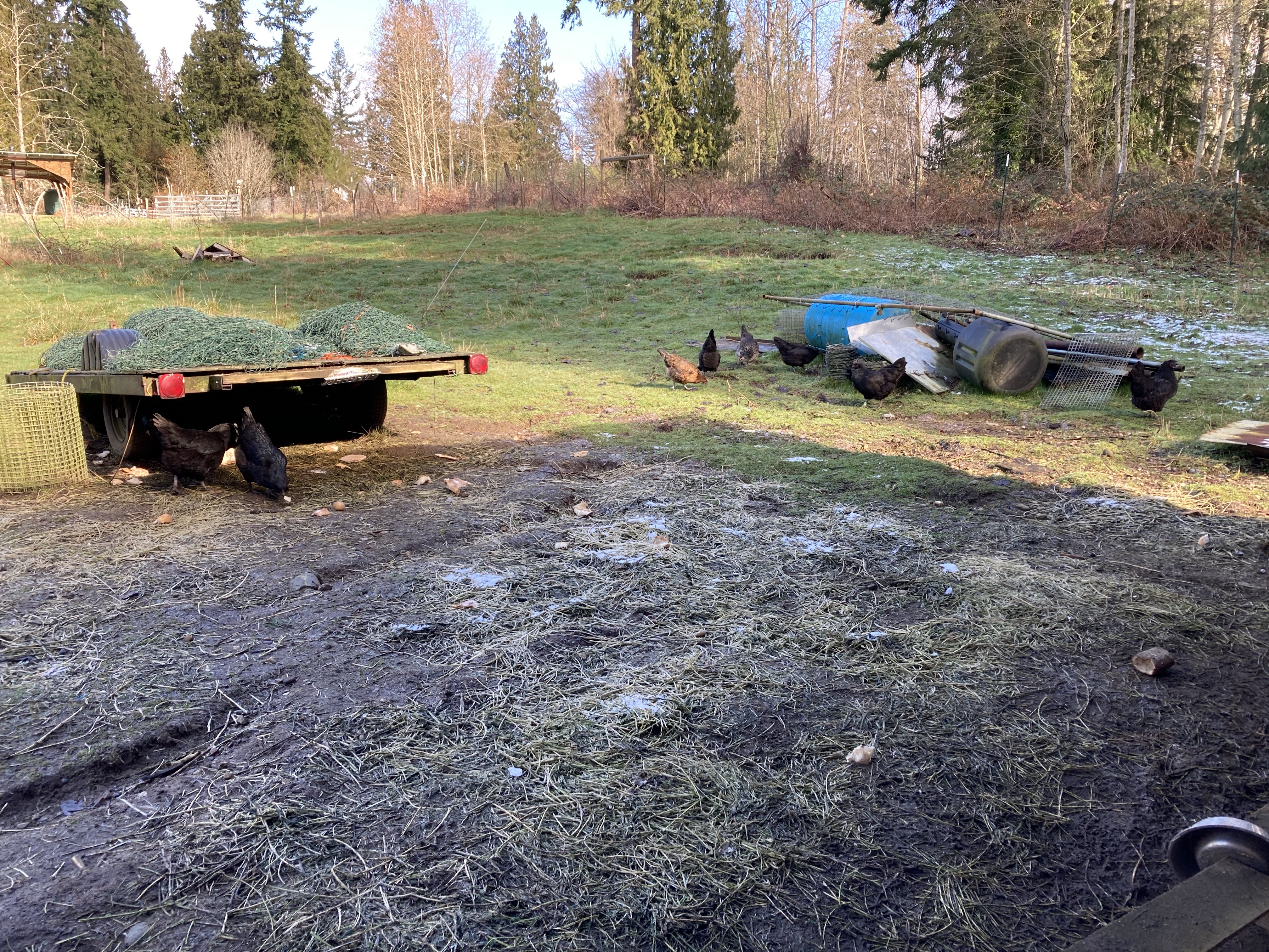
Winter rains reveal complex water systems within the landscape that are not always easy to see with the naked eye. I’ve been reviewing drainage around our chicken coop and problem solving some recent runoff spots forming around a very active space, causing mud and flooding around buildings and animals. It’s a very mild issue at present, and might be caused partially from the compaction and lack of ground cover around a summer construction area. The introduction of a trailer- rain barrier/catchment surface- which funnels the water into a concentrated flow does not help the space stay dry. Standing water on the ground’s surface is not great- though common in saturated sub-straight. I dug modest redirect ditches to keep the water out of our hay shed, and the flow only happens in flood stage rains- which are common enough in our temperate rain-forest climate to cause concern. Tracking other elements of this flooding, I followed the water in high flow and found it is also coming from the east of our property line, out of the neighboring land, where a gravel driveway was implemented without any drainage planning. This discovery, though unfortunate, did reaffirm the correct surface flow earthworks design that was implemented at EEC Forest Stewardship.
We studied the flow of water down the hillside, and recognized the benefit of digging swales to catch the surface flow, slowing flood waters as they moved across the landscape. Along our driveway, there is a ditch directing surface flow off the road down to our large catchment basin seasonal pond. The swales nearby catch most of the remaining surface flow from the hillside, preventing it flooding into the buildings below. However, there are still a few undamaged surface flow areas, which are revealing the need for more drainage design and vegetation planting to mitigate flooding. The lower driveway below our well house often catches a lot of water during heavy rains. We’ve created a wetland area with willow plantings to help, but there is obvious need for more catchment and redirect. We’re looking at french drains- directed into grey-water catchment basins or the pond. Uphill from these overflows, we are hoping to implements some more swales and plantings to encourage vegetation taking up more of the moisture.
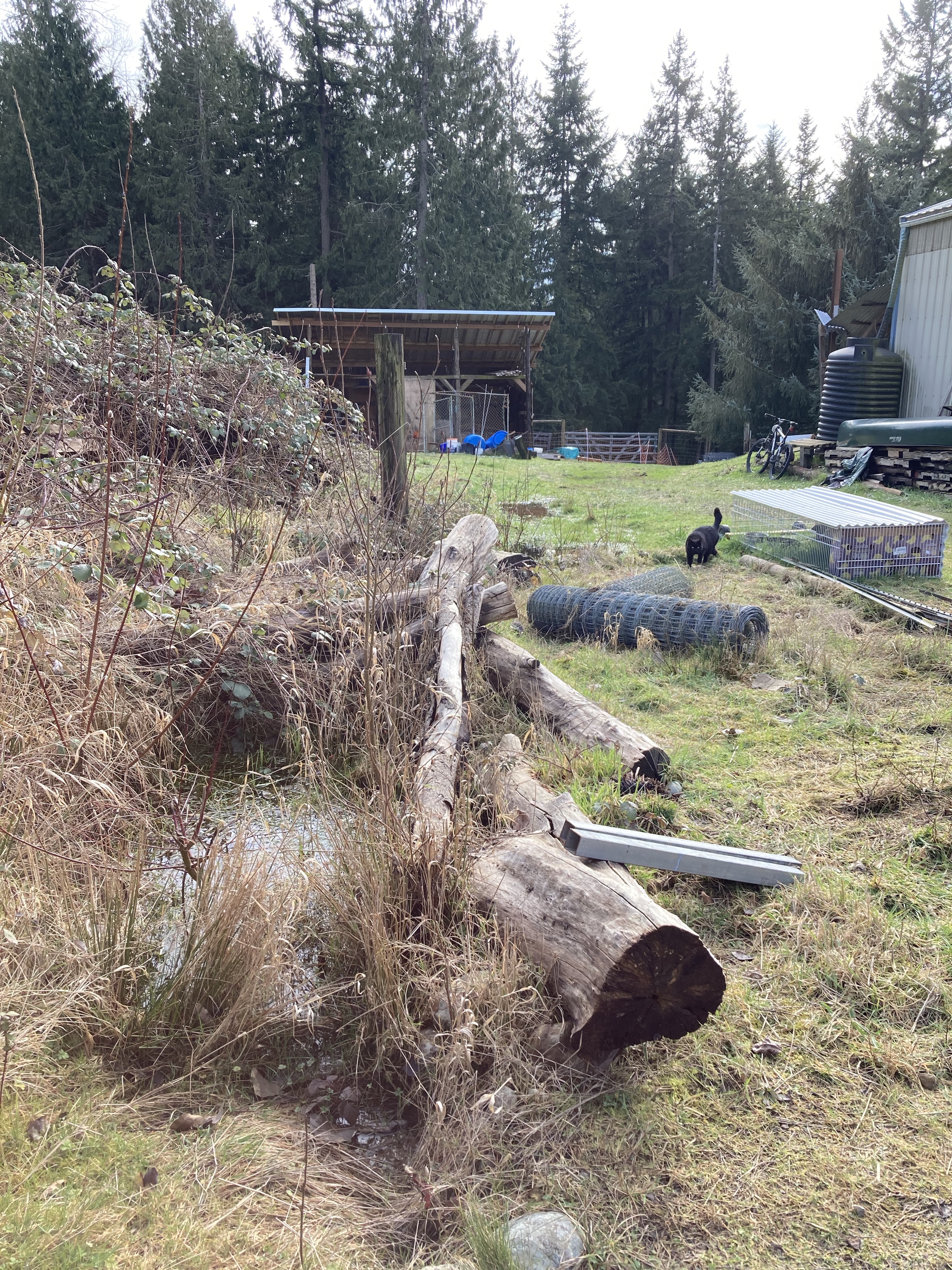
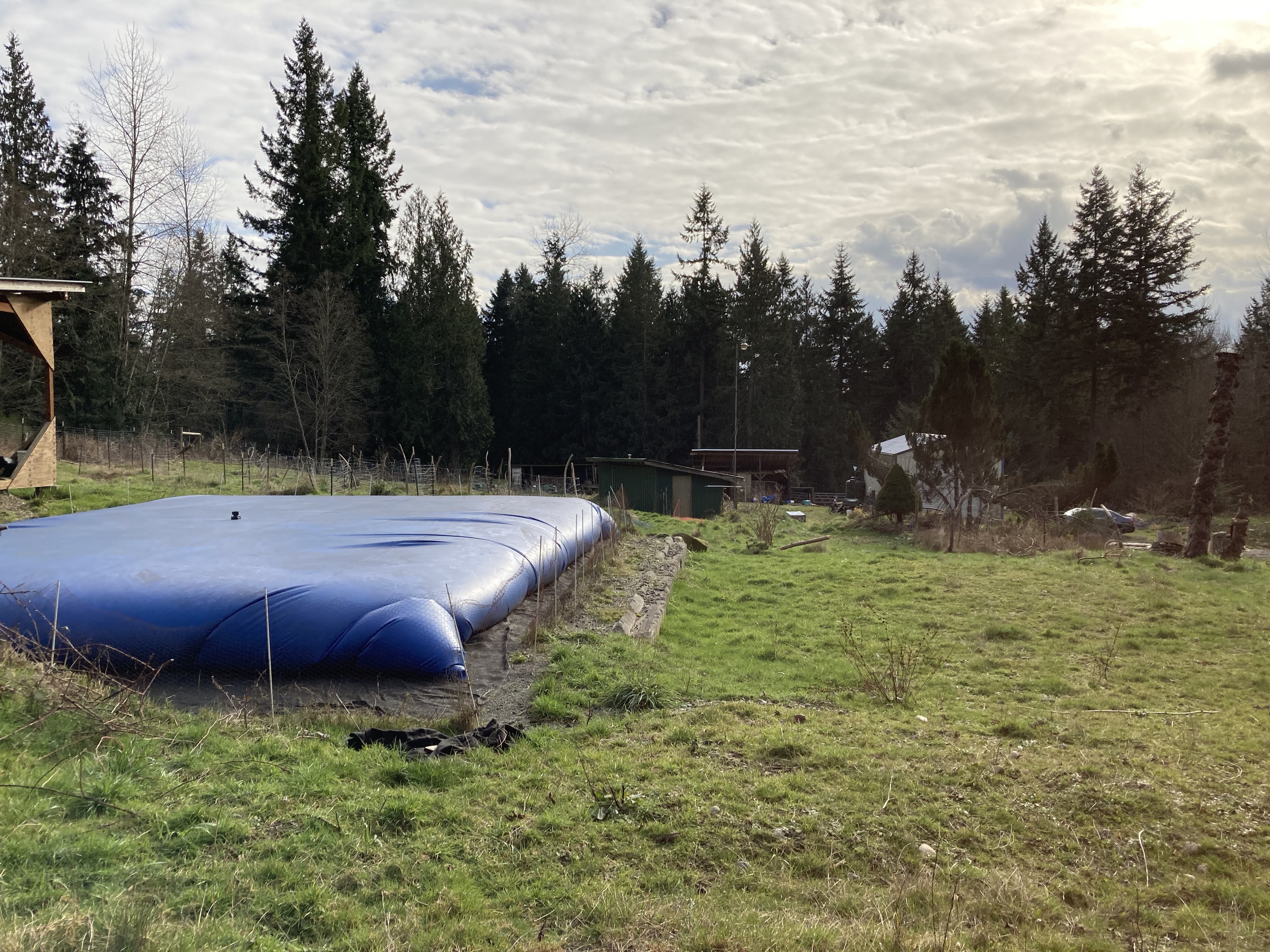
To better understand how the water collects, I took some time to look at the landscape and pinpoint places the earthworks and plantings were weakest. In the picture below, you can see swales on the left, and driveway runoff ditch to the right, but a wedge of hillside without any mitigation created a channel for the runoff. At the top of this wedge you can see the pillow tank and a cleared future building site. These spaces are a combined surface area which catches large volumes of rain, sending it down the hill with little resistance. In future, we hope to build a shed and redirect all the roof water into that pillow tank. We’d also like to invent a way to catch the water off the top of the tank and utilize that as well- but for now, we need to address the landscape below these areas, which are not slated for improvement for a few more years. Currently, there is a struggling blueberry patch, which was established here when I purchased the land. I say struggling, because it’s part of our upper sheep pastures now, and the livestock have decimated the shrubs. One solution would be to plant out the area as a blueberry plot and fence it off from the sheep. We could also implement hugaculture in the planting to retain moisture and bank fertility in the soil.
There is an established tree nursery down hill, and eventually, some of those trees will help with runoff prevention, but earthworks speed up water management capacity by offering physical redirection and storage. On a hill, it’s challenging to store larger amounts of water by digging in- in our area, the substrate is mostly gravel, rock glacial till. This terrain does not retain water well, and requires sealing. It’s another reason the water flows quickly off the land- even once under the surface. It’s best to keep adding compost to create soil, which then acts more as a sponge, soaking the water in where it falls. This is how the original old growth forest managed rainfall, especially on the slopes. That resiliency can only return with the canopy, which is why most of our land is slated to be forest once more. In the few remaining clearings, where people thrive in the sunlight whenever possible, we design alternative water catchment systems to improve vegetation and prevent erosion.
Where the water does sit on the surface, we accommodate these mini-wetlands with the plants that thrive there- such as willow and dogwood. I have a long term vision of directing this particular flow from the hillside above into the pond, but it’s a long way from that catchment system right now. Trenching and drain pipe would be required, and we might go in that direction, but first I would like to see if establishing vegetation on the up hill earthworks will be enough. The challenge is about balancing out the extremes of flood and drought. We want to catch and hold water as far up hill on the land as possible, thus banking more into the soil throughout the property. However, there will continue to be overflow during heavy rain events, which are ever increasing in our area, so directing that sheeting water into the pond would maximize collection and distribution. Since planting vegetation and establishing our food forest above the pond is already a work in progress, I would like to finish that before starting in on another earthworks project, but if the funding and machines arrive at a given time- we’ll implement with gusto.
