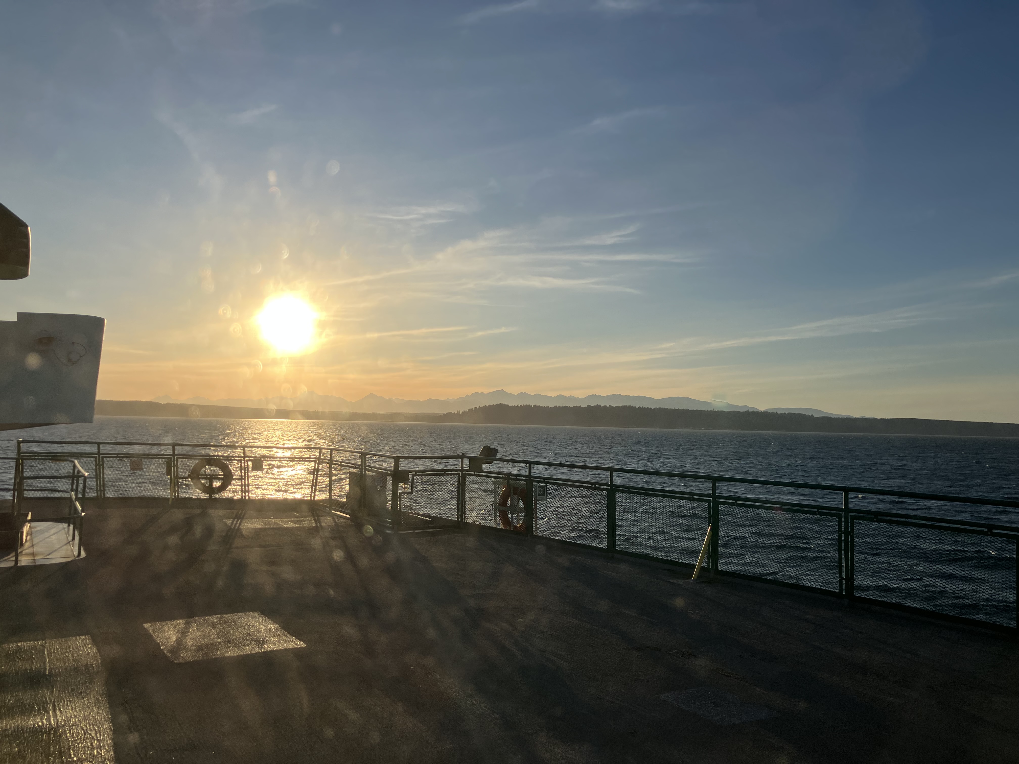
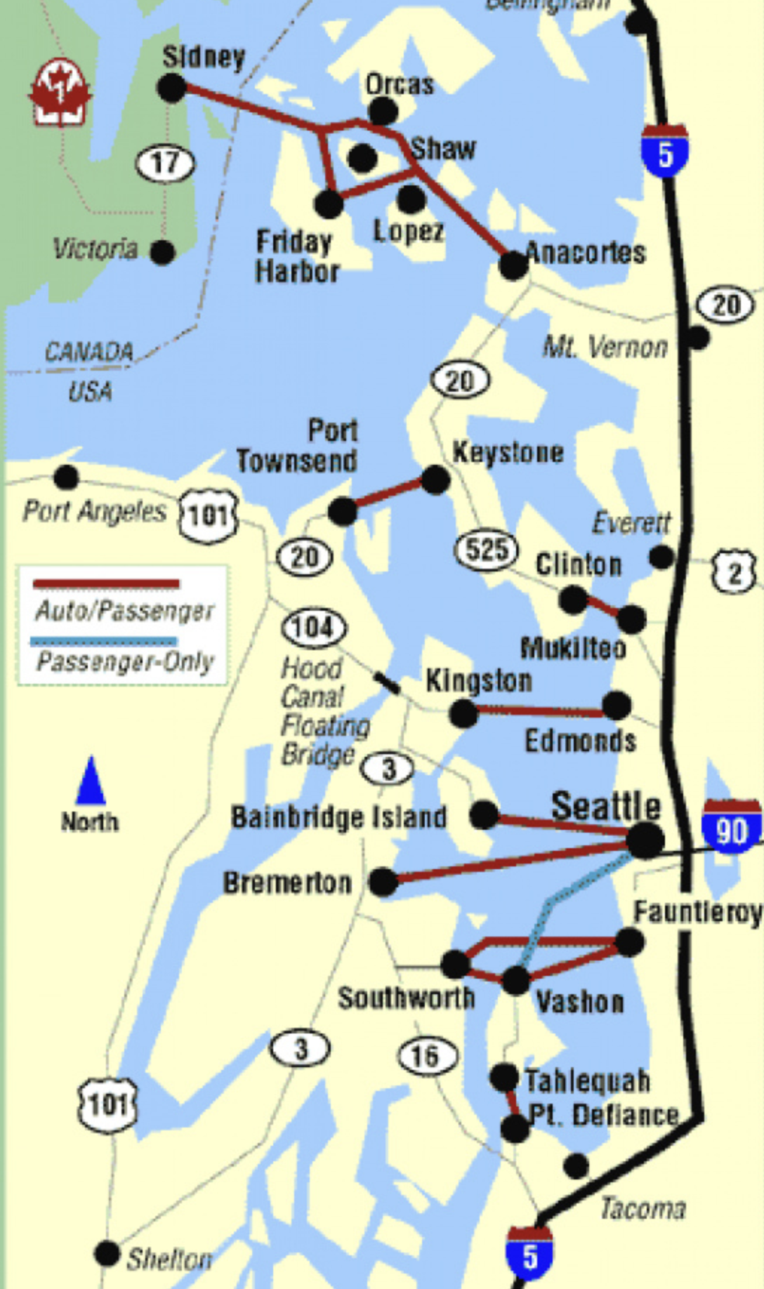
In Puget Sound, there are a lot of islands, and The Olympic Peninsula to Seattle’s west. One of the fastest ways to get across the water is by boat. In much the same way First Nation’s People have traveled up and down the sea kelp highways in canoes, ferries bus cargo, vehicles, and folks from shore to shore. Great numbers of people and goods float across x̌ʷəlč, a complex estuary overtaken by human industrial abuse and colonial legacy of toxic layers, still poisoning the land and people, as well as wildlife and wonderland that remains. Water highways continue to pollute, but there are long term visions of electric hybrid motor transport in future. Right now, the fastest way to get around in Puget Sound is by boat, so I hopped on The Edmonds Ferry and headed to The Olympic Peninsula. Even after connecting in Kingston, it would be another bit of driving over Hood Canal Floating Bridge to get to the mainland of that peninsula.
Reaching out to the western side of Seattle will most likely involve our water highways. I sometimes forget how mush access there is to the west if you’re willing to take a short boat ride. I’d not recommend trying to ride them with a vehicle in summer without a reservation. Lines can be horrific, especially during holidays. Think of these as traffic jams like any others on major through ways during peak travel times. Winter schedules are much less crowded, and there are still many beauties to enjoy along the way. Whale sightings are not uncommon on your crossing, keep a lookout along the rail and carry binoculars if you can. Though the noise pollution, leaking fuels, and constant movement through the waters can be disruptive, there is still important feeding territory for many aquatic species in the sound.
From Seattle, and a few other ports, you can ride on water highways up through Canada into Alaska, and that’s a heck of a journey, taking several days. I’ve got that adventure on my bucket list, but it’s surprisingly expensive. If you want a room, you’re looking at several hundred dollars, for a ferry ride. I prefer my $20-30 ticket for a half hour connection. I’ll sleep near the beach or at a camp site in the forest. On a rare, special occasion, a two night trip to one of The San Juan Islands can be a great reward that feels remote, but takes only a few hours to get to with a scenic ferry ride. If you find yourself with a day or two for adventure, hop onto our water highway system and take a step further into the wilds of western Washington.
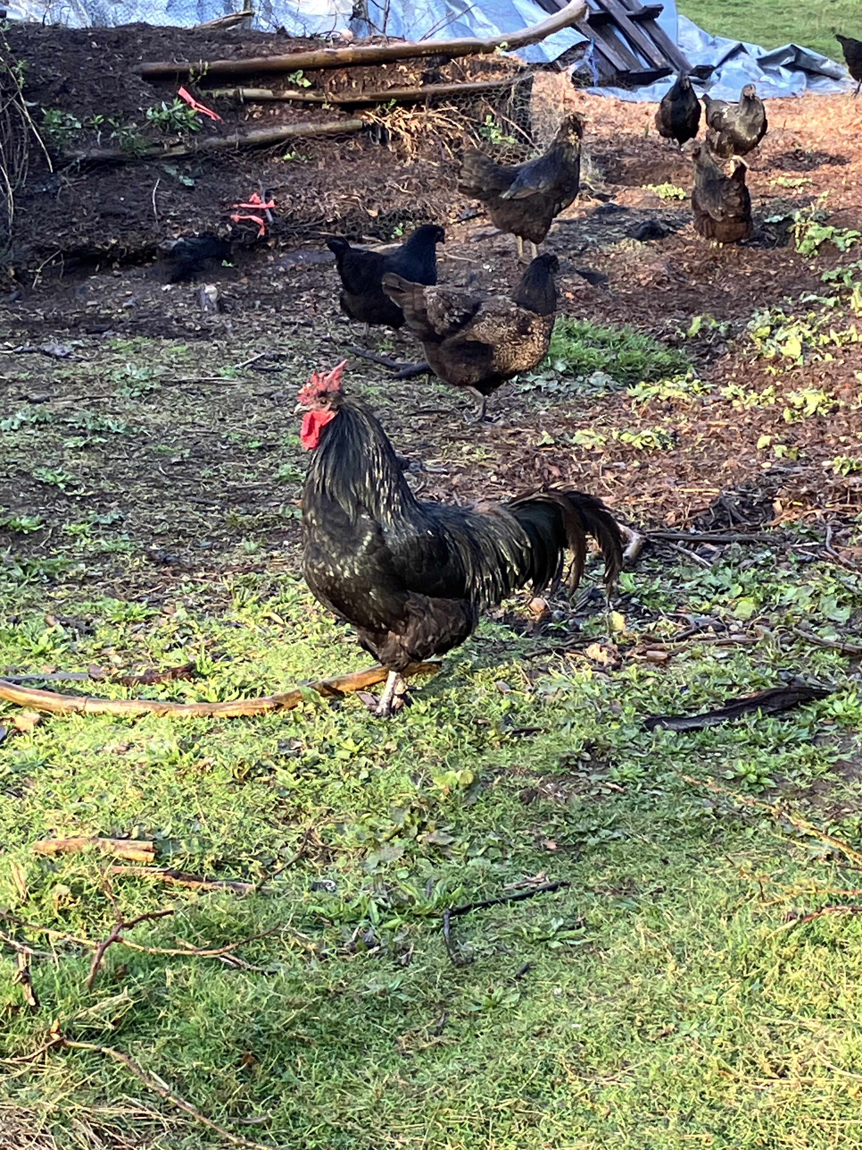
On a brisk morning, I took a different rout down to the barn to look at my orchard in preparation for winter pruning. Looking the trees over before the job starts helps me lay out a plan and grasp what needs to get done. A couple of cracked branches need to be removed, and I’m also debating taking out some of the protective fences, as the young trees have gained enough height to avoid browsing sheep and chicken pecking- yes, the birds to reach up, and even jump up to grab leaves with their beaks. They have also learned how to peck into young gourds and squash, so I’m planning a chicken run for the coming growing months. Originally, I had the birds behind electric mesh rotating pastures, but in recent years, with the setting of so much vegetation around the upper pasture, they’ve been good gleaners in the hedges and garden edges, so I let the flock wander far and wide. They had forgotten the garden, for the most part, and a set hedge around the outside had kept them at bay, until one winter, they found there way in, and learned the soil was good pickings, so I’m re-fencing the kitchen garden with waddle hazel this spring.
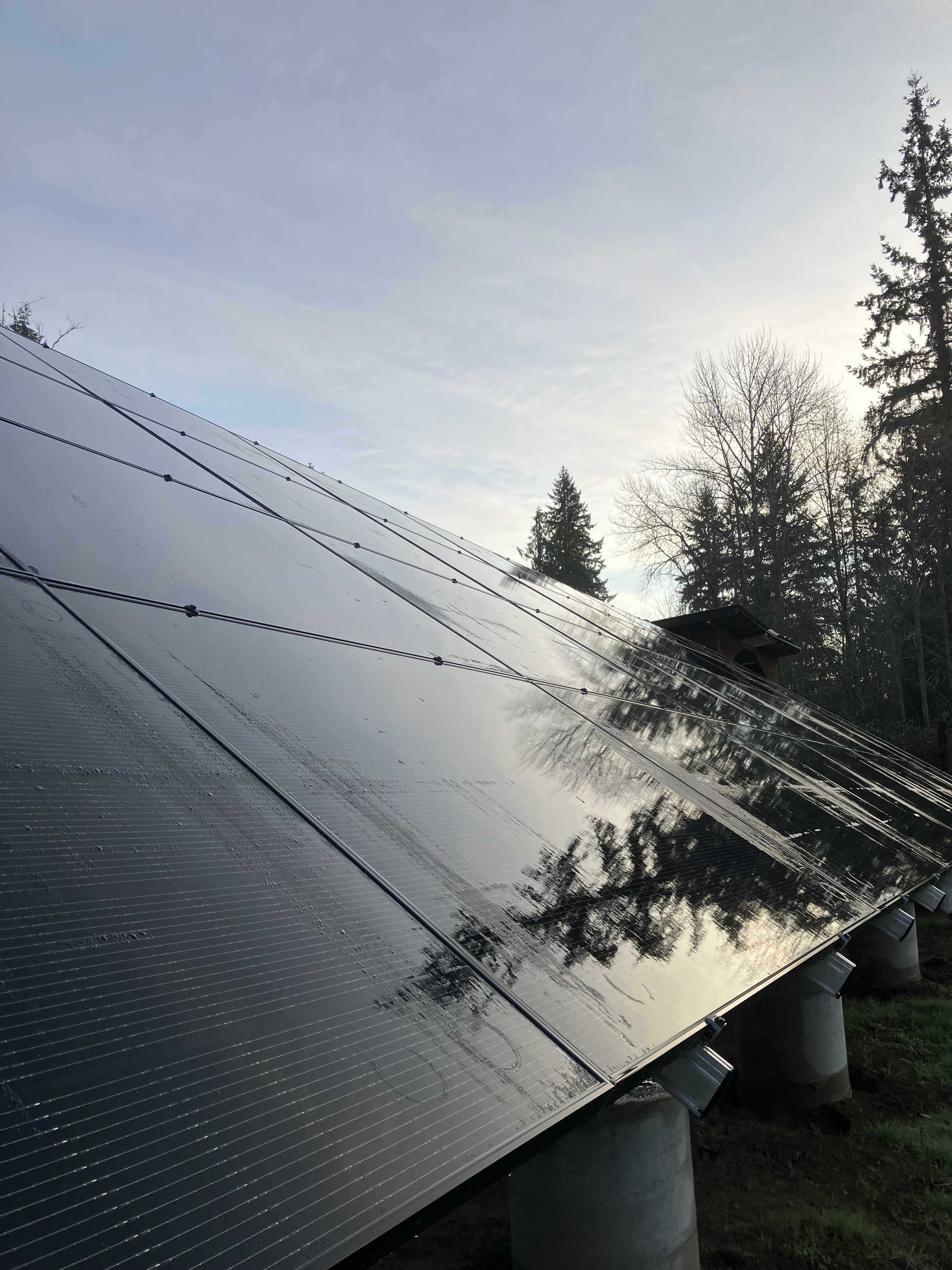
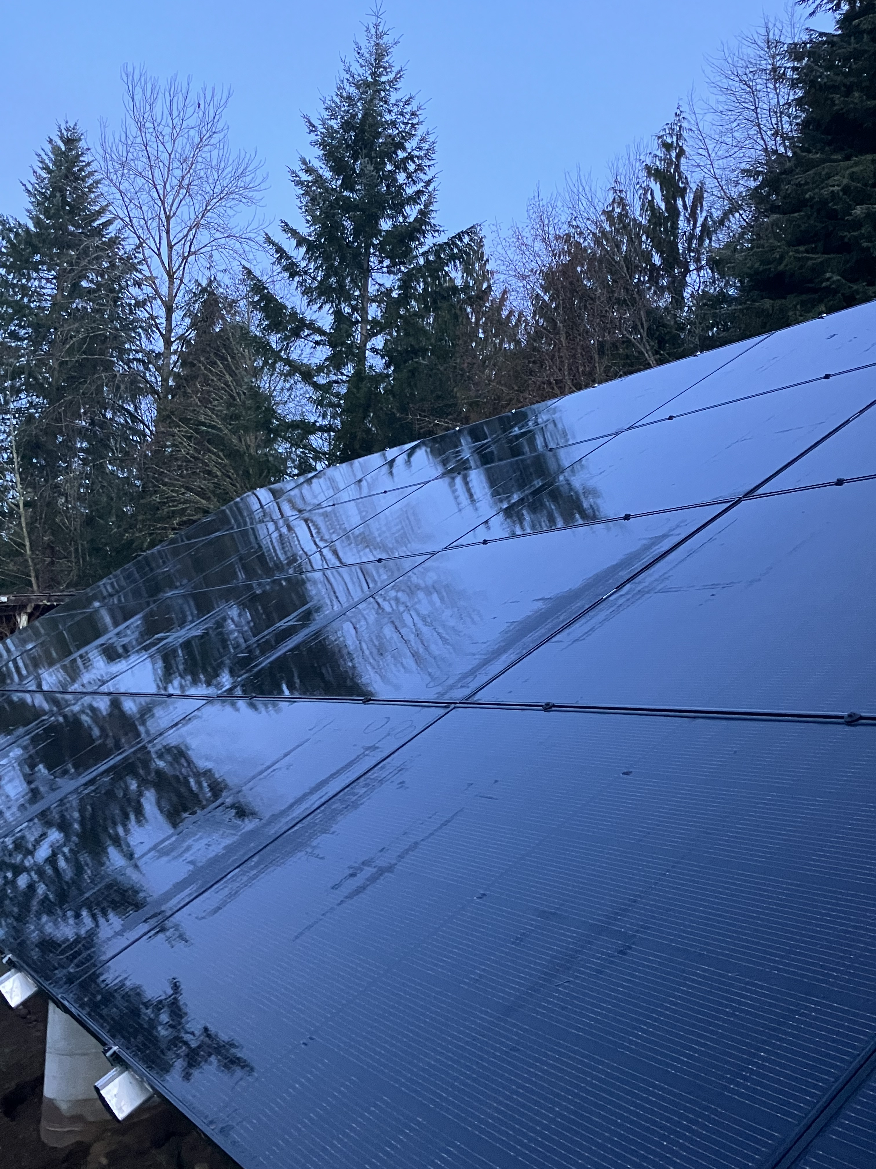
Crossing the driveway to the east, I enjoyed witnessing first light striking across the landscape, opening shape to the world, and subtle color, ash grey, ice blue, and solid shadow black. A looming new silhouette breaches the skyline, an imposing form with damp sheen reflects earth and sky. The new solar array will be harvesting a lot of kWh today. January 2026 brought in 1,002.6 kWh. I earn about 10 kWh on a cloudy day, so even when the sun is behind the clouds, power still comes in. It’s a great long term investment for the energy needs of house and farm. Taking time to look at this new instillation, I am lost in the abstract reflections on water and glass, reflecting forest and predawn light. It’s a lot of imported material, but it will spend the rest of my lifetime capturing energy from a totally green source to keep this place affordable and regenerative.
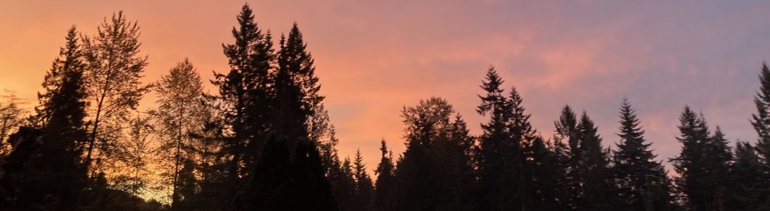
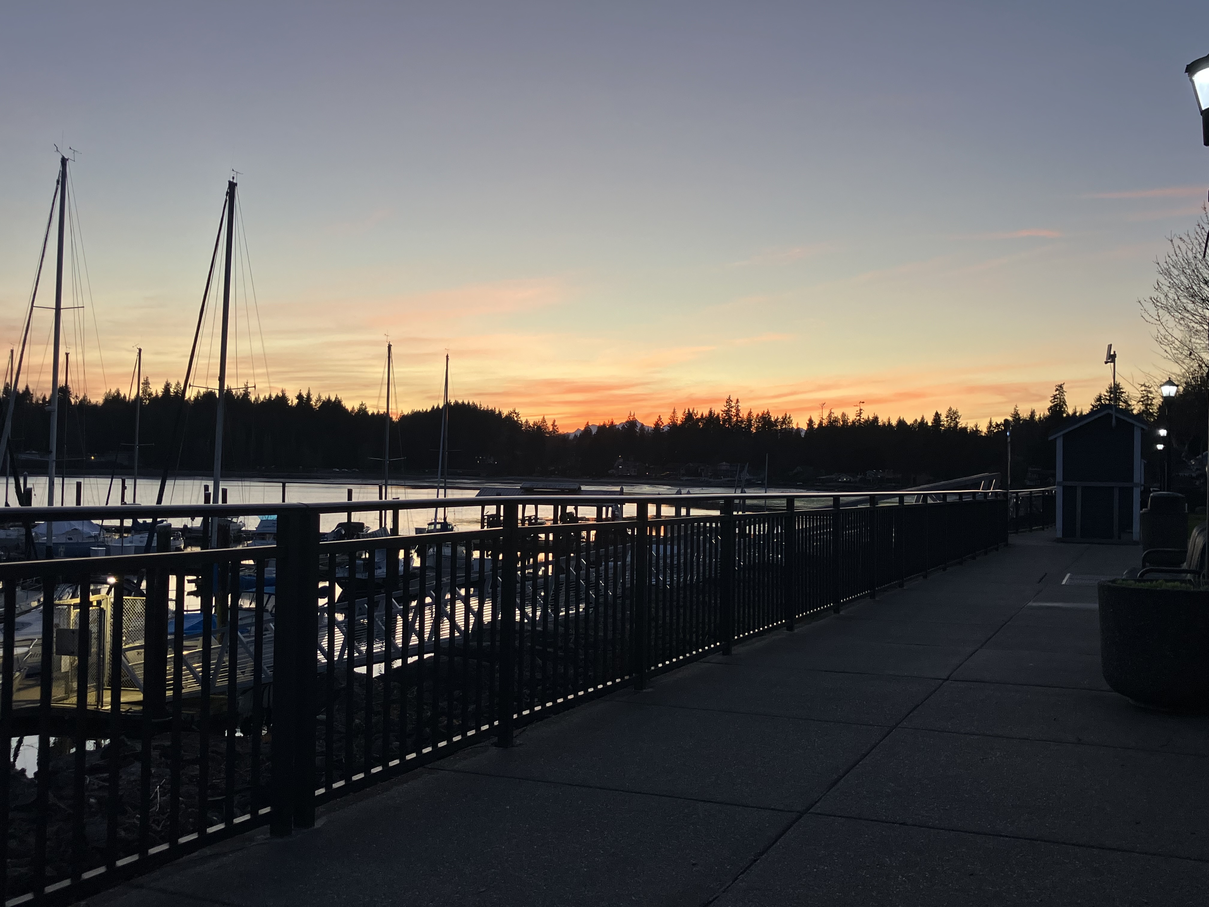
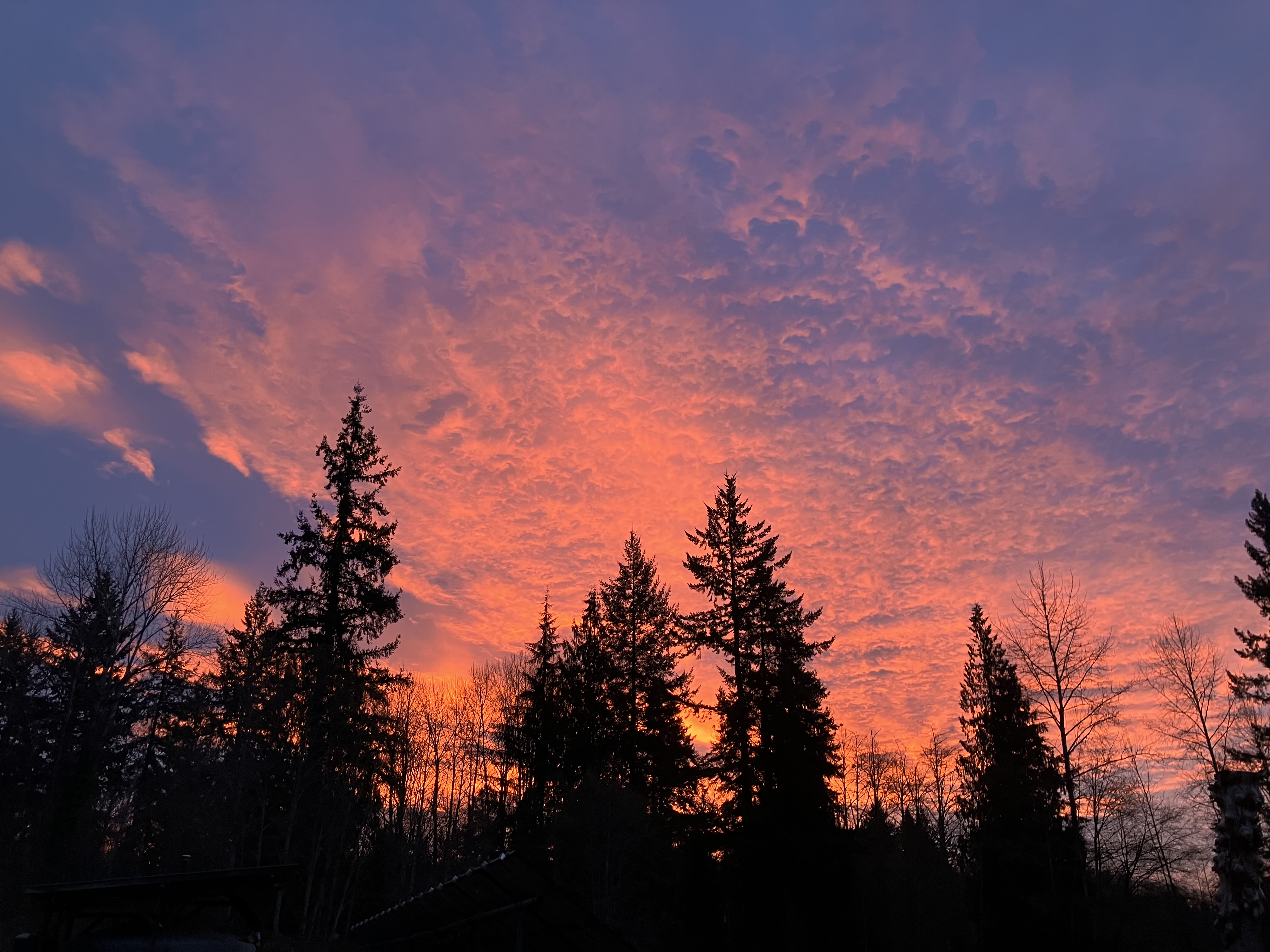
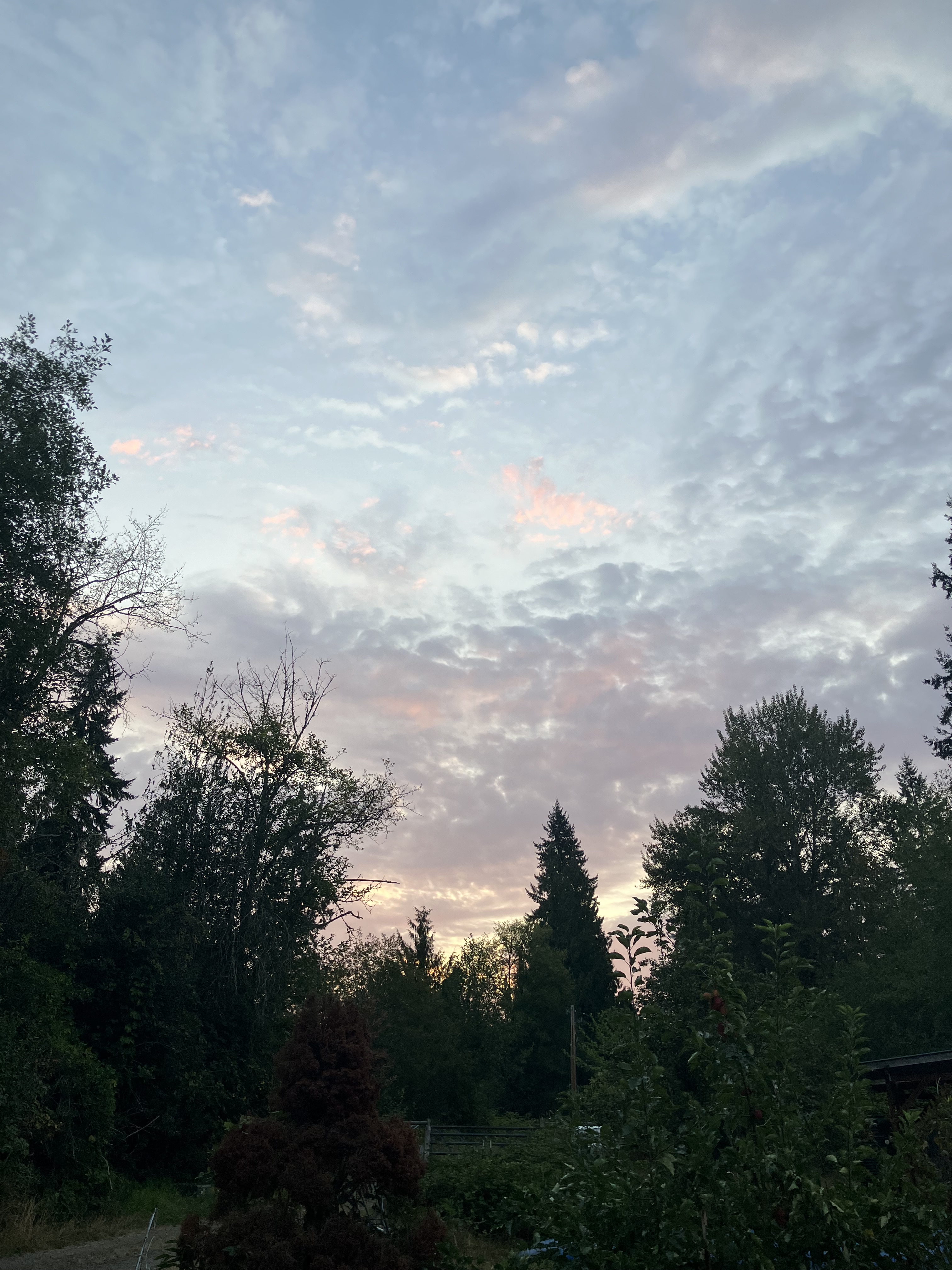
There are sometimes very dramatic sunrises in winter here. So much color in the space where bare branches allow the morning glow to burst through between silhouetted evergreen giants. A ripple of cirrostratus clouds stretch from the horizon, reflecting saturated warm tones. Even through the air temperatures hovers at freezing, seeing this morning glow rising from the east signals warmth to come in an ever lengthening day. Bulbs are pushing up strong green shoots, with more cold weather on the way, I try to cover the enthusiastic new growth with mulch for protection, which I will have to remove once Spring arrives to prevent my bulbs rotting in soaking wet ground. Mulching and trimming back are two ever present chores of this landscape. Sometimes the livestock can help, but in the more sensitive plantings, it’s all by hand. Quiet meditation while pruning back bramble and new fruit tree suckers becomes rhythmic motion throughout the daylight cycle. As sheep graze across the pasture, my shears take young wood and budding cane back to manageable shape and productive spacing. As the light sharpens, I can see the outcome of these simple repetitive labors. Healthy branches shaped to hold fruit and retain airflow. Mildew can rot young fruit, and greater dampness leads to debarking, and the loss of the branch over time. Fruit trees can be high maintenance, but once you find out which verities work well in your microclimate, you’ll have set an orchard. If you have enough light.
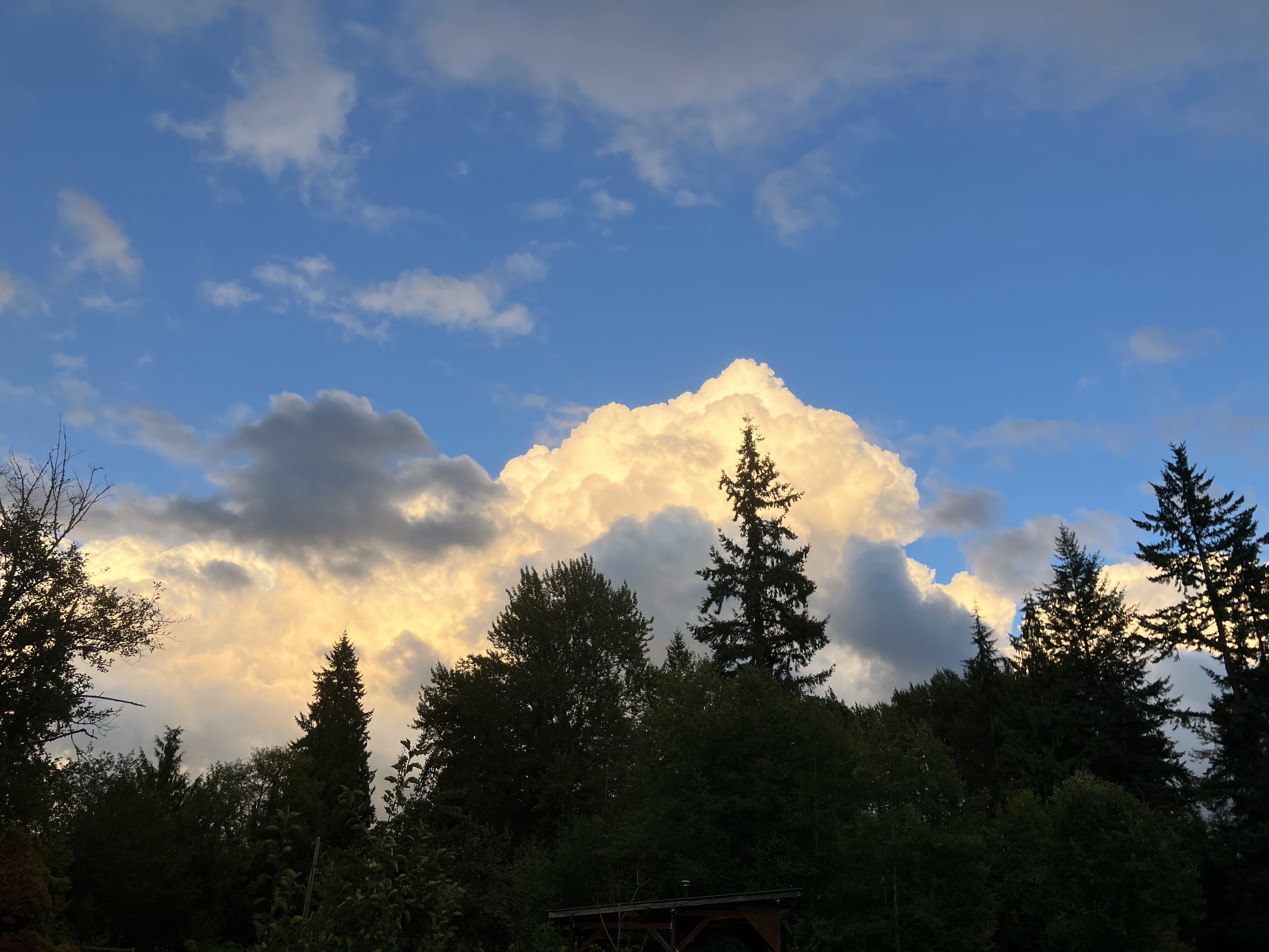
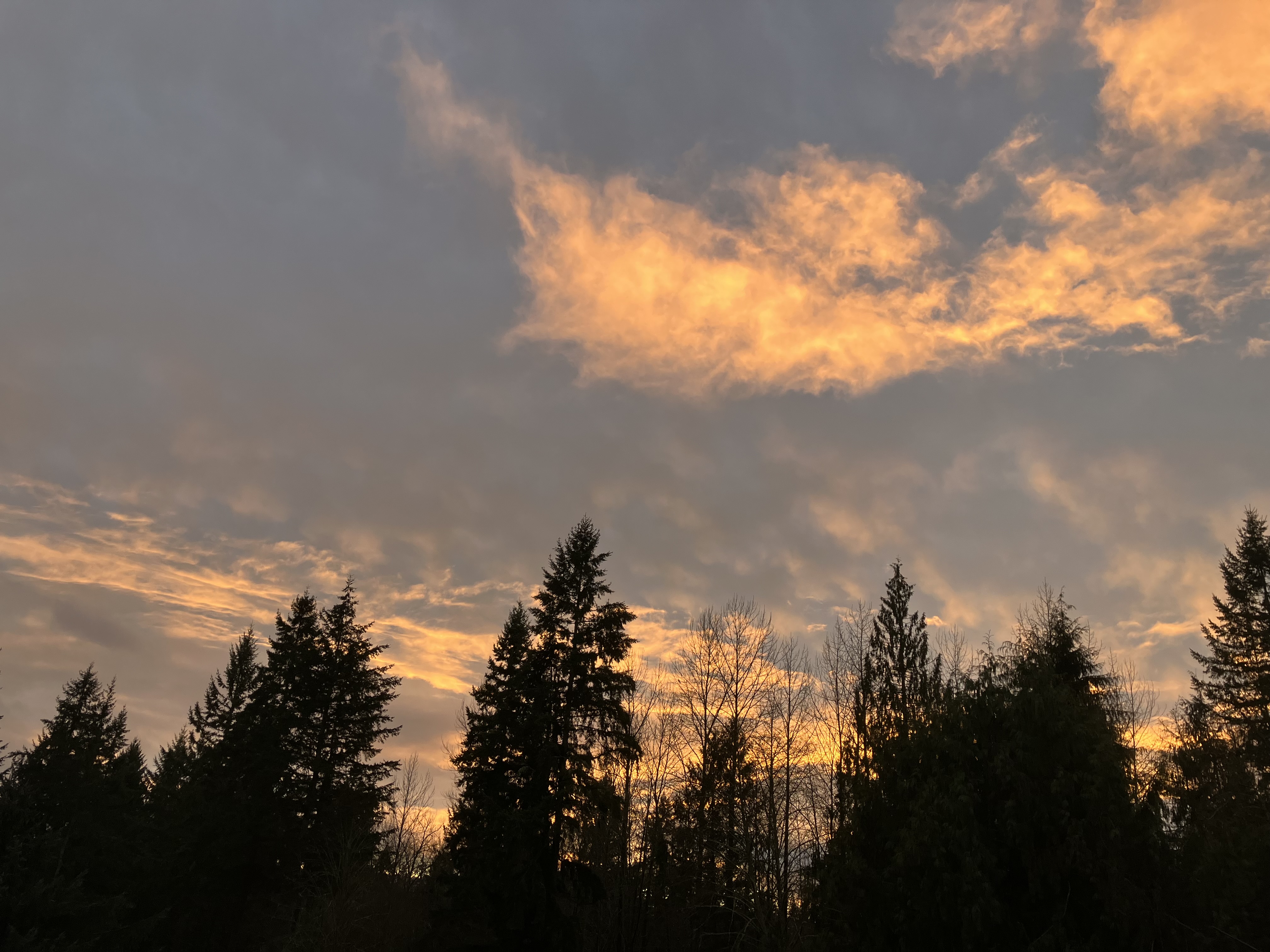
The brilliant south facing gentle slope of this property invites beautiful sun catchment in the upper most elevations, where the house and main orchards and gardens lay. This aspect invites both the open view of sky and all the shapes and colors of clouds forms drifting across it. There are days of slate gray sky, but usually, dawn and dusk have a lot of light contrasts to offer. I’ve caught a few of these magical times, like this morning, and in the evening, when the sun dips below the cloud line in the west, the light often showers the sky with orange, pink, lavender, fuchsia, and deep purples, reflections on the bright ocean waters off our coast in The Pacific. The hues are spectacular, and what some in the area call Seattle’s “5 O’clock cocktail hour”. I will say, my chickens do look good in late evening light.
Access to light determines everything we grow. Well, that’s changing with the advent of indoor growing, but the economics of that system have not played out well, so we keep tilling and row cropping using outdated industrial methods. The ground at the feet of this bird above has not seen a tiller in decades, it gets a good dose of organic fertilizer each season, along with the seeding and scratching of the flock. Sheep graze over it occasionally, and within 30 feet of this pasture space, there are two raised bed gardens in construction. A few forbs are out competing the grasses in a race to diversify the layers of pasture space, it’s not all grass if things are in balance. I’ve got some spring seeding planned that will include clover and common vetch, two “go tos” in the forb world. They are also both legumes, with some added protein. Your pasture must get a lot of sun for these forbs to thrive. Other good broad leaf ground dwellers include dock, yarrow, nettle, and countless others.
Sometimes, when the light is just right, I’ve walked into a Gainsborough. Admittedly, that’s my European roots appreciating pastoral beauty, a western implementation of dominion over the land, improving it for the betterment of a few. Yet in the replanting of native species, shifting mindset from agricultural, to pastoral, to woodland, all these legacies, yet there is light here, shining down as it has for billions of years, and the plants have for millions, even if some are transplants, the are working as a collective, in constant resourcing, adapting and reproducing in succession, notes on evolution we didn’t learn in school. There are strands I can conjure through imagination and the faint traces of bygone era. Back to stairs of vernal pools between the gigantic feet, the trunks themselves, buttressing toes, plunging each anchor far below, when there was depth. Three meters of topsoil or more eroded away down the slopes, carried in torrential rains, through temperate winters, river flooded valleys slowly cleared and burned back, into some grotesque submission. In this small parcel of rejuvenation, carry its light in rich growth and layered return of canopy and understory abundance.
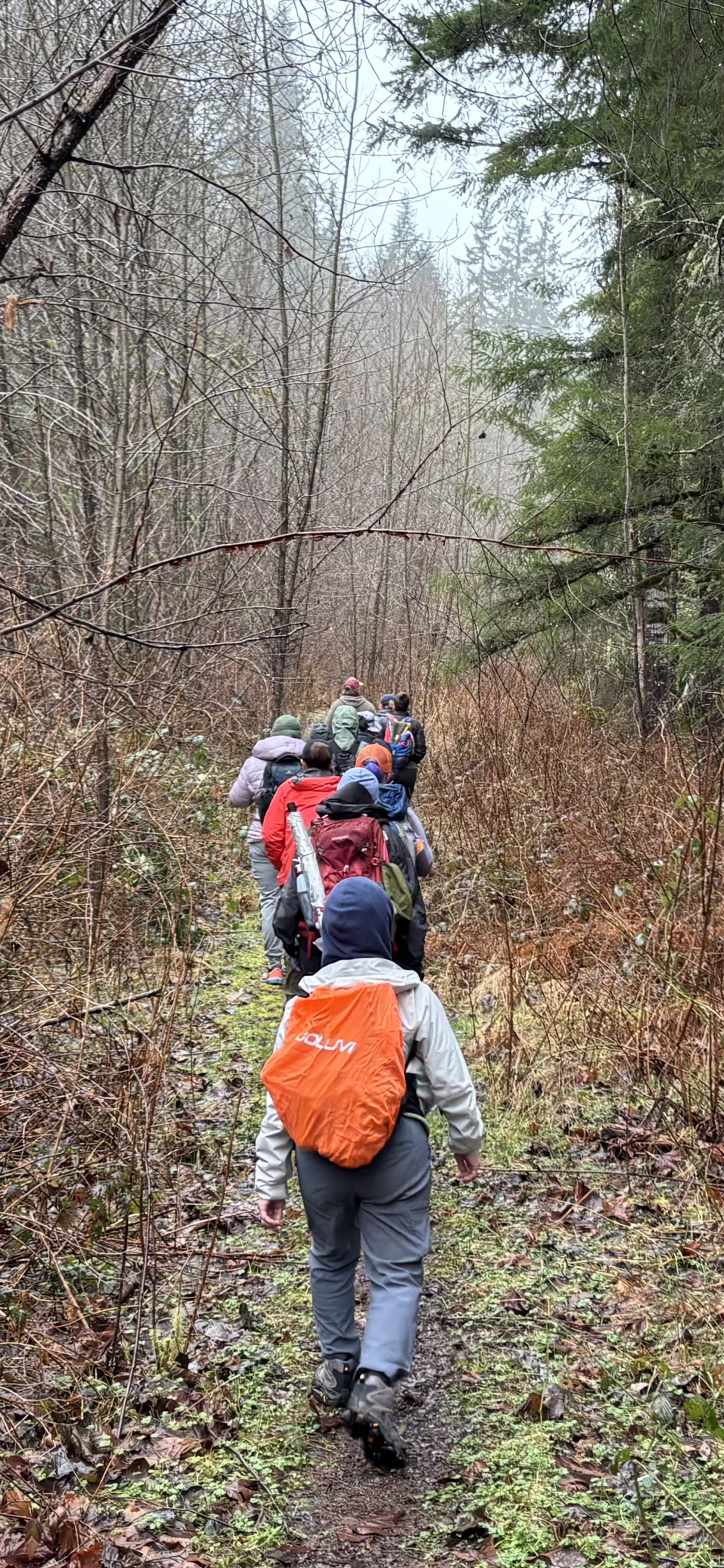
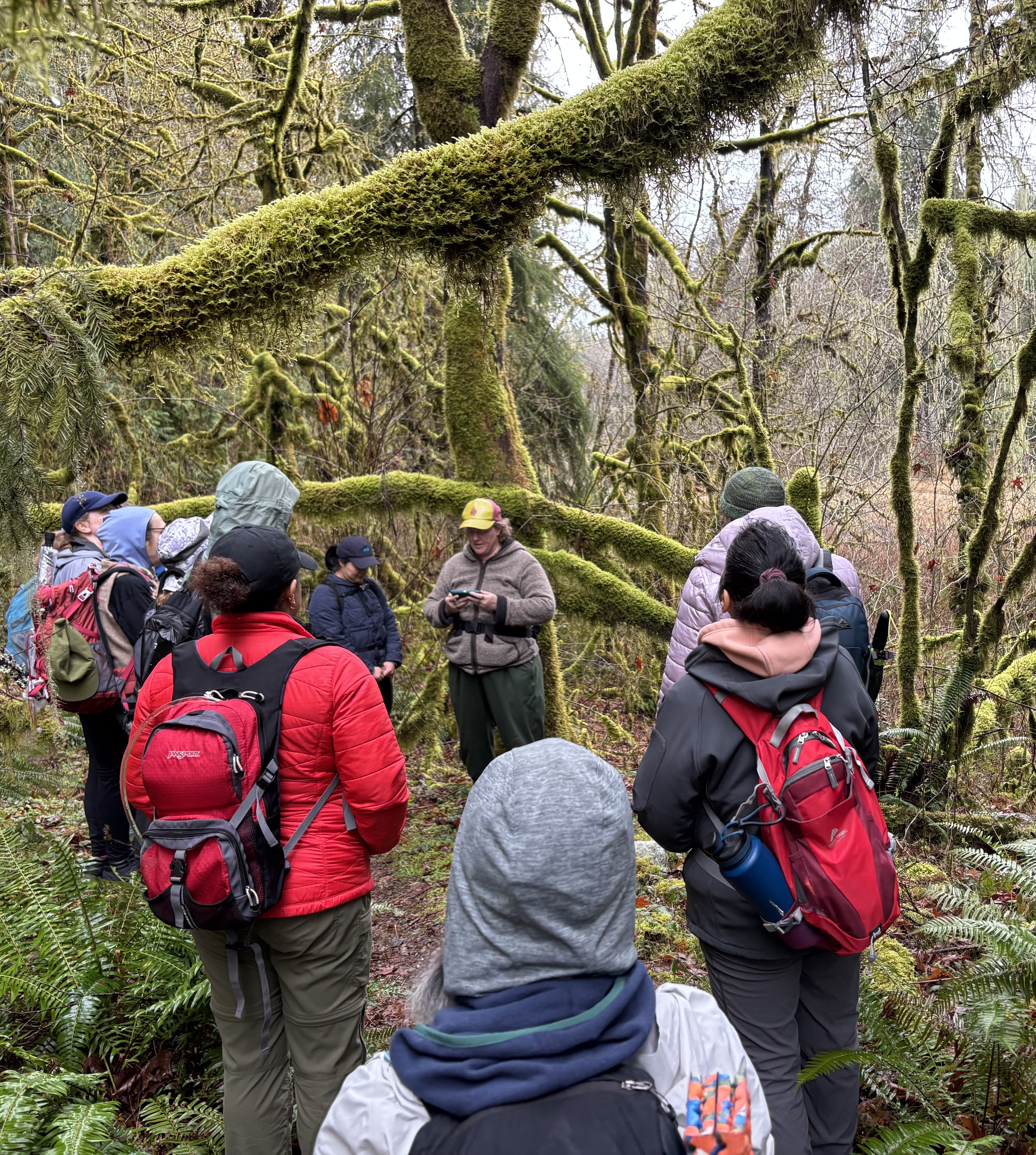
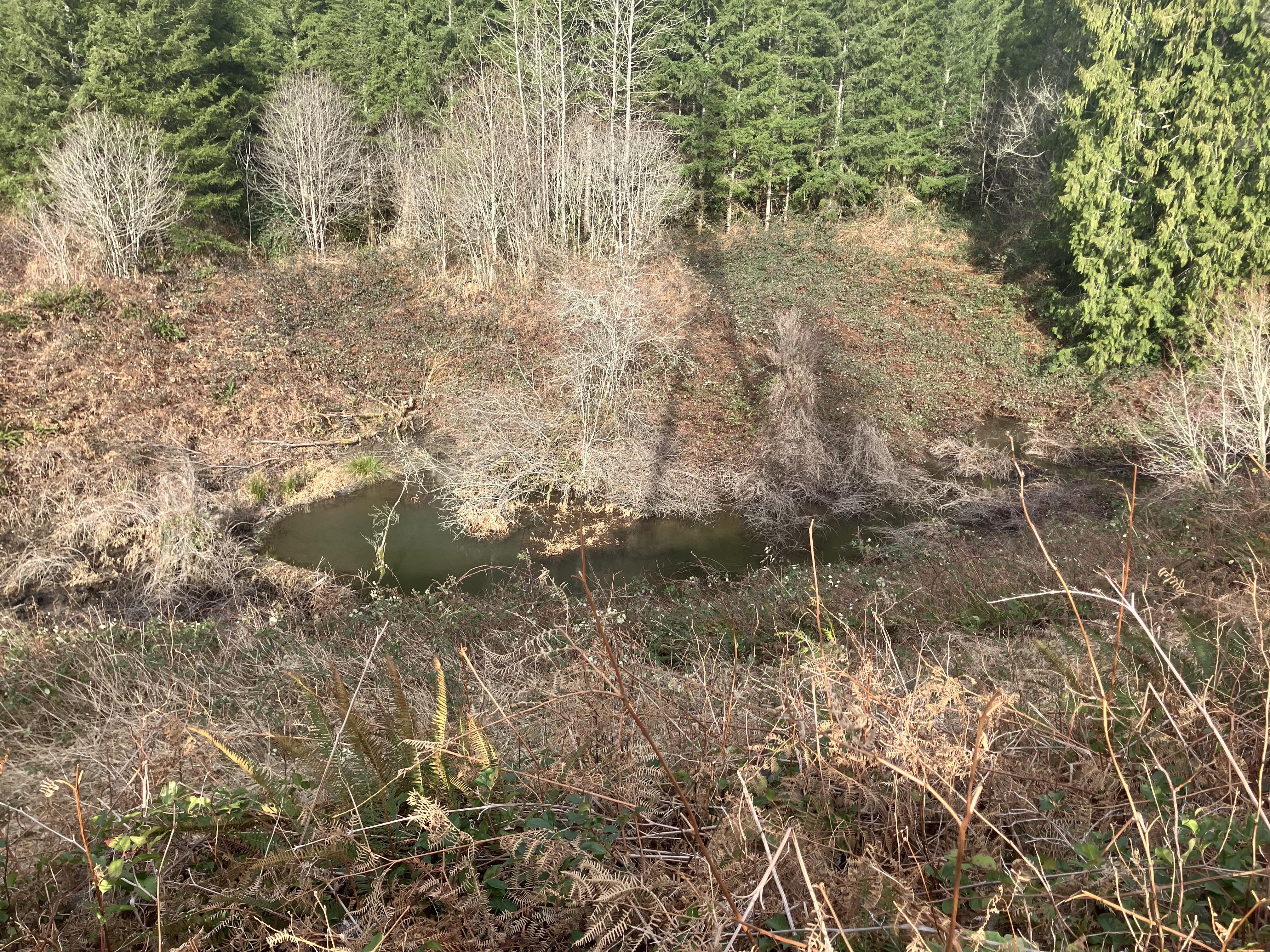
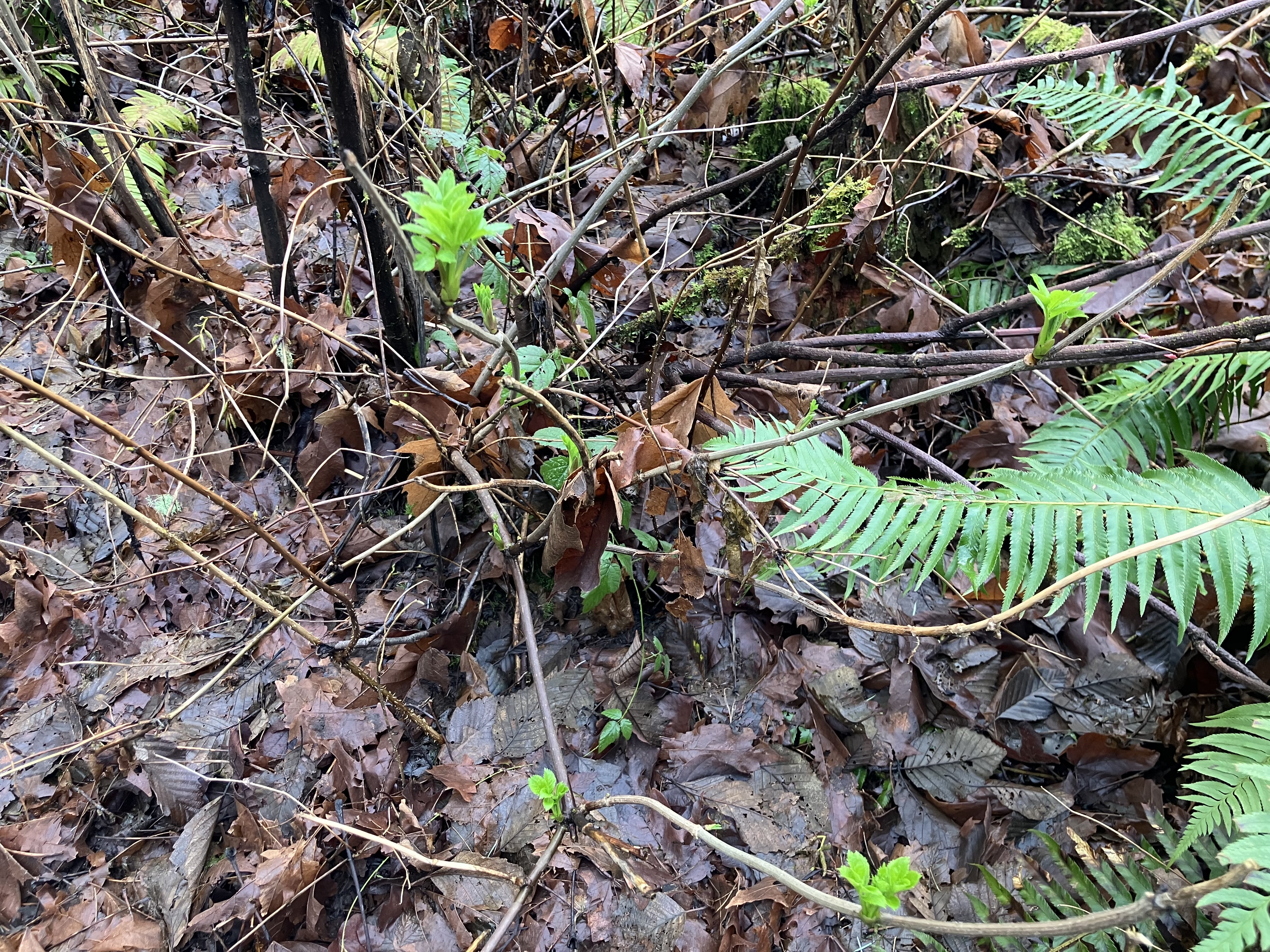
An enthusiastic group of adventurers headed into the wilds, accessible from Mackworth Forest, where Swan Mill Pond Loop, on Tulalip lands, offers a good look at local wetlands, mixed forest ages and stages, and some challenging water crossings that change with the rain forecast. The weather held for our hike, and just the right amount of misty forest magic fell, glistening in the branches and on the mossy rocks along the trail. Late winter seems like a sleeping world outside, and though many plants lay dormant, some Spring buds, flowers, and leafing edges were just starting to emerge. Someone asked about the mosses and what they can be used for. In emergencies, packing a wound, cooling a burn, or as a menstrual pad are some options. Another curious lady pointed out turkey tail mushrooms and we talked about fungal forms and certain family characteristics to look for when identifying. Though many types of fungus and plants we talked about can be used medicinally, it is best to connect with a certified herbalist and your doctor before taking wild medicine.
Our group sampled the taste of a few wild edible plants, from blackberry buds to crane’s bill leaves- eating invasive plants is always helpful to the environment. We talked about forest age, human altered landscape, and what kind of ecology was present. Reading signs like this when in a survival situation helps us know what to expect in the environment. Mapping our trail with landmarks and ecology shifts helps to familiarize ourselves with typical timber plantations, and the water systems running through that might lead us back to civilization if we get lost. There were countless topic covered, and plenty of input from the group too. It’s great to go out together, learning and sharing experience in the landscape, as well as on it. The established trail was an easy three mile walk, and we took our time, identifying important elements that could support our needs, from materials to shelter spots, what the important key points of survival are and how to address them in the field.
It was a wet day too, both in the stream crossings we completed, muddy parts of the trail, and the constant mists covering everything in this vibrant temperate rainforest. Everyone kept in good spirits, and all found a little edge in their step as we navigated a log jam crossing at The Swan Mill Pond outflow. The old log crossing has split in recent floods, so the old jam was the new trail forward. With the aid of a few fallen branches, we poled across the chaotic timber pile up, checking to make sure logs were still and our steps balanced on mossy wood. Everyone did a great job supporting each other as we moved across, and the whole group ended up on the other side without slipping in. It’s collaborative moments like this that add extra adventure and camaraderie to these women’s wilderness wanders. It’s such a good feeling to encourage and be encouraged, surmounting obstacles together, trusting the group, knowing the risk is wet feet or bottom, minimal discomfort in a day outing into the woods.
Survival is finding the comfort in discomfort, and we all experience it from time to time in our daily lives, but in nature, the discomfort brings great reward, like tasting the first blackberry buds in the rain, laughing with others as we dip and hop across uneven logs, or standing quietly together listening to the trilling call of a Pacific Wren. This collective dirt time is priceless, sharing the living world and questing for a closer connecting to each other in nature feeds community and self. Naming our food growing wild in the hedges, understanding the age of a forest and which mushrooms grow there, seeing the human influence in our natural places- both devastation and restoration, we humans do both; this expanded awareness of place and time, our relationship to nature, how it feeds us physically, emotionally, and mentally, is the best survival skills we could hope for.
Hello, as a small family farm, Leafhopper Farm LLC does not get government subsidies, we don’t qualify or apply because farms should work without handouts. Where I would like to see a subsidy would be in buying hay and alfalfa to produce food, vs. buying hay and alfalfa to feed pets (horses are pets). If the horses are used to produce food directly, they could get the discount. I only want that credit because hay and alfalfa are very expensive, the costs are driven up by horse operations. If we only used hay and alfalfa in food production, and also stop exporting it, we could make it affordable. Most of the government farm subsidies go to commodity production. Though many farmers claim they are feeding America, most of them are exporting their crops to make more money. Industrial farms are not growing specialty crops (all the veggies, nuts, and fruit).
The lovely raw foods we buy in the produce section are not part of the commodity trading markets, so they don’t get the subsidies. Please think about this for a moment- our tax dollars are not going to keep food on the table, it’s going to feed the military industrial complex, highly processed shelf stable products, and most of these crops are exported, never coming close to American meals. Meat is also highly subsidized- also through those commodity crops, which go to feed those animals, and it’s not economical, or ecological at all. It’s also driven by only four firms. The small meat producers, like me, are herds of tens of animals. The USDA definition of small farm is 500 animals- that’s small in the industrial complex. My farm is micro, not a blip in the program, but I am audited by USDA each year, turning in a 20 page questionnaire about what I produce, ear, spend, and the complete economic layout of my operation. It helps USDA set the handout scale for future farm bills, and it does not support my food production in any way.
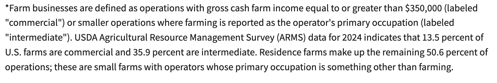
I do get a USDA check each year for a few hundred dollars to keep my stream in a conservation easement program. The pay out is to compensate me for the loss of agriculturally productive land. If I was growing food in those areas, I would be making far more than a few hundred dollars, so even the conservation programs are unappealing to major farming operations. While I participate in conservation farming, the government pays big ag to keep degrading land for profit. Those profits might surprise many of you too. The USDA defines farm businesses as grossing over $300,000.00.
Anyone with a small farm like mine cannot make ends meet through farming full time, and that’s the truth. In my farming 101 class, the teacher started the semester by telling us someone in the household would have to have another job off the farm to keep us afloat. It’s mostly true, but if we got the same financial handouts from the government, on scale with the producers high up the chain, we’d be sitting fat and happy, at the cost of our fellow tax payers. In fact, the subsidies given to commodity farmers hurts small farms like mine. Why does big ag get away with it? Because they keep telling us, with a lot of expensive marketing, that we’ll loose our farms and food if we don’t keep subsidizing, and that is a big fat lie. Below is a great breakdown (from a small farmer like me) of why this narrative is false, and an actual case study from New Zealand, to help us understand.
So, what can we do? Start by learning the facts about subsidies and why we can get rid of them. Call your local reps and tell them about it, ask them to stop funding subsidies to commodity crops- as a place to start. Try to buy from local farmers when you can, and focus your diet on more fresh, raw ingredients. Find small farms like mine to buy meat from- get together with neighbors to buy a whole live animal with option to have it slaughtered and butchered on site, then divvy it up into all your freezers. Small farms like Leafhopper rely on community investment and support to stay alive. We work within out communities, investing in our small towns and working hard to keep hyper local food on the table for our friends, neighbors, and families. Visit your local farms and learn about what they grow and how. Most small farms offer farm tours, and you can call ahead to plan a visit. I encourage all of my buyers to come see the farm and how things operate. It takes some time, but it’s worth the investment, and your hard earned dollars are reinvesting right at home.
Restoration farms, like Leafhopper Farm, are also restoring the soil and ecology of the region, making soil healthy to grow in for generations to come. We’re also protecting water quality, clean air, and replanting native forest. These actions help to create lasting resiliency and recovery for everyone. Industrial farms do none of this, and in fact, deplete what’s left of our nation’s soil fertility, rather than protecting it for future generations. The United States has some of the best soil on earth, with the transportation to move crops all over the country and the world. We should not have any food scarcity, yet food deserts exist across our nation, and that’s complete BS, considering how much of our taxes go to supporting agriculture. Again, those subsidies help farms grow commodity crops that are exported away, none of that money protects keeping food on our tables, so let’s demand a change- stop funding farm subsidies!
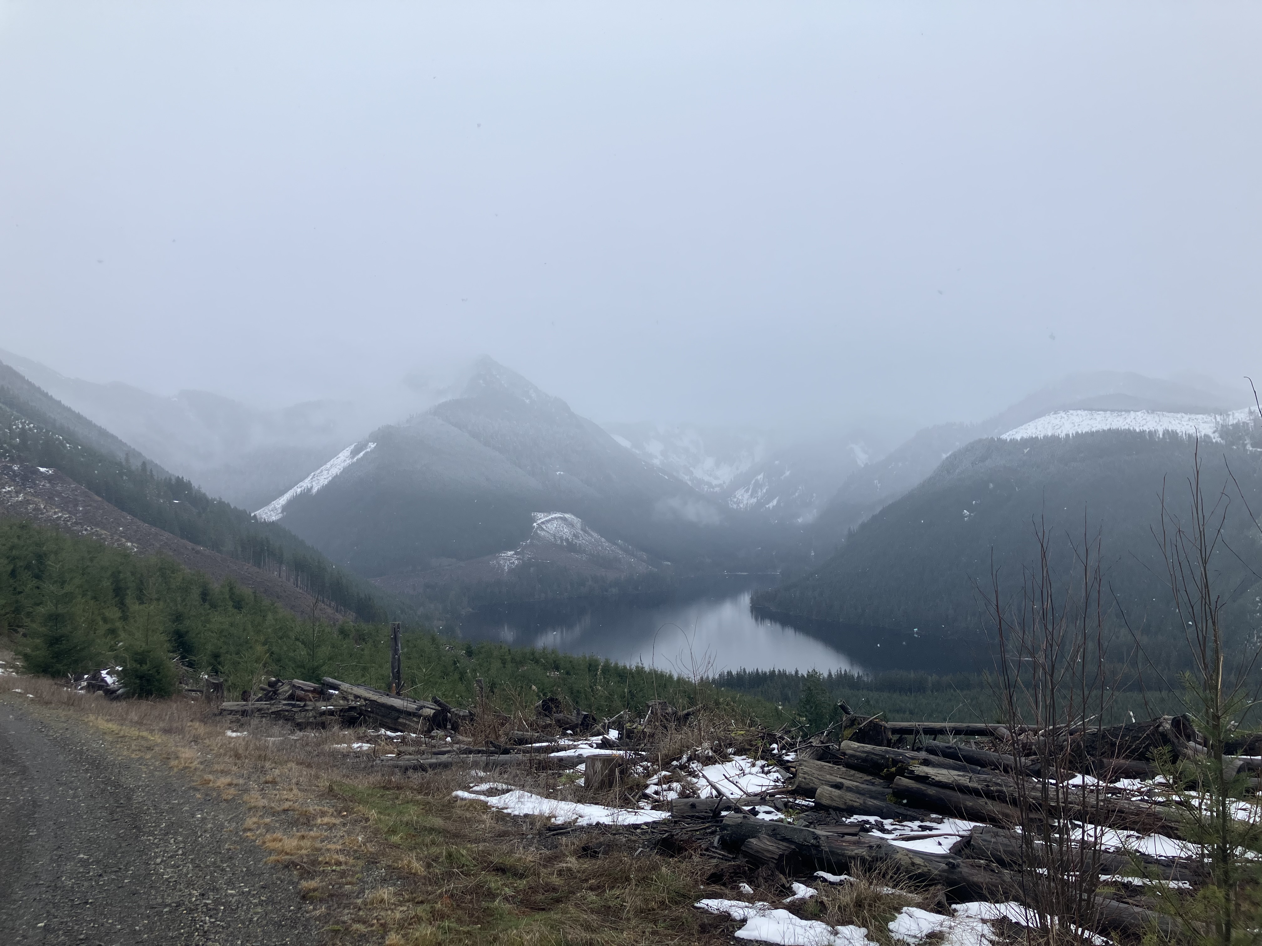
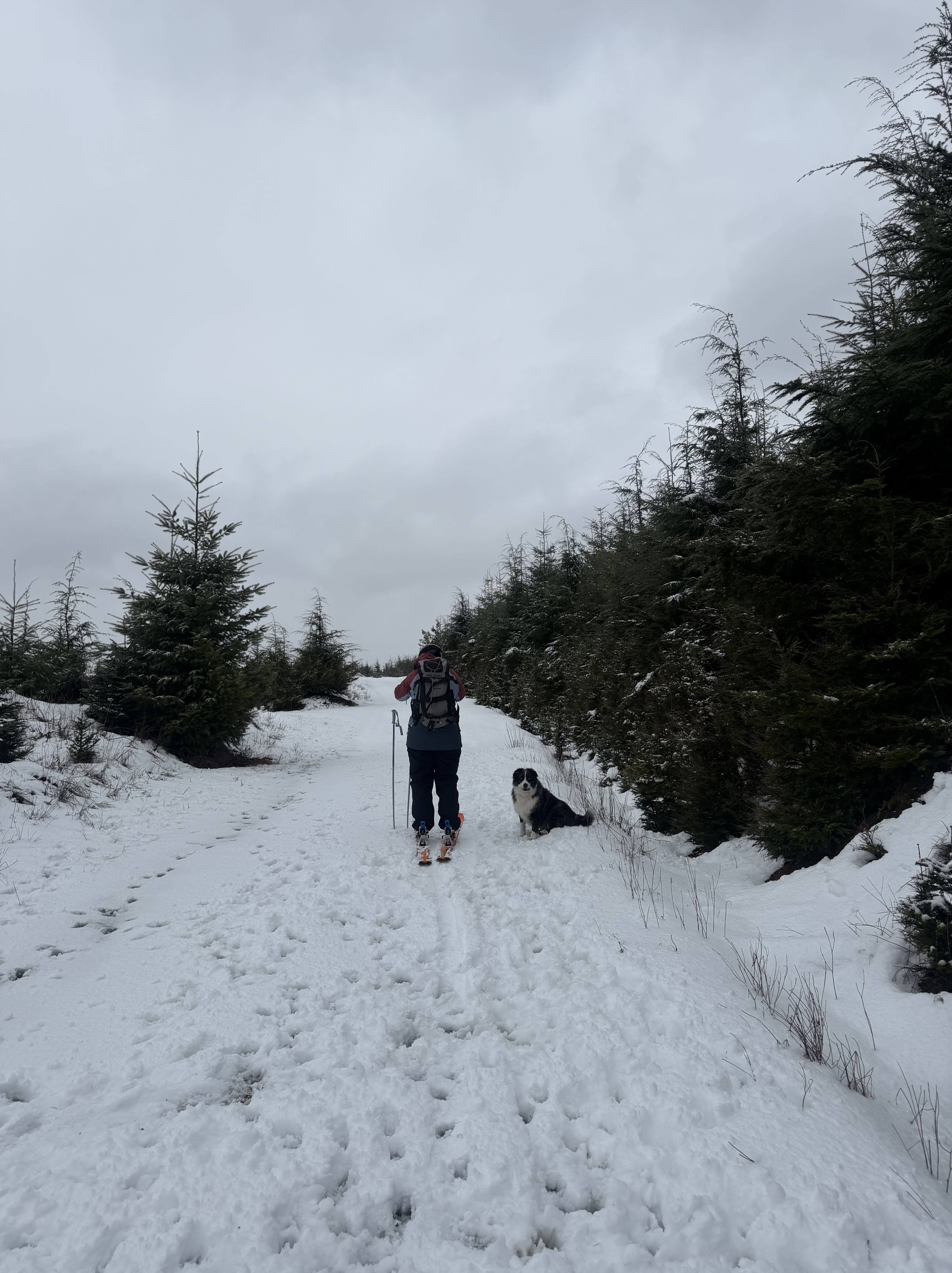
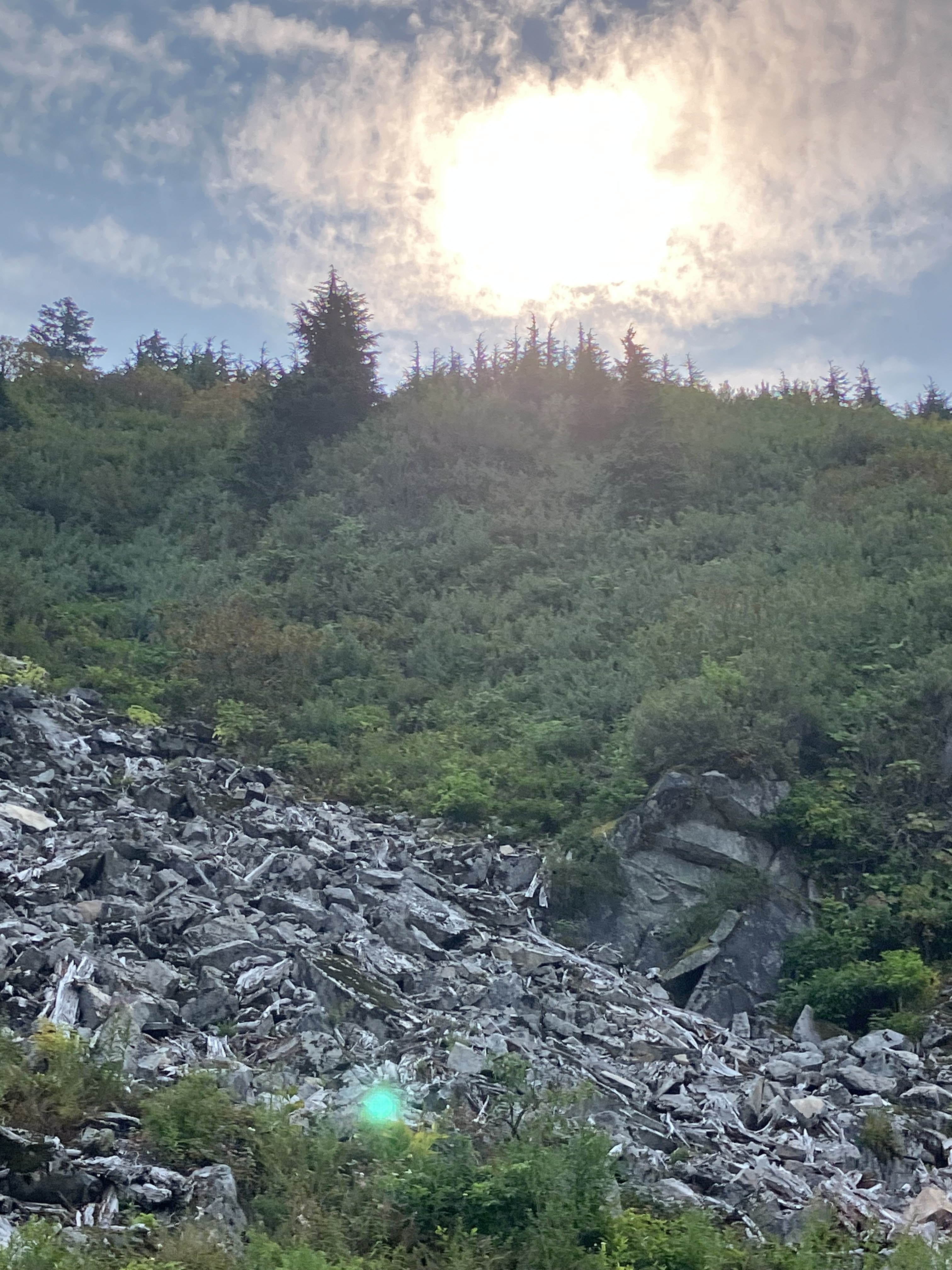
Climbing up into The Central Cascades on a snow day promised some fresh powder in the higher elevations. This is a special part of winters in The Cascades; snow above, cloud below. Elevation temperature changes drastically from week to week around here, and the snow level fluctuate wildly. I wrote another snow report type blog a few weeks ago, when the snow level was much higher in the peaks. This adventure, the snow was really building up at over 4,000′. It takes about an hour and a half to drive up to a point where the snow become deep enough to plant your poles. From there, with skins, even during higher avalanche danger, the logging roads of Snoqualmie Tree Farm offer safe powder access, along the well maintained roads, where there are few, if any, open fields of lurking danger. Instead, tens of thousands of acres of plantation forests dot the hillsides and mountain tops all around, and we took off up a ridge line, heading east towards The Alpine Lakes Wilderness.
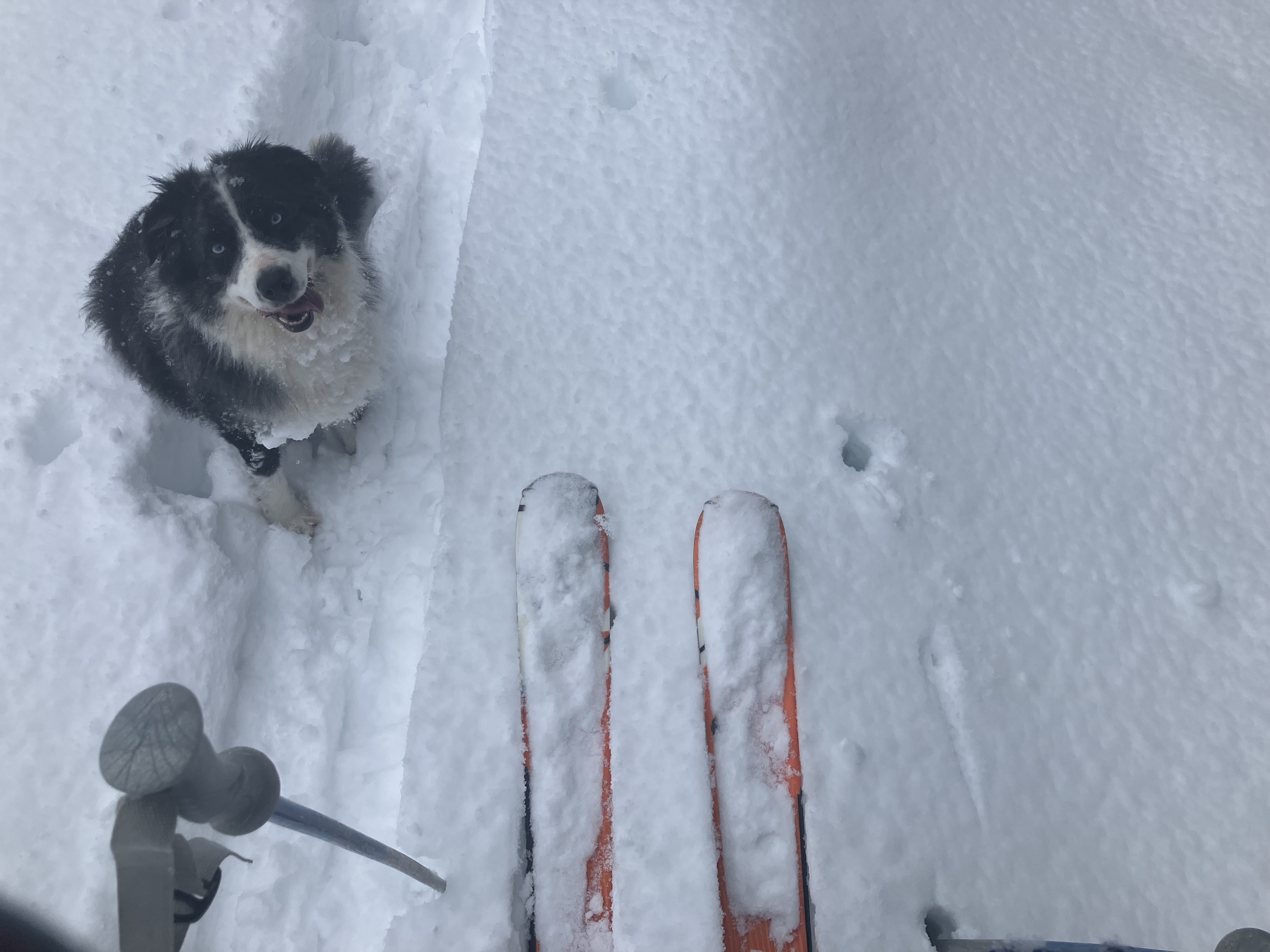
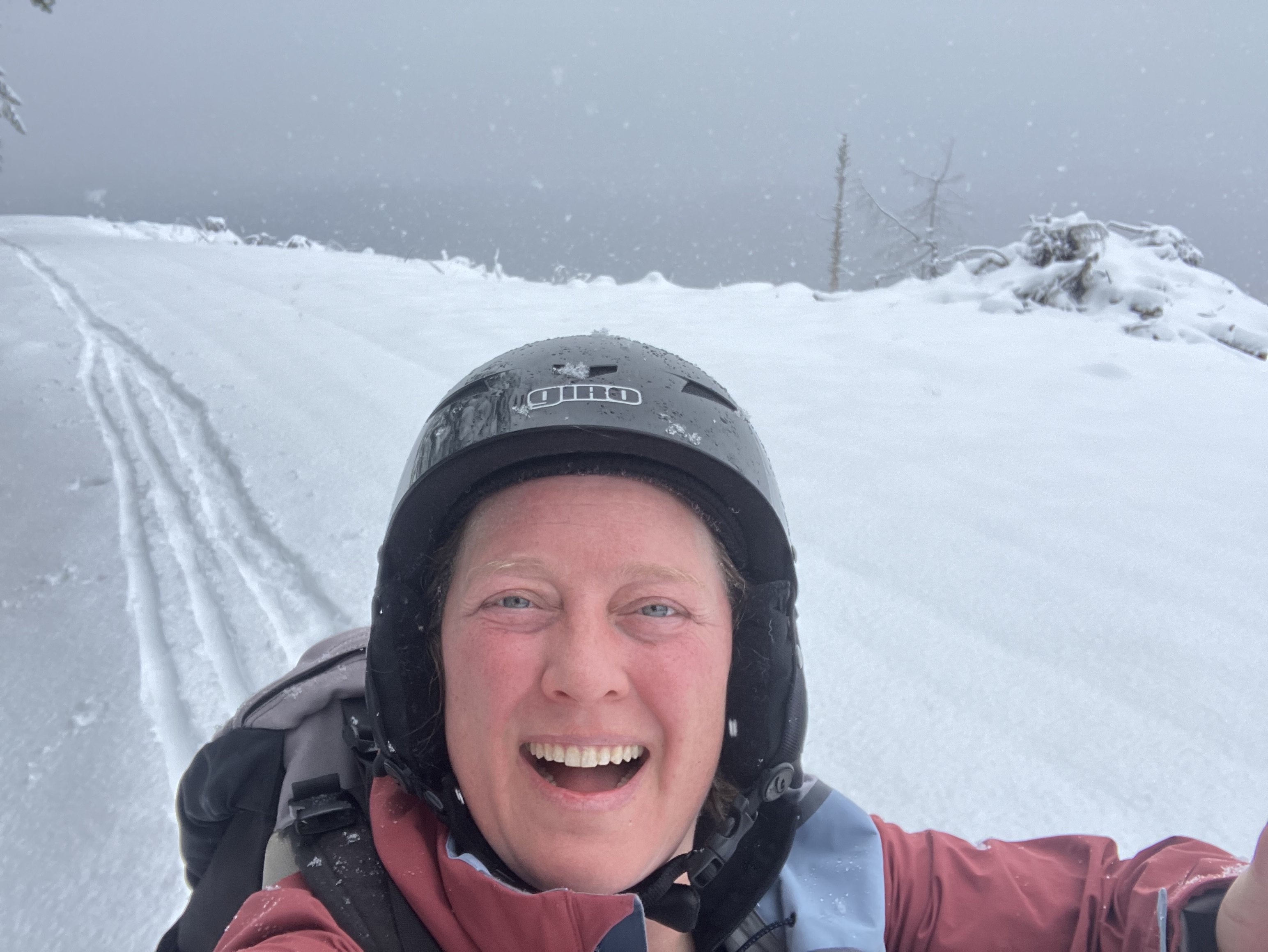
A new front of snow was moving in over the mountains to our north, and soon, the clouds banked against the slopes, releasing a new powder coating for our trail. Over 4500′ the deeper snow became a challenge for our pups, and Valentine was collecting some epic snowballs on her belly fur. My feet were also reminding me of why I don’t do a lot of skinning up hill any more. At the point where I lost complete circulation in my right foot, I called it, and my ski buddy and I turned back towards the truck and took off our skins for the fun ride back down. Admittedly, the pain in my feet made it hard to revel in the ski down, and I’ll be sure to snowshoe up next time. My back country snow gear is also a bit outdated, with a pair of big powder skies I bought a decade and a half ago. The kit worked well though, my aging feet just didn’t take to the tight boot without an orthotics, something my podiatrist had warned me about in recent years. An old fútbol americano injury from high school has created some limitations to my extreme sport activity. It does not prevent me from enjoying a bit of winter sport from time to time. Fresh powder can be limited here in The Pacific Northwest, so when it’s here, go for it.
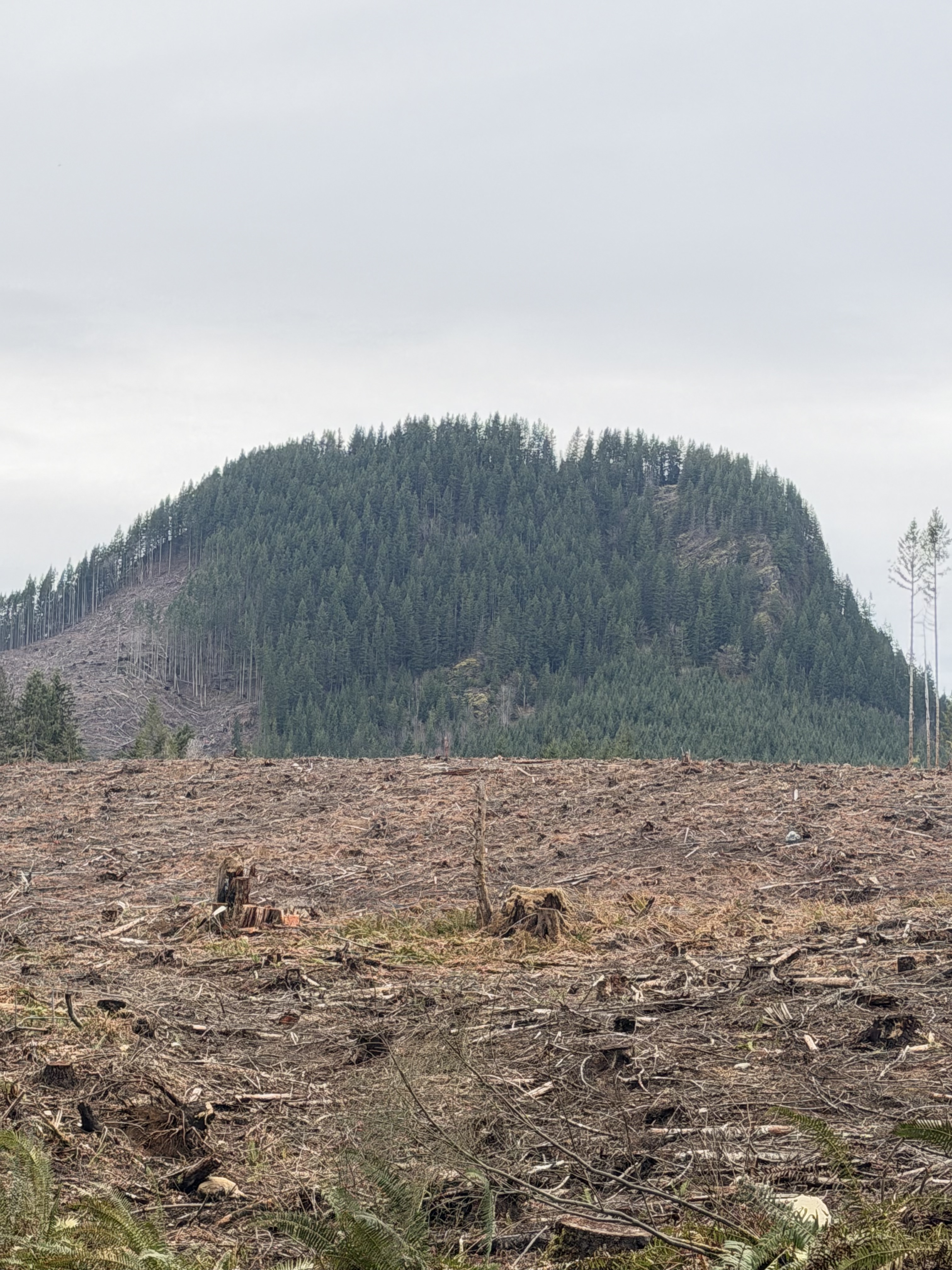
Our heads got a dusting as the elevation weather continued to bring snow. Our cruise back down the mountain a success, we packed up and headed back down, below cloud level. Timing had been perfect, we got in a good run before the weather socked in, and had enough time after our physical endurance tour to drive casually and take note of the beautiful evergreen scenery where temperate weather held the snow at bay. It was not raining at lower elevations, which was a little bit of a surprise, but inversions like this are common in winter. We could have packed a couple of fishing poles with us and wet a line, but instead, we saved some of the fun for another overcast day. Our time in the snow had wiped us just enough to enjoy the lookie-loo journey. As we headed back the the gate, our horizon opened up with a dramatic aspect of Mt. Fuller. It’s part of the traditional lands of The Snoqualmie People, in a region they call, The cək’ʷdup ʔə tiił sdukʷalbixʷ (Valley of the Snoqualmie). You can look at the regional map with place names made by the tribe here.
It’s good to know places, and their histories, especially ancient lineages of people who have lived here and thrived for tens of thousands of years. A special thanks to The Snoqualmie Tribe, as they continue to educate and help us new visitors about their sacred lands. When we recreate as guests in these places, it is good to give thanks to the people who have stewarded this land, lived with wilderness in deep connection, and continue to practice their relationship to the land to this day. By recognizing the strong ancestral histories of places we inhabit, we can become more closely connected too.
I’d also like to remind readers that back-country skiing is not something to do on a whim, without any knowledge of where you are going, potential threat to safety, and the proper gear. Not only do I have ski gear, I also have avalanche gear- like a probe, shovel, and beacon. I made a plan, shared it with a trusted contact back home, with clear timing on how long I’d be gone, and when I would return. I went with a buddy, who is avalanche trained, and also familiar with back-country skiing and safety protocol. We knew there was a mid-level threat of avalanche danger in our area, and took precautions in choosing our rout and access to avoid high danger areas. There are maps online to help you check before you go. Always have a plan and take a buddy if you can!
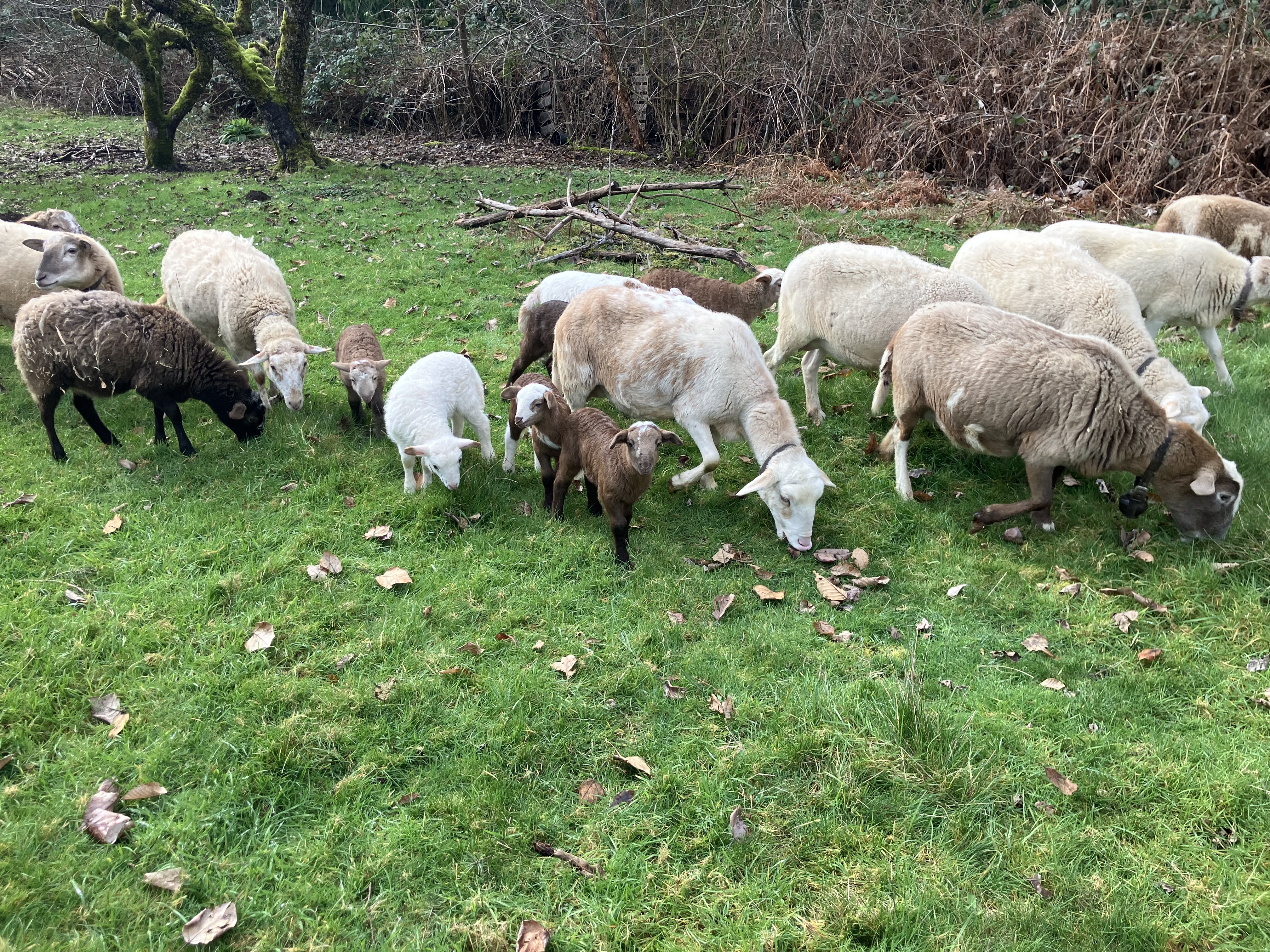
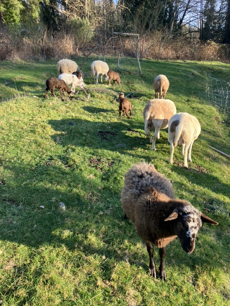
It’s late February, 2026. Yesterday it snowed, but nothing stuck. Rain is forecaster for the next few days, and we badly need it. The pasture is growing just enough to let the ewes out for some early grazing. I’m still awaiting the drop of 3-4 more lambs, while the seven already born romp and play about. Lambs get the zoomies, and it’s always fun to watch them frolic in the sunshine. I’ve still got plenty of hay and alfalfa safely stacked in the barn, but fresh greens are always preferred, and the quality of taste comes from the diverse diet of Katahdins. They are a browsing breed, preferring broad leaves and off the ground vegetation, as well as grazing. This early blossom and bloom has it’s ups, but the downside could be a rough dry summer. I might be saving hay now, but could be stuck buying more early to supplement in late summer, when no rains makes the ground too brittle to graze ethically.
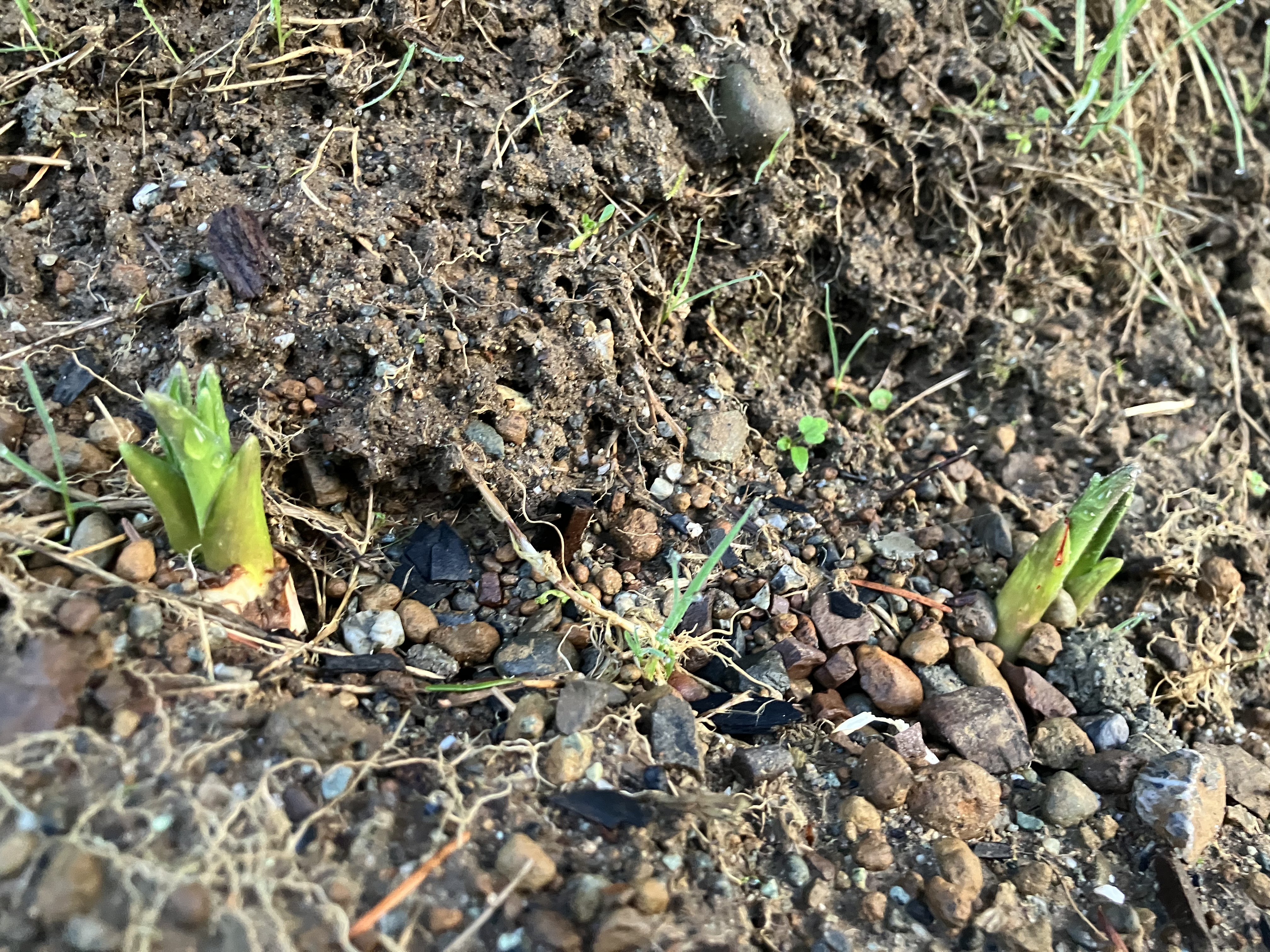
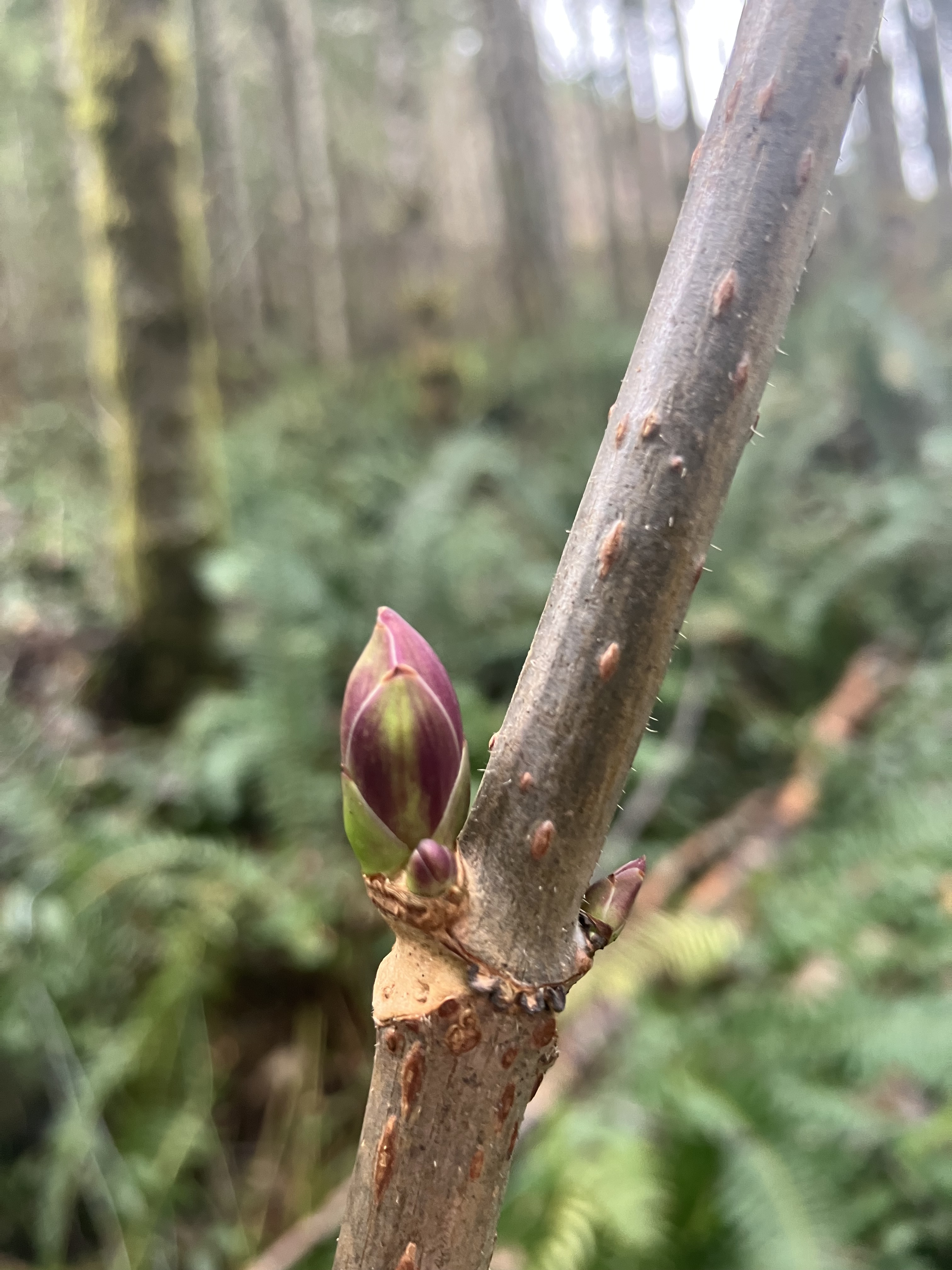
Right now the sheep can free graze in larger pasture by the house, where all the gardens and fruit trees reside. Since none of the plants are leafing out, the sheep leave them alone. Once buds burst onto the scene, it’s a final count down to spring green. In some parts of the coast in our temperate climate, leaves are peeping. Here at the farm, stinging nettle is out, and we’re harvesting it for some much needed fresh veg from the landscape. Blackberry buds are also out, and they are nutty in flavor with a sweet aftertaste. I brows them off the fence lines while watching the animals move around the open space. It’s good to observe what your stock is eating throughout the year. It also tells you what is missing from the landscape, in this case, more oso berry, currents, and elder. These three natives are leafing out, and will offer great browsing by early April, before a lot of the other shrubs and trees have fully leafed out. Bulbs are also sending up tender starts, which the sheep would brows, if the slugs and snails were not already out and about after dark. These well adapted gastropods shelter in freezing temperatures, but as soon as rainy evenings return, they are out hunting down what little flora appears.
When camas bulbs germinate, Spring is on it’s way, even a month early. I think it’s going to be a bad fire year. But right now, we’ll get a little more much needed rain, followed by a few days of potential snow. I’m grateful winter’s will is taking hold, we’re overdue for enough continual frozen days to knock out insects, their eggs, and some weed seed. The ecology of the soil has adapted in certain climate cycles that have begun to change, signalling change in soil composition and productivity. The winter freezing cycle may not be cold enough to kill most soil pathogens, but it did activate cold tolerance and adaptation to exist in freeze cycles, which in our Pacific cost region, also means a lot of rain and snow. While up in the higher elevations hiking this month, I did not encounter the usual feet of frozen water destine to slow melt into the ground to replenish the water table and prevent summer drought, which ushers in wildfires. The earth’s living matter evolved into complex systems that are still trying to adapt today, I say trying, because things are changing at a faster pace than ever seen in the earth’s living history.
In response, my instincts brought me to a wet region of the country with access to a relatively intact water table (do a deep dive here). However, long term aquifer recharge is slipping, while use goes up. This theme is common around the country and the world. Finite resources are just that, and matter can neither be created, nor destroyed, so go figure. The colonial legacy of scarcity continues to push exponential growth in market economy, which expects us to buy buy buy in consumer dependency, while reminding us why costs keep climbing, because resources are in high demand and short supply. The pollution created to maintain supply chains has already contaminated those finite natural resources, like clean drinking water, safe soil to eat from, and clean air to breath. The energy it will take to clean up our environmental messes continues to be the cause of financial scarcity, which is compounded by mass consumption and no moderation in site- that would hurt business dividends. But back to cute lambs and restoration farming.
This is where some small part of slow food continues to carve out a niche in ecological mindfulness. People come to see the farm, buy larder supplies, and take in small scale systems that do pay for themselves and provide a necessary product, sustenance. Our farm still buys some inputs from commercial operations where gas powered machines are used, we source our hay and alfalfa form reputable sources that measure their product’s for nutrition, but it’s not a certified organic operation. There are some short comings in our farm’s holistic approach, but we’re as low impact as you can get in agricultural production that pays its way. Our planting maps are dominated by native species, and supplemented with some fruit and nut trees that are a short term plan in the long term restoration of this space. Adaptability remains paramount to success for our economic viability, as well as the survival of the ecology, which is the only way we’re growing food folks.
When most agriculturally minded people look into a bit of untended land, they cannot see food, only wilds needing to be tamed, aggregated into productive space. It is not in the forefront of their minds that what’s there is already a successful, and very complex system. It’s not sustaining a tangible product that can be harvested and sold in commodity markets. Those systems were designed by very short sighted profiteers, in a time when the world was flat, germs were evil spirits, and most people could not read or write. We’ve come a long way as a species in understanding how our world works, and I’d love to see it reflected in how we live as part of that complex system. As spring blooms here, I glean some buds, but leave others to blossom into other treasured edible and medicinal plants. I note where early leaves appear, and note what kind of climate cycle we’re in this year to hinder or hasten vegetation into active growth. Bugs are out and about, so that protein source is readily available year round. This is the mindset of a forager, which recognizes opportunity, rather than extractability. The two mindsets are starkly different- the opportunity being positive, abundant, and adaptable, while extraction mindset is about removing something through force, taking, leaving behind a void. This is the mindset of scarcity. How can we all adapt?
In the natural world, it’s Spring in haste, followed by dormancy though the hot dry months. Some cycles will miss each other, as flowering trees blossom, no pollinators are out yet to move fertility around, thus it could be a bad fruit year, but the tree might be forcing it’s flowers early for just that reason, recognizing we’re not getting enough water in the soil to support it bearing fruit this year. It might be saving it’s strength to wait out the coming drought year. Our region has been in drought since last year, which could also be part of the signal for this tree to bloom early, then drop into dormancy till next year. Lots of seasonal cycles adapt in this way, and our ancestors knew how to read these signals. Could we pay more attention? Always, but who has time these days? Just step onto some raw earth in bare feet and look up to the sky- if you can, for those not in a safe place to take off their shoes, try to get to a window or step out onto the stoop to look up. What time of day is it? Are there clouds in the sky? What can you smell, taste, hear? Is there a breeze on your skin? Can you point north? These are grounding steps I take when I’m in need of a little slow down and look out. What do you do?
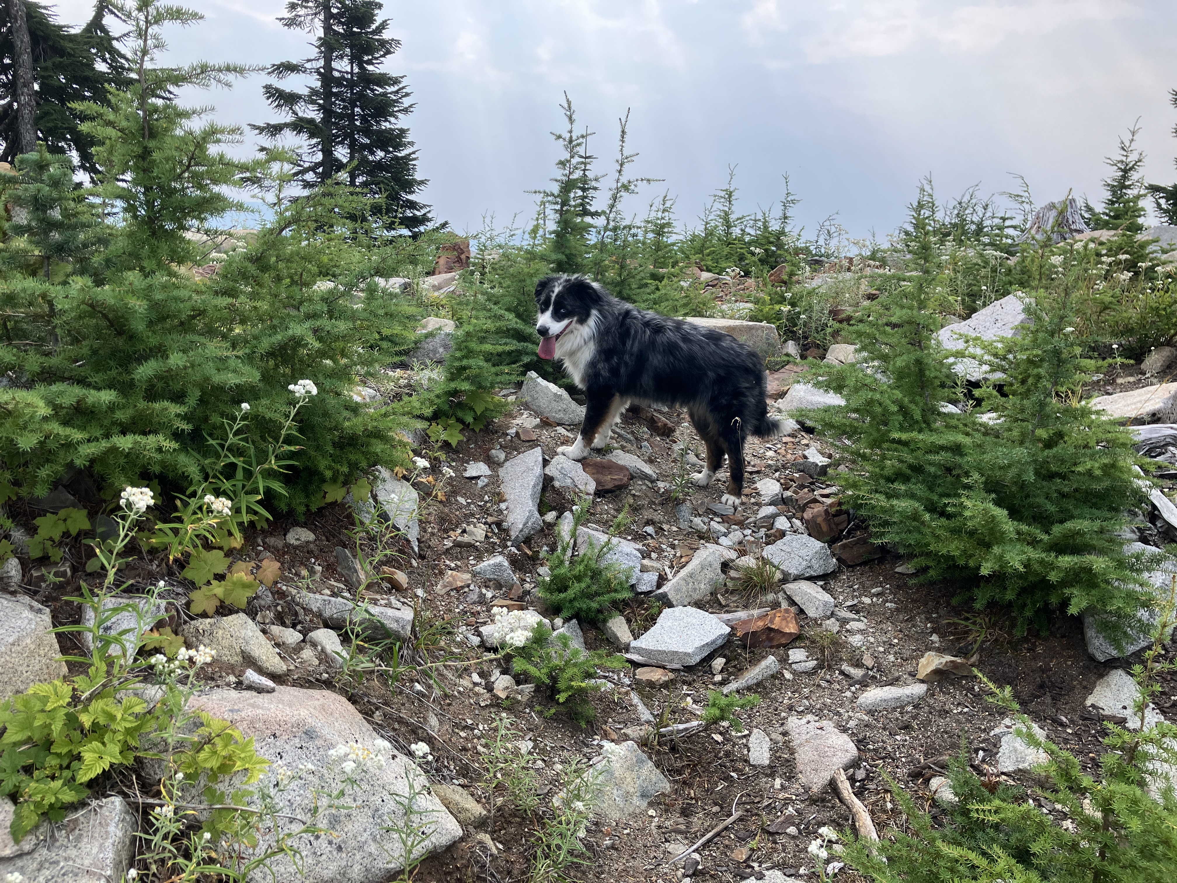
On a late summer day, the Snoqualmie Valley was hot and thick with haze of wildfires from far to the south. The stock and farm were well tended with water, shade, good ventilation, and room to roam through the forest groves at EEC Forest Stewardship. Valentine, the Aussie Cattle Dog that allows me to be her co-worker at Leafhopper Farm, was eager to get a good run in that day, and I could tell we were headed to the mountains. Packing up the 1 essentials in my day pack, I grabbed Val’s leash and pack, extra water for us both, and the basic med kit for scrapes and bruises along the trail. Images of my rout, driving time, the weather for the next few days, and text to my housemate with a hard return plan and location while in the back country assured prompt response, should something go awry.
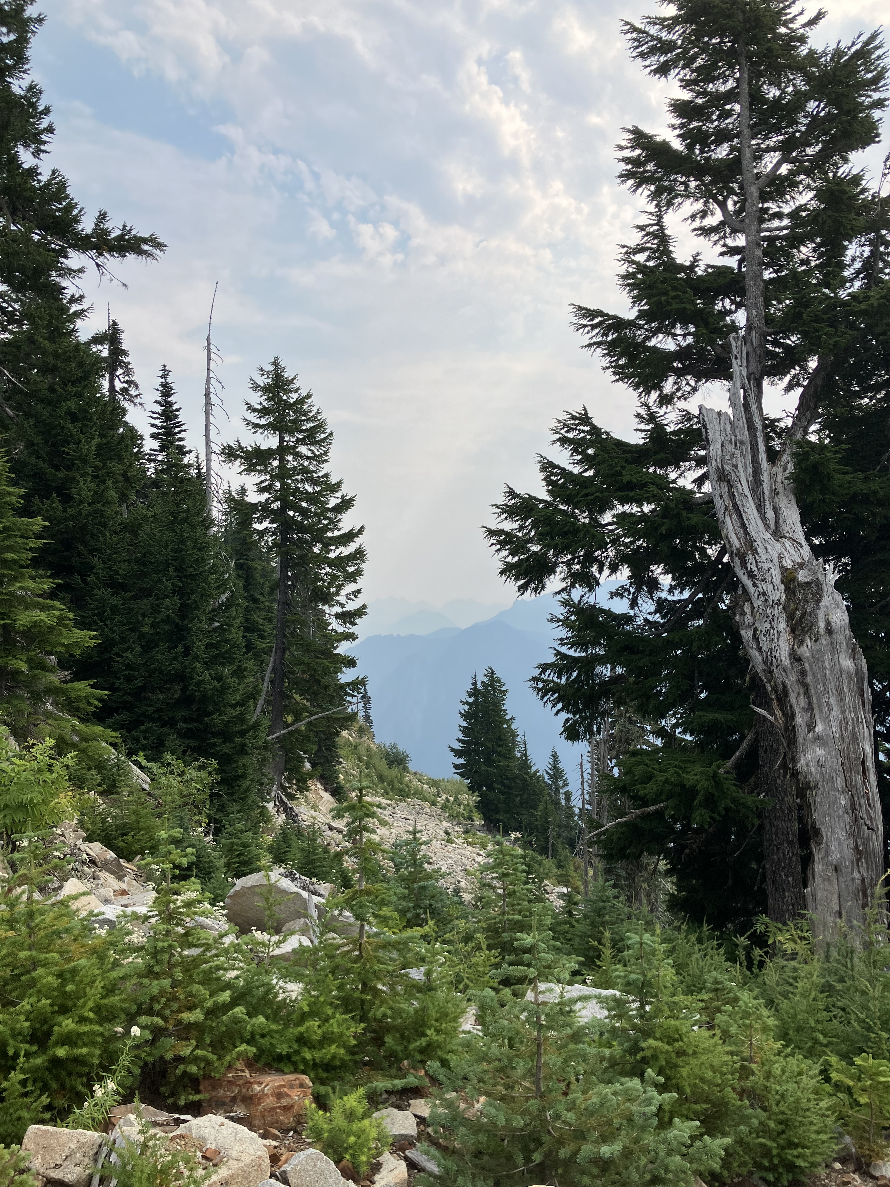
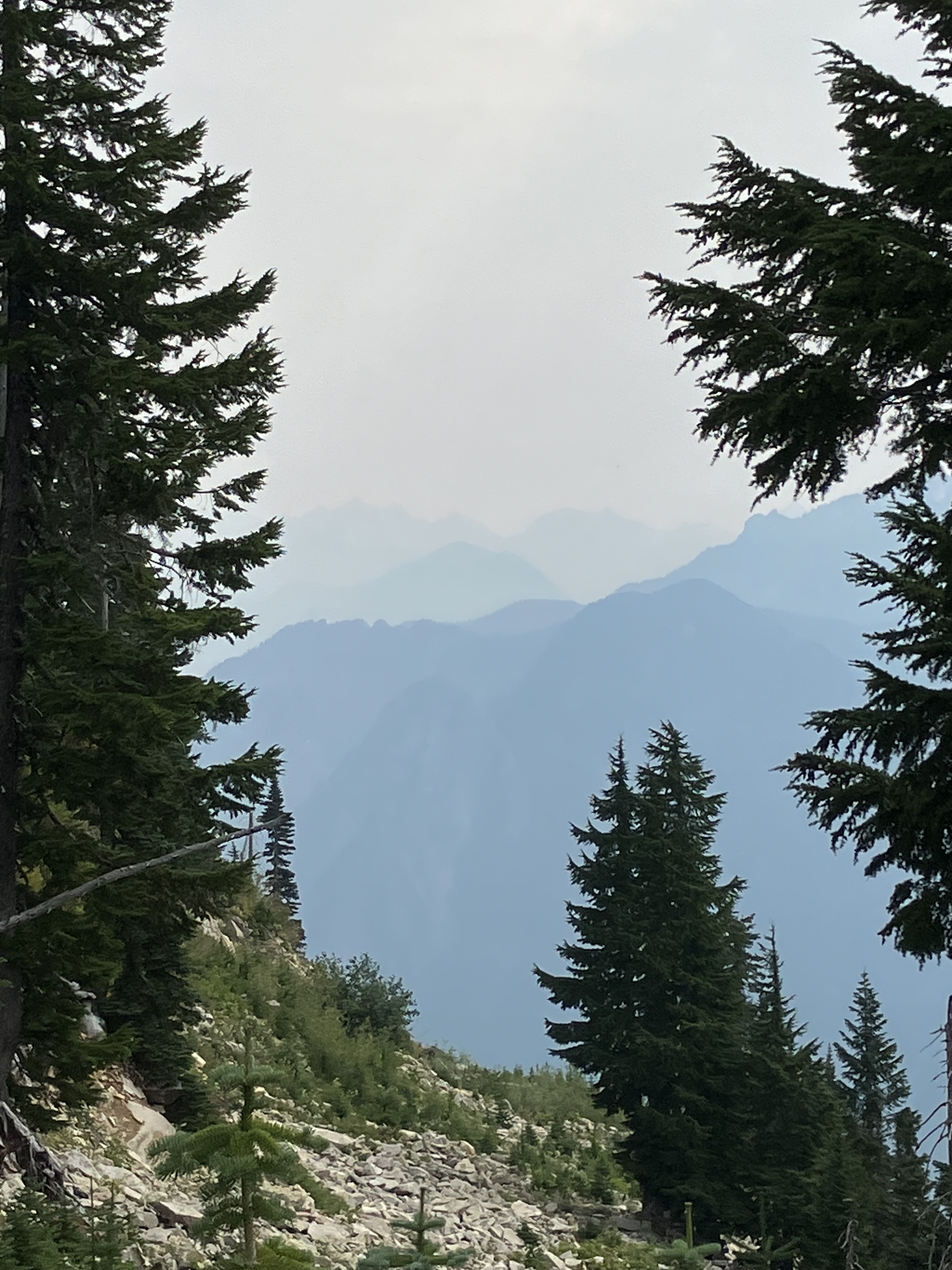
I’m often out alone in these woods, with a good dog companion and the personal safety gear to feel confidant about back country exploration on a day hike through established trails. It’s almost two hours from major hospital care, but a flight for life of less than 20 min. I can see Seattle from The Trail Head- because I’m 3,600′ above sea-level with a spectacular west facing view across the entire Puget Sound Region, and The Olympic Mountains beyond. This eagle eye view of the landscape inspires me every time I catch this view from the edge of The Central Cascades. Then, through a portal of high evergreen canopy, flanking me with spruce and mountain hemlock, slide alder, and bear grass; I am in the subalpine slopes, looking up at crumbling crags of stillness against arching clouds and glacial carved lakes holding the rains of atmospheric rivers. These waters cascade down tectonic uplifting slopes, and to the north and south of this range, rising up outside this chain, two volcanoes, active maws capped in ice to assure us, it’s not often going to blow it’s top.
For this hike, I’ll be turning my back on coastal drama, returning to the rocks of Cascadia. Layers of mountain peaks stretch out beyond my planned hike for today. The series of bowels I’d be skirting, rising slowly on a smooth course, with no switch backs, climbing a mere 600′ in total. From there, I could take some steep climbs up scree slopes, but alone, that was not my first choice of smart moves of the day. I’d gone up alone once, to see the crest to the next rise beyond, a saddle dipping down a more extreme 3,000′, with countless switchbacks. I’ve never gone down “the back side”, but it’s an established trail, so I have plans to ascend it some day. Today, with the ease of my hike, I did take a few off trail scrambles up small hills to check the forest for mycological activity. There had been some low clouds in recent days, which is enough moisture in the air to trigger many mushrooms into fruiting. Temperatures were another matter. Though it was summer and hot in the valley, up at these heights, the heat was bearable, and a dip into one of the alpine lakes would ensure an opportunity to cool off along the way. Val was fast to her favorite smell spot under a huge boulder along the first scree slope the trail cut through. My path was a logging road legacy trail, towering rock battlements loom above, and one gets the sense that this place is very unstable. The large rocks littering the edge of the trail compel timely movement around to the next bowel.
Wandering over the first of two saddles, I pop out on the vista of Lake Nadeau, which is the smallest of the three. I’ve seen surface activity that leads me to believe there are fish in there- but I’ve not carried a pole in yet. There are steep walls down to the shore line, and I’ve hiked sown to the west end, the outflow, which becomes a series of wetland bogs with forested islands till the next sloping drop to Lake Hancock below. This area is magical, with forested peaks, literal triangle towers with craggy outcroppings reaching up to the sky. I have enjoyed summiting a few of these surrounding spires, and the views are spectacular. Most have a ridge that takes you right up to the tip. I do not scramble or climb rock faces out here, the stone is loose and slipping in many places, and rockfalls lay evident on the slopes all around.
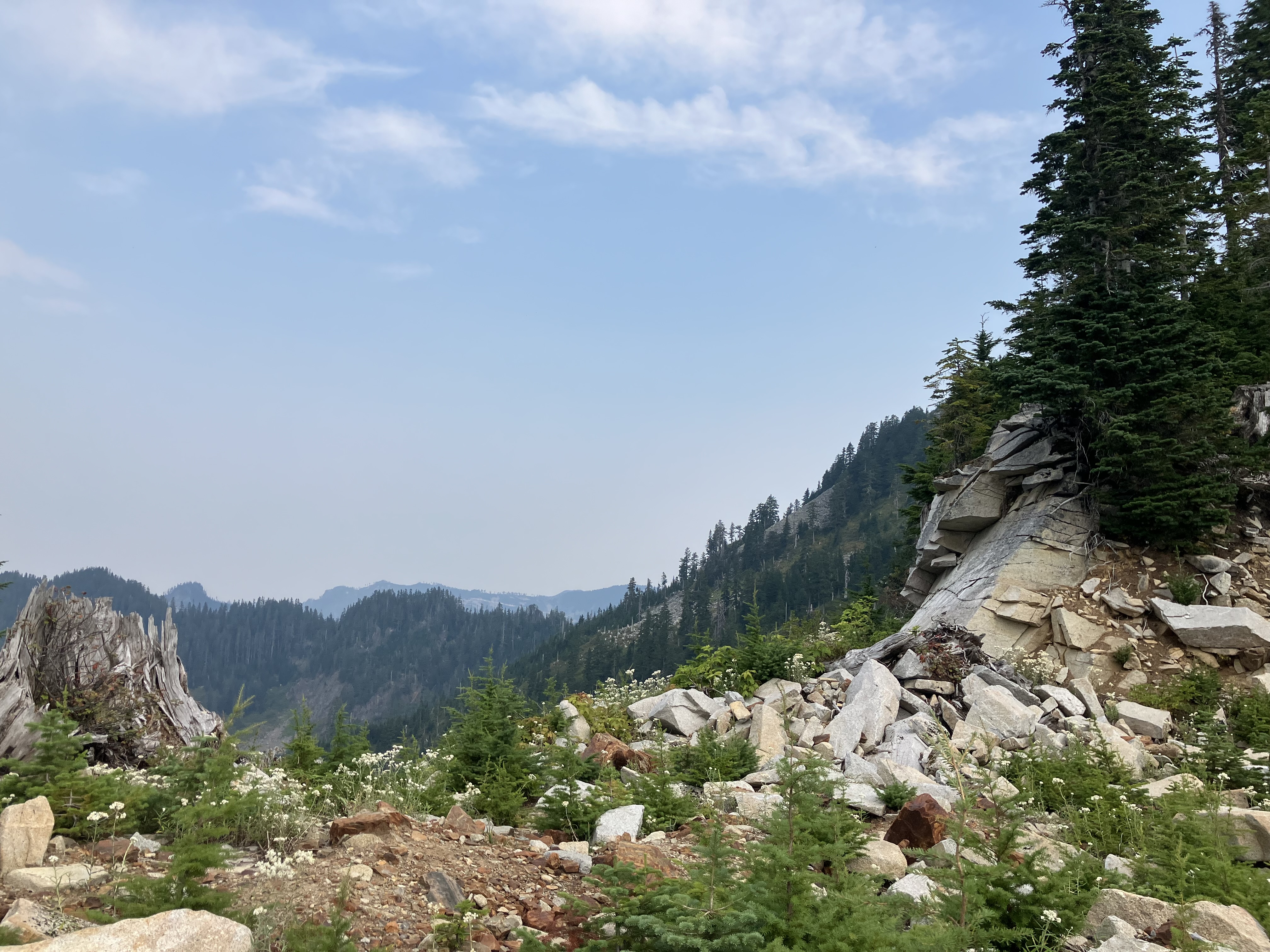
The trail arcs to the east, around a much higher ridge with towering old growth Douglas fir trunks twisting out of stone scree with determined crowning snag. Any tree towering above the ridge line or alone on a slope will be wind torn. The damage shows in missing tops, jagged openings where branches, twice as wide as me, strained under gale and ice, bow low over festoon boulders. My dog has picked up on a pika scent, and stands pointing at a rock crevice where I catch a glimpse of a dark brown blur darting back into the protective stone fortress it calls home. The warren of nests and cash sites woven under tones of fallen mountain face have hosted these rodents, and many other wildlife and plant roots for centuries. Before that, a mile of ice or more ground down the basalt and granite core, remnants of a great volcanic chain in a shallow sea. How can this ocean legacy stand now at over 3,000′? Faults are fascinating, and the thought of a force great enough to lift oceans has my awe. Of course, those dynamic activities of volcanoes and shallow seas happened millions of years ago, a stretch of geologic time my brain cannot fully wrap around, and yet here I am, walking over the second saddle and seeing the white limestone layer of coral, overtaken by basalt, and deep red clay left from a huge glacier lake that could have stood here, over this whole depression, before more uplift drained the melting ice into the sea, leaving fertile sediment in the valley floors far below.
Washington State is an impressive geological map of countless terrains, form exotic to Mesolithic, There are young strata hugging some of the oldest on earth, and that reflects the cataclysmic fault lines that run along our Pacific Northwestern coast. When our North American plate lets loose, the Pacific, Cascadian, and Seattle faults rupture, but it didn’t happen today, so I’ll not dwell on it now. Instead, Val and I come down a crowded stand of blueberry bushes, stepping carefully along the muddy bank to a rock outcropping where I like to leave my pack and gear before dipping into Lake Moolock. The water is cold, sometimes too cold for a long swim. I wear a wet-suit when going in. The clear water reflects turquoise in the shallows, and a midnight blue to black depths at it’s center. I don’t swim into deep water here, especially not alone.
Swimming alone in a remote alpine lake is risky, but driving here was worse on the scale of eminent threat. My wet suit makes me more buoyant, I stay in shallow areas where I can stand and touch bottom, and I don’t overstay my visit into the frigid waters. Still, it’s not the safest choice, but I do enjoy some back country swimming in wild water. The lake is so clear and beautiful, and the wildlife in the water with me is awesome. All the amphibians are here- from newts to the Giant Pacific Salamander. They stay well away, but float around nearby, watching the only real predator threat they’ve encountered (besides each other) in this fish free water feature. All of them would be, before people stocked them with trout. Luckily, this gem remains a haven of native species, for now.
When I plan to swim, I pack fins, goggles, and my snorkel. It’s a little extra weight to my day pack, with the wet suit, but I love the chance to get into wild water, and especially this lake, because it’s always been me with the whole lake to myself, and Val of course. She loves a good swim, and will let me know if she thinks I’m swimming too far away from shore and her watchful eye. The south shore where I spend most of my time, is quite shallow for the first ten or fifteen feet out, then gently slopes down into the depths. The north shore is steep, plunging down in a cascade of boulders from the crumbling mountain above. It’s quite a dramatic scene, but I don’t swim over there often, that’s a little too far when I’m out swimming alone. I have circumnavigated the water with a friend, but we had to take time out on the rocks to warm up half way around. Valley wags her tail with relief when I come back to shore.
After letting the sun dry me, I pack up my wet gear and decide to bush wack out a different way, wandering over the saddle at a higher elevation before dropping down onto an unexplored peak. There is a little thick brush to press through along the edge of the woods, but spruce and fir quickly build a canopy above, catching most of the light, and leaving me to wave through fallen branches and slick needle duff on the slope below. When I hiked in, I stuck to the easy sloping trail. This warmed up my muscles and joints, then I swam, using my whole body to move through the water. Now, my frame was ready for the slanted traversing. There’s no flat ground on these peaks, so your ankles and knees take on a lot of extra work. If you’ve not warmed up for this, injuries are probable. The twisting, bending, and scrambling to get around in this terrain can be strenuous, but I love the exploration and coming across new paths and accesses to the area.
My wander took me across two peaks and down towards the north side of Lake Nadeau, where there would eventually be a shear drop, so I angled left, to the east, and found another old logging road grown over with willow and slide alder. Now a game of twister really started. I love climbing through non spiky vegetation. In the lowlands at home, a lot of shrubs have spikes, which get into your hands when you push back the branches. Here, the smooth young saplings were a welcome handrail through the underbrush. I popped out at the crossroads where the main trial was and headed back around the eastern arch of the lake towards the first saddle. The stone blocks along this causeway are very impressive. They line the trail, flanking either side like some king of prehistoric monument. The white granite glimmers in the afternoon sun. It’s a partly cloudy sky with some smoke haze, but there’s no precipitation in the forecast, so I don’t need to be watching the skies for a ques to descend.
Weather at elevation can be deceiving, so study your forecast well before heading into the high country. Summer storms are not uncommon, with clouds building up on the horizon blocked by towering peaks, which do not herald the storm until it’s over-topping the mountain and coming right over head. Always keep an eye on the ridge-line from the direction your weather usually blows in from seasonally. Today, the clouds were strung out in small billows without a sign of rain. It made exploring more relaxing, I was not worried about wind, fog, or sudden cold drops. All these are possible in the mountains, and I’ve had to hike and drive out of fog banks when clouds are low over the mountains. Having your sight line disappear and the winds pick up can be the start of hypothermic weather. That’s what you’re most likely to die from in this environment.
Most of us are not thinking about subtle drains on our reason, like cold. When you’re moving around, you may not notice the cold, but when you slow down, and the sweat on your skin begins the cooling process, shivers set in, and by then, you’re heading into a dangerous count down. We’ve all been cold, shivering, teeth chattering as we stand in a cold place without the right layers of protection. Maybe you run from a sauna into cold snow and quickly back into the steam room, or wear a t-shirt to run the garbage out in the rain, but imagine being far out in the mountains as you begin to loose feeling in the tips of your fingers. Cold seeps in slowly, taking the feeling out of our limbs, making us slow and groggy. Eventually, people think they are too hot and start taking off layers, even shoes and socks. By then, the brain is in survival mode, and most of our reasoning has gone dormant to keep our core alive. If you are alone in this state, no one else is there to tell you it’s happening. You won’t know until it’s too late.
That’s why I’m up here on a warm sunny day, enjoying the end of long days and extended light to guide me back out on the trail home. It’s been a great outing, and Valentine pants along, having gotten out her zoomies, smelled all the scents, and bounded over every rock and log she wished. We had no wildlife encounters, which seems to be what most people worry about outside. With the dog around, I’ve never encountered anything, most animals know to clear out at the sound or smell of K9s. The most dangerous predator we might encounter in the woods is another human. With that in mind, bears and cougars are a rare site indeed. So are other people at this location, though I have run into others on occasion, with pleasant greetings exchanged. No one joined us in the elevations today, but it was a great solo hike with a clear start and finish. Looking at the time, I see I’ve made it back to the trail head with plenty of time to get back down and home before dark.
The light is changing fast as the sun begins to sink into the west. It’s always good to time your day trips into the peaks with plenty of exit room in your schedule. The last thing you want to do is hike out in the dark. I’m at the truck, and enjoying the sunset from atop a boulder near the road. My drive home is familiar, so I’m comfortable making it in the twilight. I’ve already sent a text to my housemate, letting them know I’m back to the truck and getting ready to come home. I give a clear arrival time so they know when to expect me. Even though the hike is over, the drive could still pose obstacles and hindrances to my safe return home. Still, the vehicle is one step closer to being back in my own surroundings once more. As the last of the orange globe sinks over the horizon, I start the hour long meander back down the mountain and across the upper and lower Snoqualmie Valleys, all the way back to my own ridge on Big Rock Road, names for the large glacial erratic at its start in town.
May we all continue to have safe adventures in the outdoors. With good planning, smart gear, knowledge of the terrain, and sharp self awareness, our journeys into the high peaks can be safe and epic at the same time. Good hiking, biking, driving, and exploring to all.
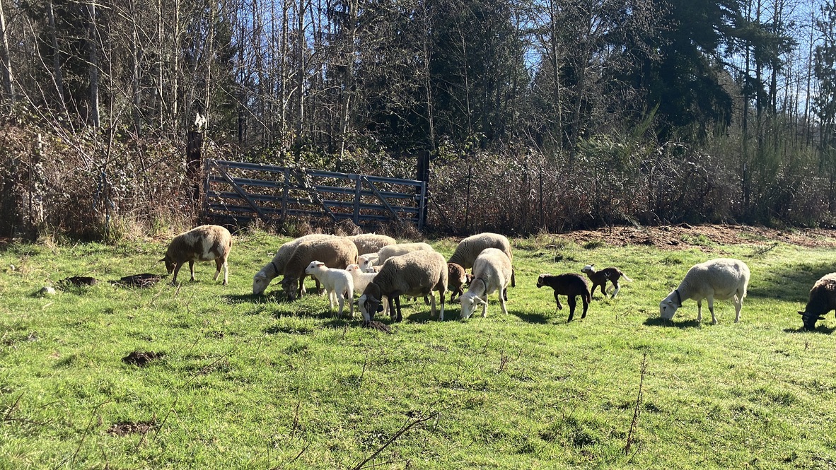
New life is bursting out of the barn at Leafhopper Farm. We’ve had three sets of twins and a number of other large singles, all healthy and growing up fast. Ewes are embracing motherhood with gusto, and it looks like I got my timing right this year. What timing? When the ram was put in to breed last summer. I opted to put him in early, in July, and the ewes were at peak weight because the land was at it’s most abundant. Since these sheep eat off the land exclusively in summer, the most abundant growth of vegetation determines when the ewes are ready for breeding. Two summers ago I put the ram in when the ewes were not at their peak, and got all singles out of the breeding that year. A ewes ovulation will be less active if she is skinny. I was not paying much attention to that, as I was more focused on when I wanted lambs to drop, which can also be important. However, in delaying the ram’s introduction, I missed the peak window of the ewe’s weight gain, and missed a more abundant ovulation cycle, which would have upped the potential for twins. This last summer, I watched ewe weight and pasture production, timing the ram when everything was at it’s peak of performance, and got three sets of twins, which is moving back in the right direction for lambing numbers.
Ideally, you get twins from all your ewes each year, but I don’t grain my animals, so they are bound to what the land can offer them during the growing season. In lean years, I’ll have leaner lambing, which fits into nature’s natural cycle. If I was beholden to industrialized expectations, I’d be graining my animals year round, and hoping for triplets or even quads from my ewes. The extra lambs would be bottle fed, and I’d have to be raising tens more animals, which would certainly not be sustainable on my acreage. Industrial systems don’t care about the land, the animals are being fed by costly inputs that will fatten the carcasses, and build maximum gain from each animal, but the outputs, like manure, become unwieldy pollutants, full of the chemicals used to grow the corn and soy fed to the animals. This conversion from plant to meat is a horrible payback- madness actually. If our stock market reflected the losses on crops fed to meat animals, it would have crashed a long time ago. I’m not n economist, but I do see the inequities of industrial corn and soy, and what that cost to produce earns back in meat sales. It’s not a winning bet folks, but it keeps the fast food industry and your cheaper frozen food sections of the grocery store profitable at one end of the scale.
Since we live in a finite world, to gain somewhere means taking from somewhere else. Here in North America, we rarely experience loosing something noticeable, materials are available, but becoming more expensive every day. We’ve gotten quiet about groceries, because we can still order same day delivery, and stream shows on our screens without too much complaint. We the consumers are most adaptable- able to swipe what we don’t want, and receive hundreds of suggestions in our feeds. There will always be something on sale, always a perceived discount from a club card, and even the good old coupons for those who prefer more tangible savings. Here’s the secret- you were already paying too much to begin with, and even with sales and discounts, you’re going to pay more in future. That’s exponential growth in a nutshell, but it’s a one way street- with your costs going up, but your pay stagnating. Welcome to corporate slavery, where you are beholden to investors from an elite “cabal” of money market account controllers. But what does this have to do with lamb love? Liz, are you starting to click bait us with your blog titles? No, because these lambs are beholden to ecological indicators, not stock dividends.
When we can participate in cycles of the natural world, we can better our investment portfolio for long term sustainability. When we can tend literal gardens, instead digital ones, we’ll have the food we need, and abundance to share and barter. When our minds transcend legal tinder, and dive into the waters of community involvement and cultural cultivation, we’ll find a wellspring of initiative, opportunity, and abundance in what’s already growing around us. How can you grow something? Even ideas count in this ecological economy. I’ve seen so many people get involved, then invest in their own systems of production for the better, stronger community involvement, production on holistic scale, enjoyed and encouraged by other like minded producers on limited scale within the bounds of finite resources. And guess what? When more invest in this way of life, it grows in value- just like stocks, but in tangible wealth- food, village, friends, health, and other basic needs being met together. Why is this hard for us today? Because corporate profits rely on individual need and want- rather than collective. If we have public transportation, we don’t need cars. We’d then have less traffic, affordable infrastructure, and less need to go away from the village to get what we need to survive.
When I first started raising small ruminants on my farm, I had to calculate how many animals the land could support, and it took several years, through several different seasonal cycles, to know the capacity of the space and what would keep the ecology in balance. There are plenty of pasture calculators online, but they do not have seasonal drought and flood data for my area, much less the traits of my breeds in play. I’ve talked many times about the living system that we’re working with here on the land. Pasture rotation is crucial for holistic management, and though I live in a temperate rainforest, we don’t get a lot of rain in summer, and without irrigation in the pastures, I am beholden to the rains for production. The industrial world ignores nature’s fluctuation, fitting everything into a nice data point to be logged in a spread sheet of statistical data that brings predictable structure to our corporate overlords, thus making their investments infallible. That’s how our investments keep growing- from one pot to the next in consolidated money market accounts promising a certain percentage gain. That’s the greatest myth holding up our economy to this day- exponential growth.
I can’t keep growing my herd every year, I have finite constraints in production- as does the whole living world. But money can keep appearing, more wealth, consolidated in the top 1% of people on this earth. While most of us watch our slice of the pie dwindle- which is what’s happening on the planet, out ecology- it keeps getting smaller, depleted nutrients in the soil- less nutrition in our food, less water, less affordable places to live, a world of scarcity. What if we could find enough? What would that look like? Here at Leafhopper Farm, the production part of EEC Forest Stewardship, we’re working towards balance, not profit. What is enough sheep for the land? What is an affordable amount of alfalfa to buy for the winter? How few animal can we keep, and how large a herd can we grow? I’ve spent the last ten years trying to answer these questions, and the numbers change every season. I can keep buying some inputs and produce more to sell, broadening the market for hyper local meat, or shrink down to just a few animals for myself, removing the need to buy hay, and returning the production to a sustainable closed cycle, but that’s not the current intention here at the farm. I want to produce enough to sell to my community- creating a food source that is ethical and without chemicals. I also fight to keep my pricing affordable, and make sure I can donate a few lambs to non-profits as well, keeping abundance in the system.
It’s February, and the sheep are grazing, getting alfalfa, and lambing. The most abundant rejuvenation of the herd happens at the most dormant time of the land’s seasonal cycle. I would struggle to raise this many lambs without hay, bedding, and LGDs to watch the flock and keep predators at bay. This system pays for it’s self, why can’t industrial systems be held to the same requirements? If they were, we’d have less options for purchase, and a lag in competition would stagnate the markets. Nature does not operate on these principals. It rests sometimes, not caring about growth, but pausing when there is not enough light, water, or soil to grow. Nature knows its limitations, and will self correct if the balance tilts too far off center. We see trees drop their leaves and slow sap production, flowers go dormant, bulbs sleeping under the ground till warmer weather triggers renewal. We humans are prone to sleeping more when there is less light in the sky, and other mammals go into full hibernation, slowing their biorhythms through the cold dark months. What if we treated our economy similarly? How would that look?
I’m coming at all this from the farm, where there are finite obligations to producing ethical food. What if the world moved in this direction? How can you as a consumer take a step in this direction? Buy local when you can, look for seasonal options in your diet, learn a craft and contribute, volunteer in your community, and get face to face with others, in person. These are simple steps to regrowing our village connection, holistic living, and mental rejuvenation. Just being outside can improve quality of life- in most places. I’ll always note that outside access is a privilege, and nice outside space with green belts, wilderness, or even a playground, can be hard to locate in highly industrialized societies. We were pushed into factories and corporate offices- where we’re still obligated to return today. Where can you undermine these systems? How can you tune out, unplug, or unsubscribe from online addiction? I’m heading out to the pasture now, to move the herd, muck out stalls, and feed the dogs. It’s another beautiful day in paradise, made possible by friends, family, clients, and the plants and animals of this restoration operation. Gratitude to the living world, it’s abundance, the lessons we learn and share together, and those willing to read these reflections. Thank you all.
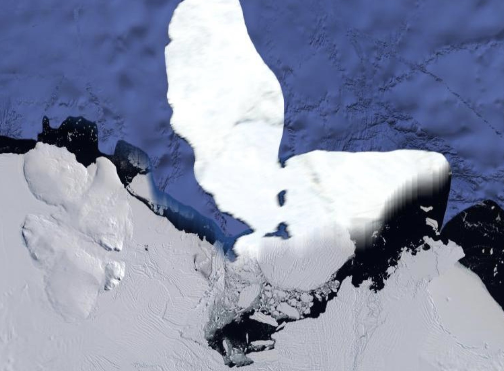
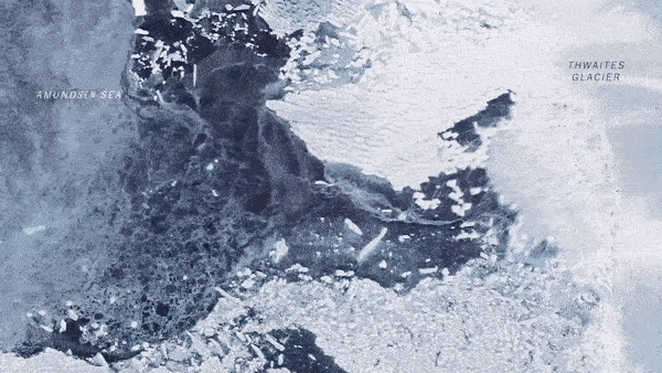
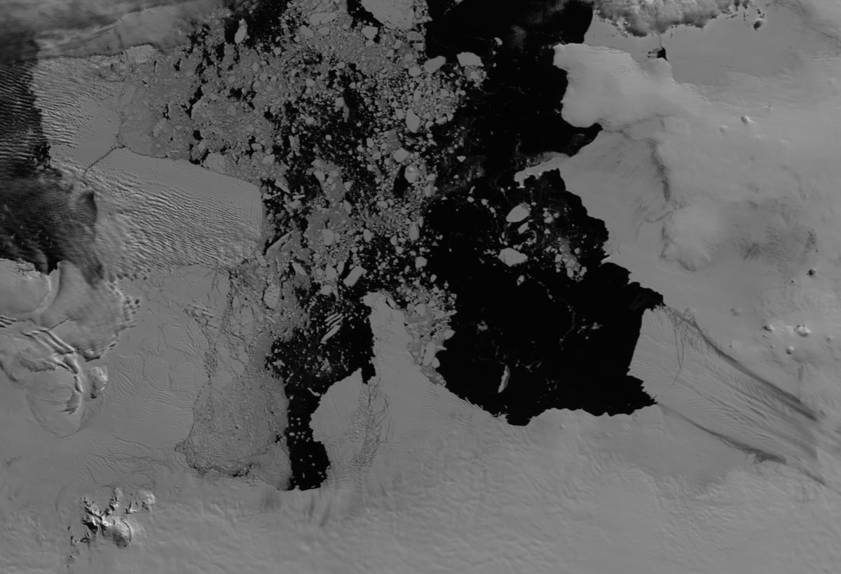
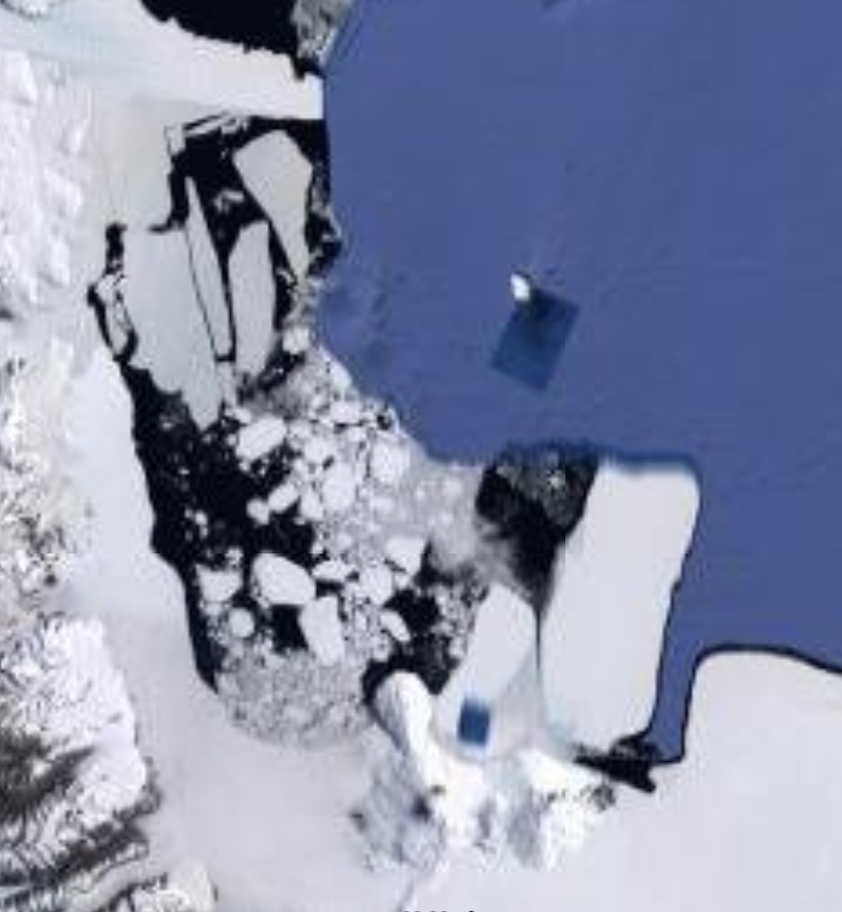
This is the Google satellite image of Thwaites Glacier. You can see a little signature of the ongoling melt by the ice breakup right along the edge. Now, what you are not seeing is how extensive the breakup is, extending further out into the ocean beyond, though obscured by strange white smearing and blobs of color that easily abstract what’s going on. Below are some clear satellite images to help bring the reality front and center.
In short, this glacier is breaking up very fast, being undercut by warm waters flowing in from the north, ocean currents that carry tropical temperatures down under the ice, melting it far below our visual comprehension. This ice melt is huge, and when it’s done, the sea-level will rise around the world at least 2 feet, and more in some places, like the southeastern US. Thwaites is also known as “The Doomsday Glacier“, because the world coast map will be redrawn when it’s done melting out. Yes, if just that glacier melts, but it’s not just this glacier, all around the edges of Antarctica, the edges of ice are unraveling, cracking off and melting at different rates, depending on where the ocean currents blast the ice with warm tropical water. Even where there are not strong currents, the ice is still in retreat.
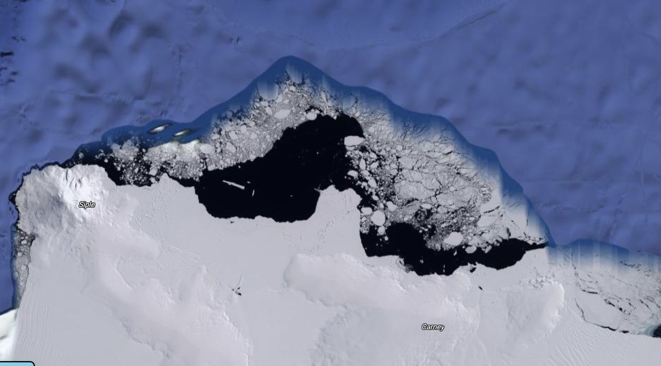
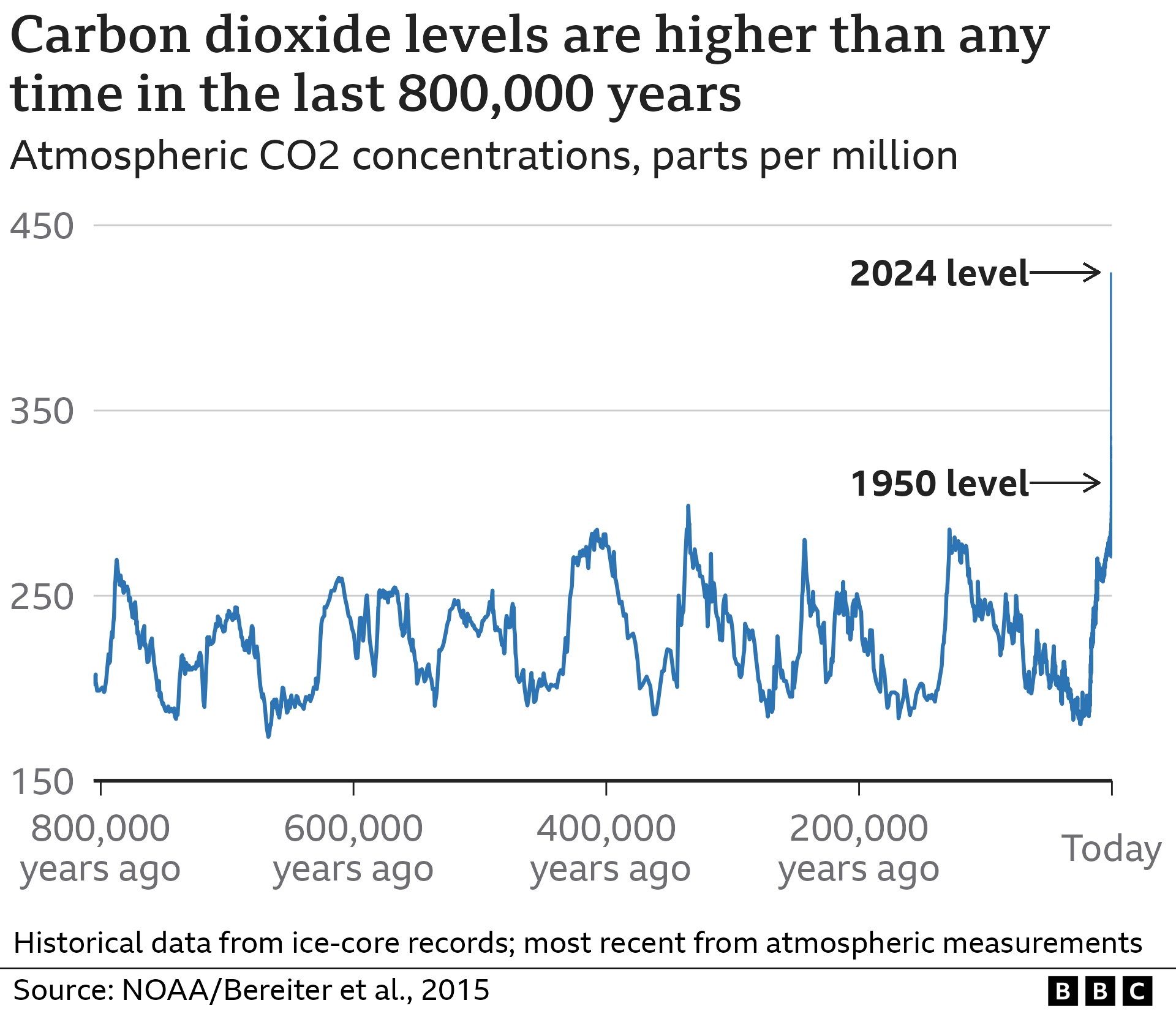
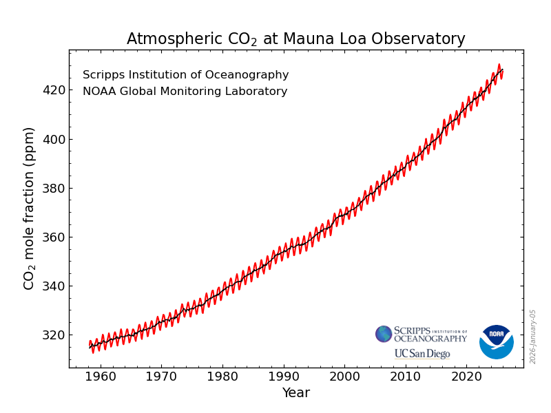
Satellite imagery is had to bring into proper scale for our monkey minds, but it’s big stuff when you’re talking about the 5th largest continent on earth. Thwaites glacier is about 74,000 square miles in area. That’s about the size of my home state of Washington. There’s a reason it’s going to have such a profound affect on our ocean waters. The MacAyeal Ice Stream, pictured above left, is also a major ice melt happening in Antarctica. Imagine those icebergs, or sheets breaking off, and know some of them are larger than eastern US states. The ices at our poles are always seasonally dynamic, but in recent decades, someone turned on the hot tap (CO2), and we’re watching a mass melt off that remains exponential and impossible to reverse.
Thank you NOAA, though on the federal website now, it’s just the map of our record since modern record keeping, which, though constantly growing, does not quite hit the mark on our obvious human cause of that CO2 growth since industrialization. It’s crucial that we at least grasp our very recent growth in global output and personal responsibility in this climate change. The knowledge out there is endless, and research still continues today. I’d recommend a recent NOVA episode on PBS about Arctic and Antarctic climate history. Scientists are working hard to collect data to help shape our understanding of the dynamic change in store for our planet. If we can plan ahead a bit, we could figure out adaptation for the rapid climate shifts heading our way. Please be encouraged by a PBS Newshour story about more research being continued on this issue, it sometimes may feel like USA has gone off the rails with climate science and fallen into complete denial of reality, but no, many educators and scientists continue to get the message out about this crucial survival issue.
This is not writing to scare you, but to prepare you for what’s coming in our generation, the next, and those thereafter. We won’t be well settled on Mars before these events come to a head, and coastal cities not already preparing are places to move away from if you can. The storms and violent weather patterns are only going to get worse, and it may be scary to some, but to me, it just means adapting and doing our best to understand why, and what we can do to build resiliency. Visit your cost lines and try to imagine two feet of rise, then a meter of rise, and enjoy the beach while you can. I’d seriously reconsider any beachfront property investment, and avoid basement apartments in coastal tide areas.
It became quite real to me when Sandy hit The East Coast. Places I had known in NYC, when I lived there, were underwater. I’d never seen anything like it. Now flooding in Manhattan is common place, but it was not a few decades ago. That’s measurable change that sends a chill up my spine. With exponential melt happening in our poles, these floods will become common place, and eventually, the water won’t go away after the storm. In another 20 years, I believe this will be happening in low lying areas of coasts all over the world. That’s what I still have trouble comprehending, what a global catastrophe flood would do. COVID game me some idea of global shutdown, but how will the vast majority of world population move inland and re-home at the same time? How will our finite resources handle that kind of migration? Our infrastructure won’t, not without planning now.
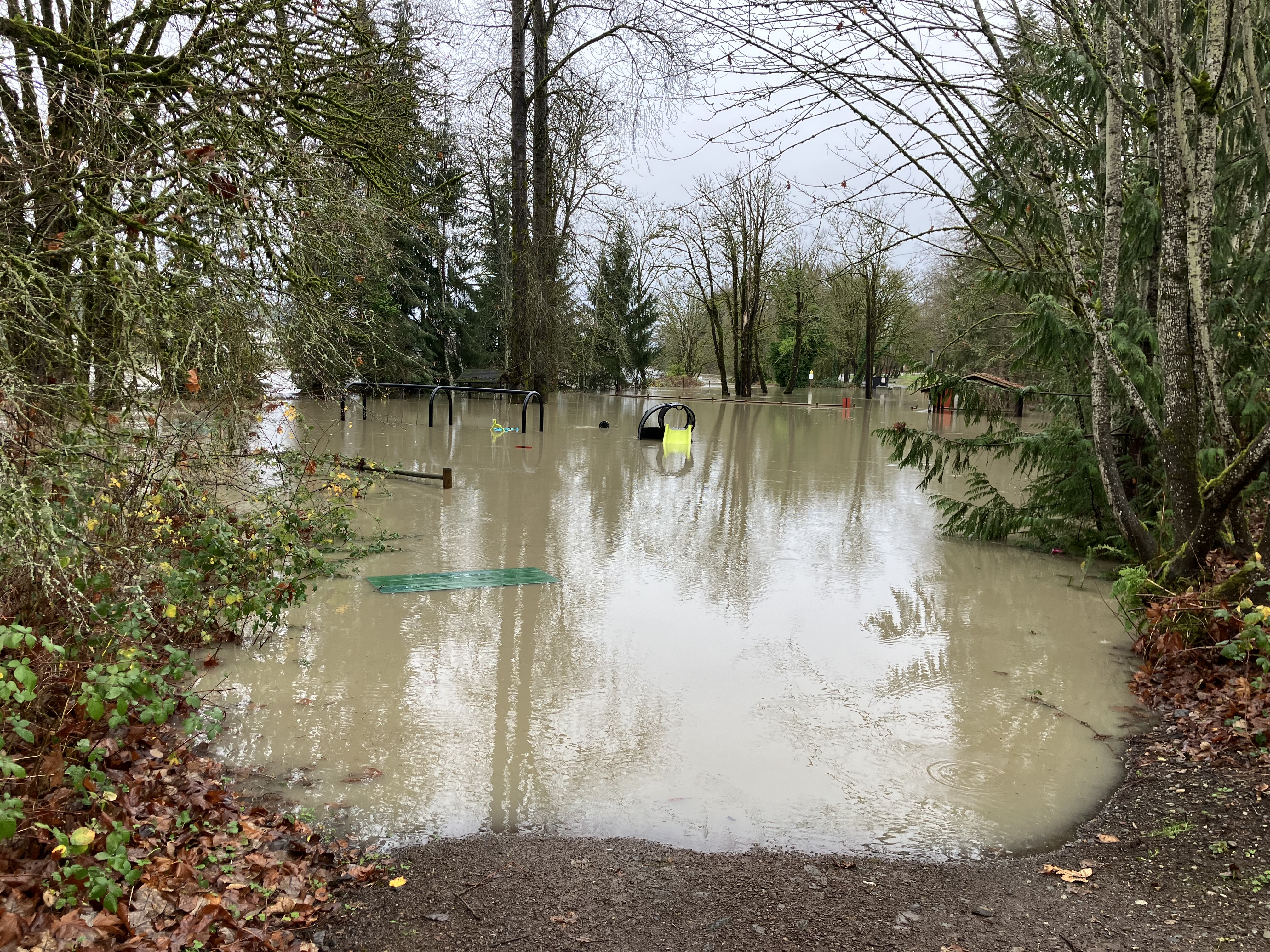
My town flooded in Fall, 2025. It was not unheard of, and I’d experienced higher flooding about a decade before, but this was the second 1,000 year flood in a decade, and multiple 500 year floods have come in that time too. What does that say about exponential change? Here’s another bean for your thought pot, our town is 30 miles inland. We’re not coastal, but close enough to feel the effects of sea-level rise and climate change. In another fifty years, our river could have back tide flow, causing salt burn in our agricultural fields. It’s already happening in The Middle East. I was in Jordan in 2018, and saw a rose farm shut down by salt in the aquifer. It’s also starting to bother the farmers in our Skagit Valley up north. The tidegates there are aging out, and the ocean keeps pressing in. This seawater intrusion will also salinize wells and water tables further inland as sea-levels rise. We’re not talking about this enough.
I know it’s a lot, and so many will be affected, but you can start learning now, forming your own plan of adaptation, and making smart choices when and where you can. I’ve talked about daily changes we can all make in these writings, and online is a treasure trove of many options and ideas still. The most important thing you can do is accept this change is coming, and learn what might be expected, especially in the next 20-30 years. It will be in my lifetime, and probably yours. But hey, I also choose to live in one of the most technically active places on earth, where there is more than likely going to be an unimaginable great quake nearby within my lifetime too, so how do I sleep at night- scale. The geologic scale of a great quake means we could wait another 2-300 years before it happens, or tomorrow. I get into my car often, never thinking about that very high risk, probably the most perilous thing a person does almost daily- but we don’t think too much about it. The climate change challenge is at least a weekly thought in my head, but I also made plans over a decade ago, and here I am, up 600′ of elevation, on a relatively stable ridge, with a lot of fresh water, ecology, and temperate climate.
I’m not saying we should all go start a farm on a ridge somewhere- a lot of people in Asheville had hill farms, that Hurricane Helene wiped out. Fire will wipe our farm off the face of this earth very quickly- when it comes. That’s the most likely scenario for Leafhopper Farm, but EEC Forest Stewardship would be right back to planting native trees and shrubs, relocating logging road edge side ground covers to the landscape, which has millions of years of ecological fire relationship. The plants and animals rebound quickly after mass devastation strikes. Just look at lawilátɬa. Dynamic landscapes are resilient to change of all kinds, that’s what makes this area so special to me. Even after the big quake, the land will continue it’s abundant rejuvenation. Those are the lessons I take in every say I step outside and reflect on this land. It’s been through a heck of a lot in this century alone, including the complete removal of forests thousands of years old. I believe they will be back here one day, with humans continuing to live along side, perhaps more closely intertwined with the natural world as we once were.
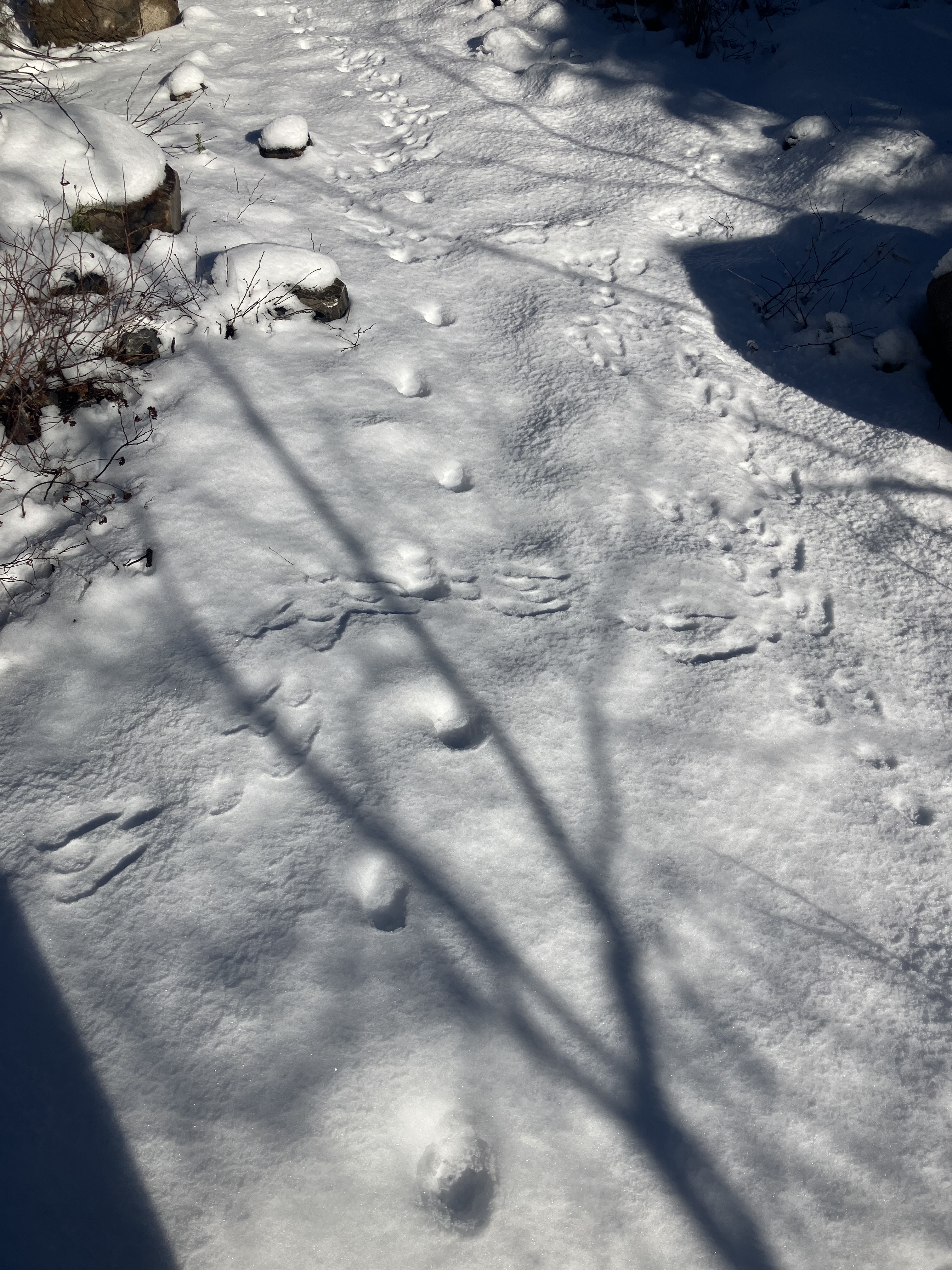
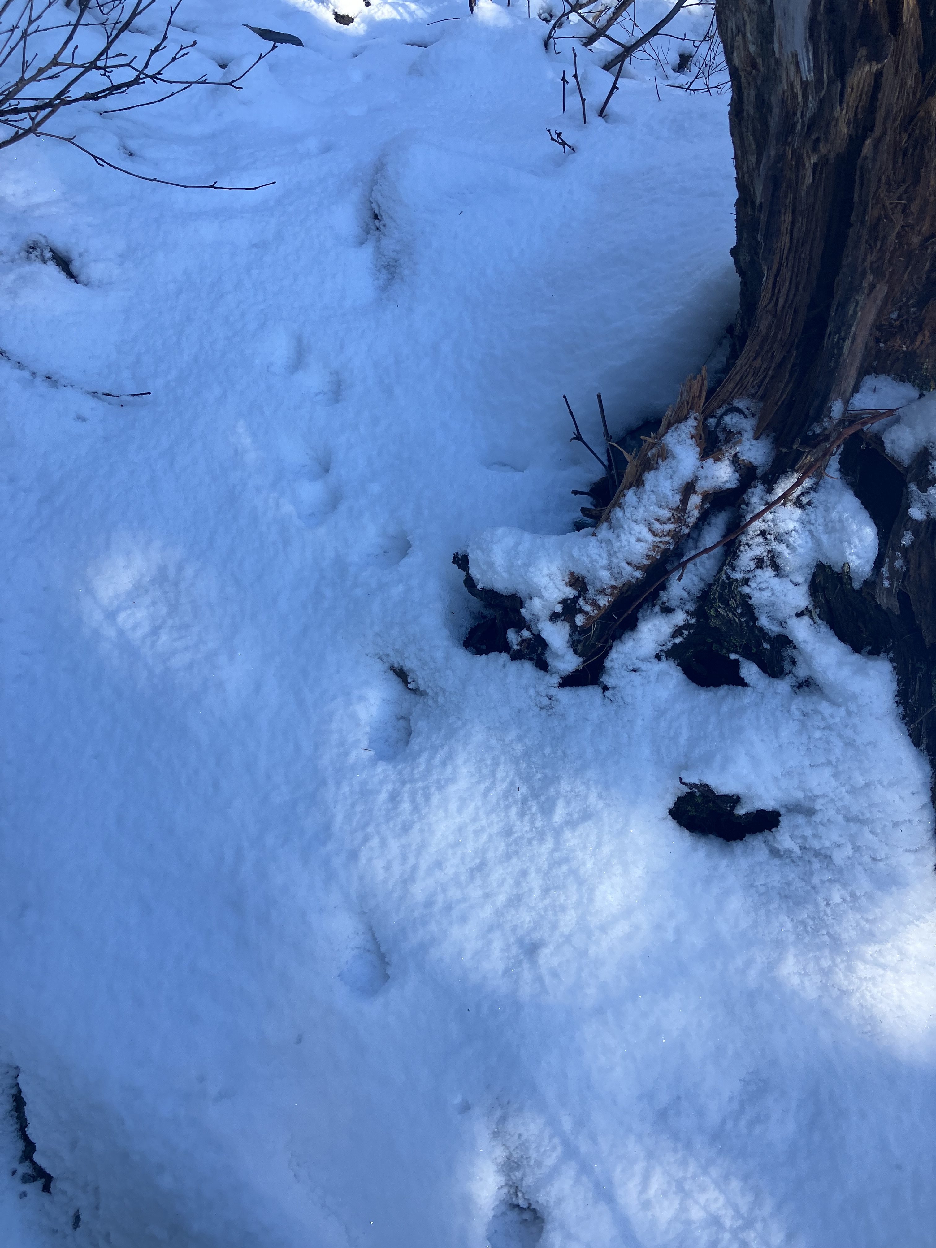
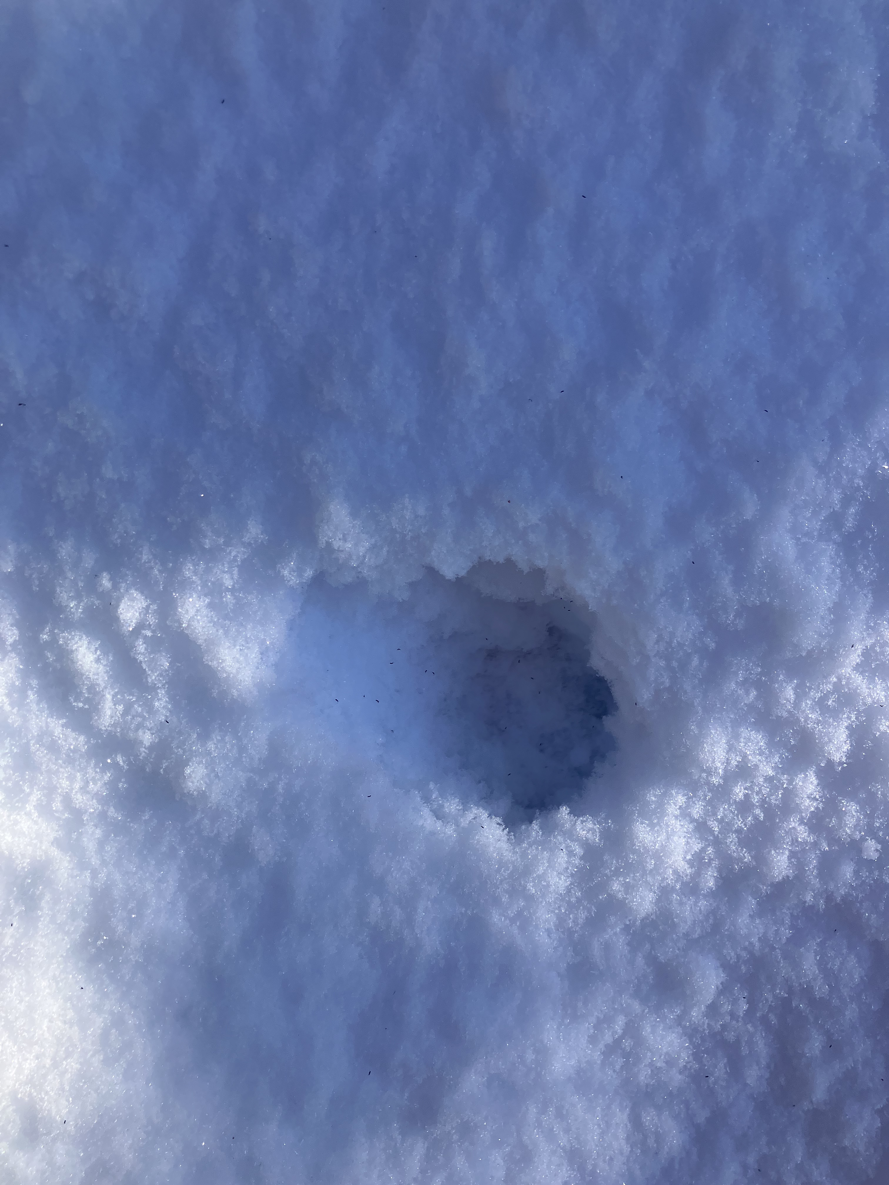
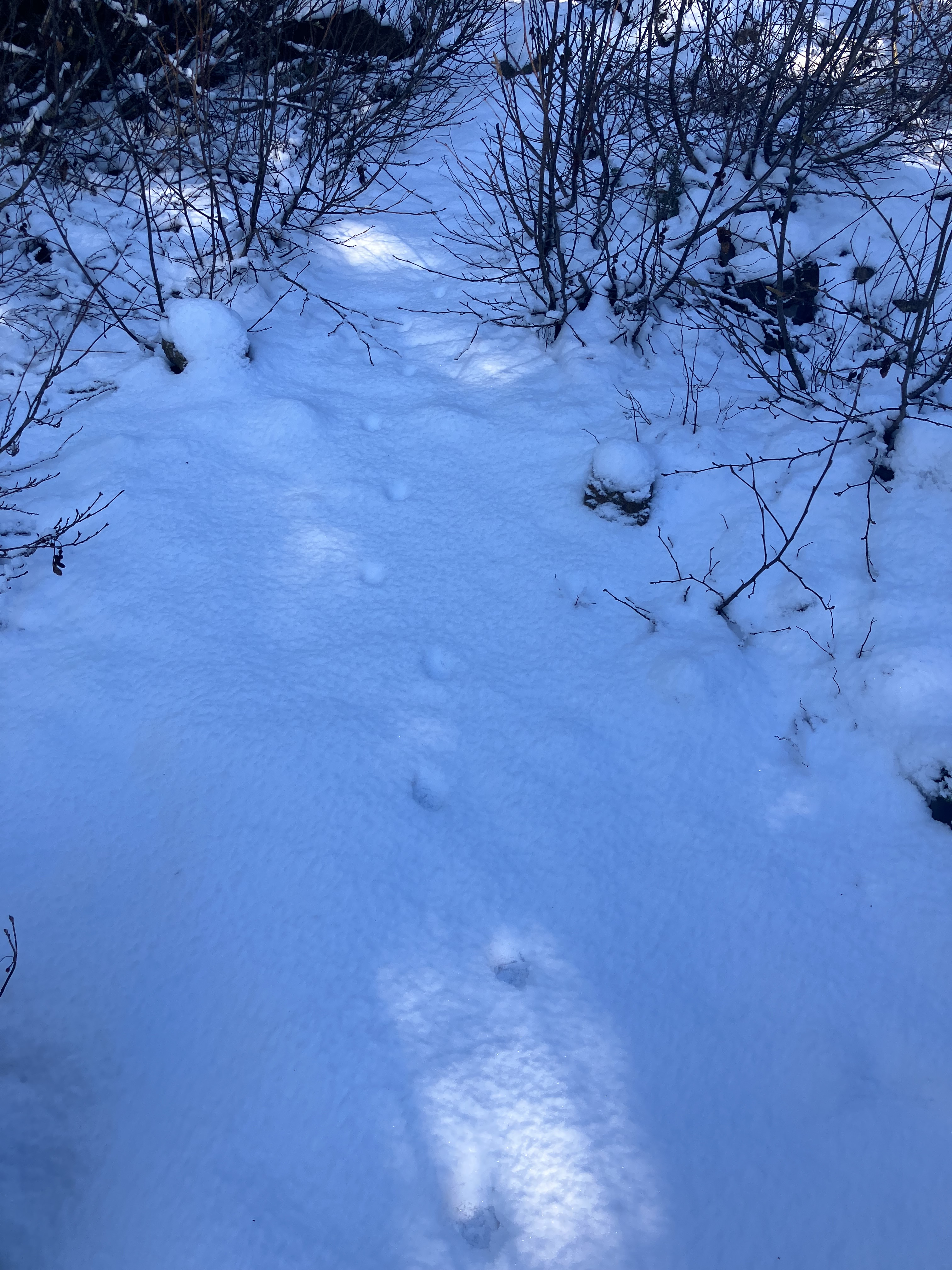
Winter’s wonderland remains austere as longer daylight hours invite more adventures back into the mountains where Val and I picked up some tracking dirt time in The Central Cascades. I’d not planned on tracking, but a fresh dusting of soft powder and the right afternoon light left incredible sign on the trail. The dog is not an easy tracking buddy, as she has no appreciation for the prints already placed on the ground for us to observe. She has learned, along with me over the years, that staying back behind the human staring strangely at the ground earns more reward and less correction. There were some wonderful stories left in the substrate for our learning pleasure, and I took time to observe and record, instead of getting somewhere further on. Since there was already so little snow, I could walk easily in snow boots without postholing. Quite a bit of the trail was actually melted off, showing glistening wet stone along the cliff edges of the mountainside. In direct sunlit areas, the sound of dripping water echoed through the groves of spruce and mountain hemlock as the last of the overnight snow melted away. Still, it was cold enough, and sheltered enough along my hike to catch a glimpse of what’s moving around these peaks.
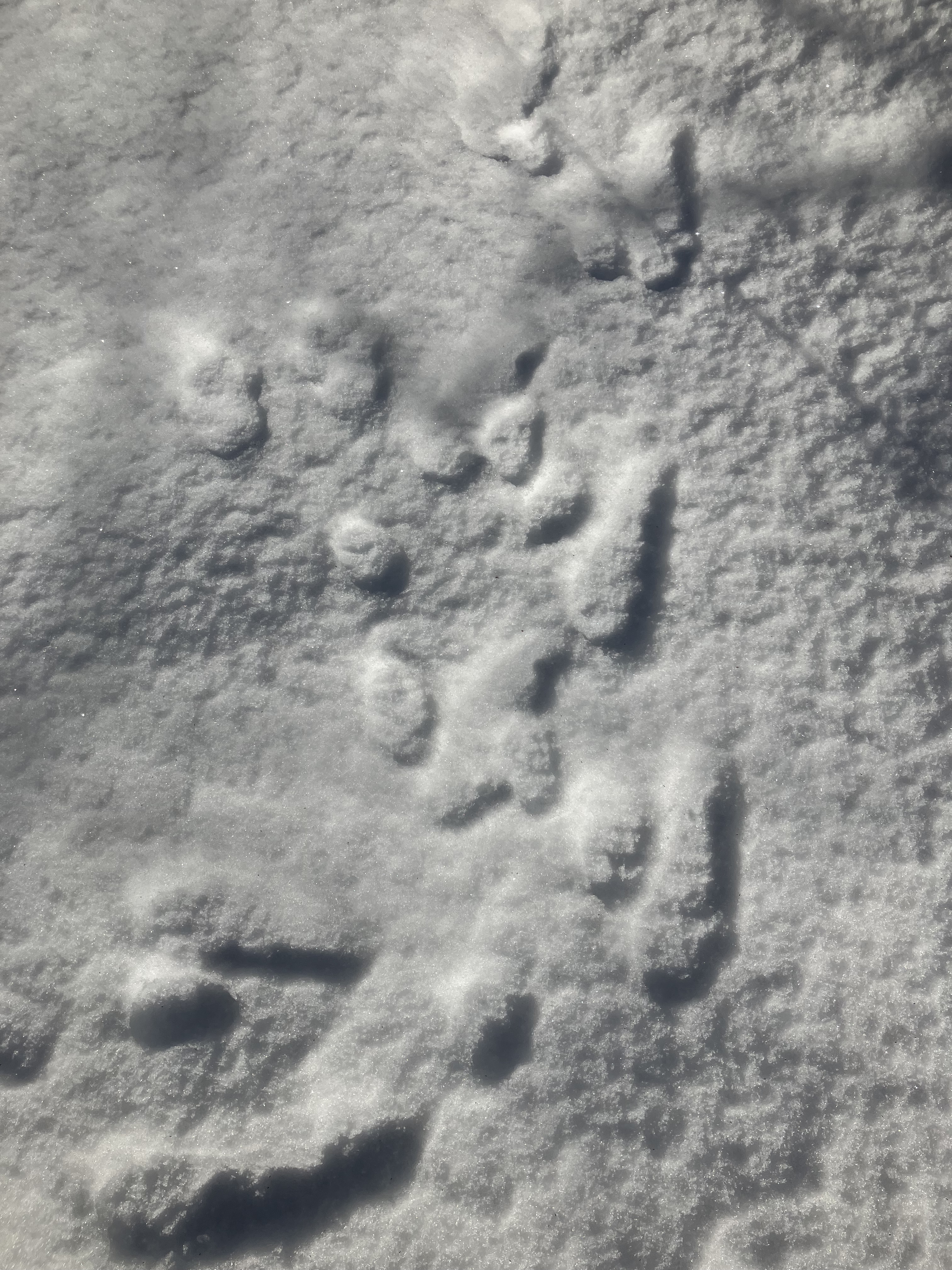
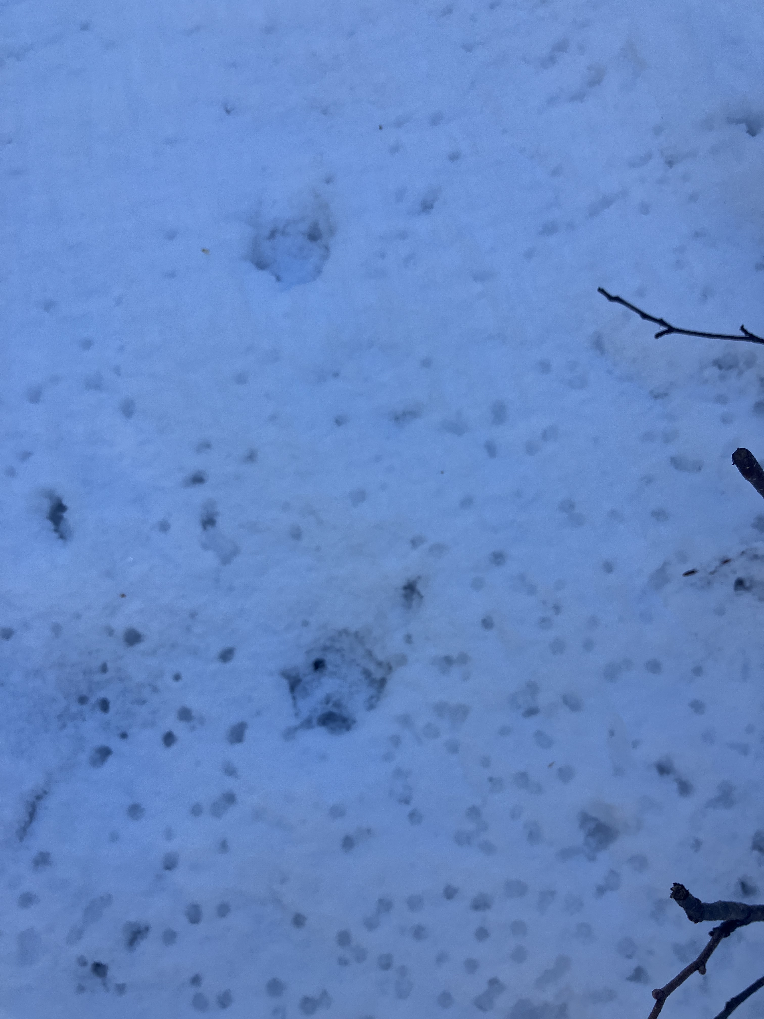
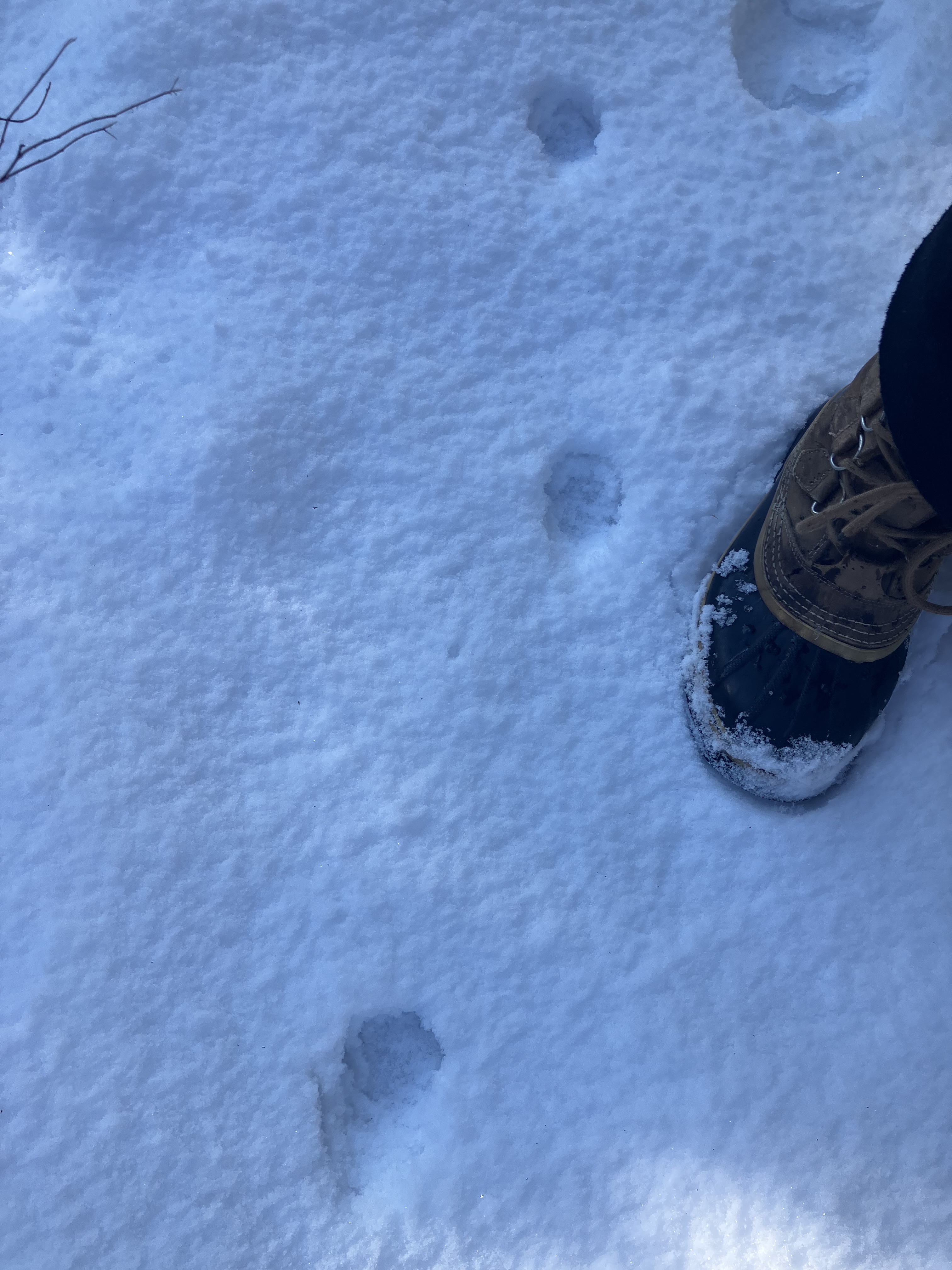
Sometimes tracks form an individual set, and more often, they are scattered about in a collection of multiple species going about their day or night. Squirrel and snowshoe hare were two expected ground dwellers leaving a trail from burrows to larders, water sources, and easy track ways connecting these crucial resources. Between all the little scurrying creatures, a larger set of earlier tracks comes right through along the human trail. The larger set of tracks were confident, steady in direction and pace, assured of safe travel out in the open. These were the footprints of a predator. The size and spacing of each paw gave me a size estimate, and from a distance, the animal could easily be coyote or bobcat. At this elevation, a lone coyote would be a little surprising. As I looked closer at the tracks, other shapes and behaviors moved the mystery closer to feline origins.
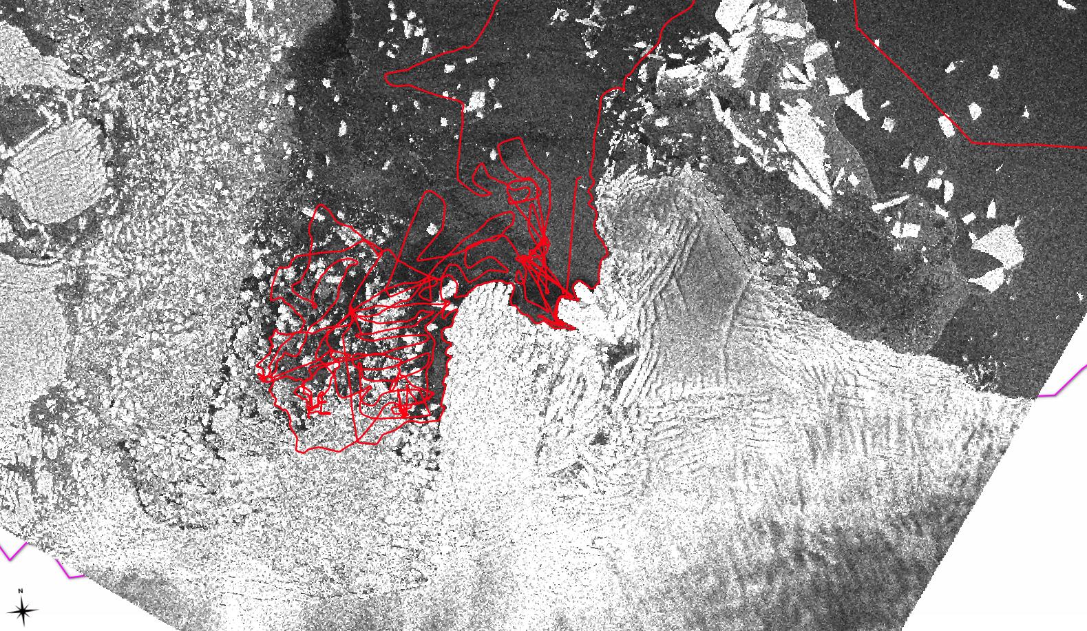
The most obvious dimorphism helping me see the animal is a bobcat is the roundness of the track. Canines have much more oval shaped paw prints, and this animal’s feet are much more circular, like a cat’s. In multiple pictures above, you can look very closely and also see individual pads of the cat’s toes in the tracks, which are more teardrop shaped. A k9’s toes are oval shaped, and aligned in a symmetrical pattern, where a cat’s toes are asymmetrical. It’s very hard to show all this detail in the pictures above, but in person, the signs were clear, and I enjoyed trailing this animal for about half a mile on the trail I was hiking. It stopped to check a hollow log, crouched down between two young willows for a moment, maybe to watch potential prey without being seen. It also knew where it was going, and had probably traveled this trail many times before. It turned at intersections without hesitation, and moved to the edges with more cover effortlessly along it’s way. Reading the behavior of these wild creatures brings me great joy, and many lessons. I’m glad to share them with you, and perhaps inspire your own tracking adventure in the snow. You don’t have to be out in the wilds to follow some tracks, a park or backyard holds all sorts of nature mysteries in tracks and sign for you to see if you look. Gratitude to all the wildlife and wilderness available to learn from, and having access to it.


