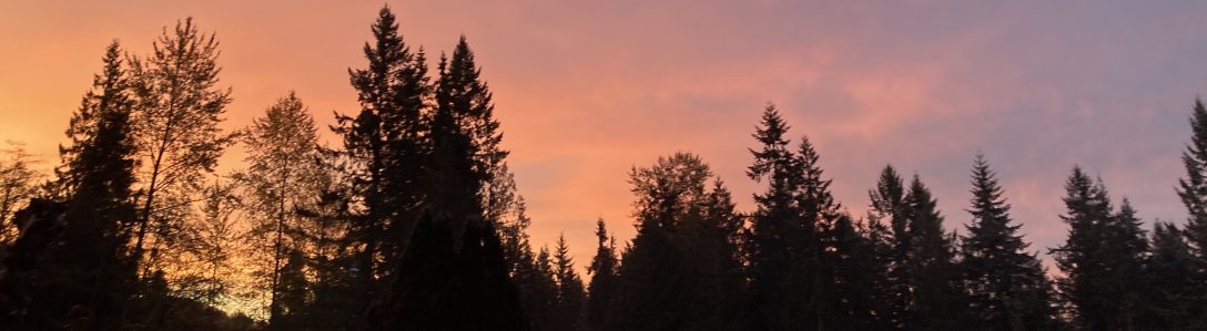
Climbing up into The Central Cascades on a snow day promised some fresh powder in the higher elevations. This is a special part of winters in The Cascades; snow above, cloud below. Elevation temperature changes drastically from week to week around here, and the snow level fluctuate wildly. I wrote another snow report type blog a few weeks ago, when the snow level was much higher in the peaks. This adventure, the snow was really building up at over 4,000′. It takes about an hour and a half to drive up to a point where the snow become deep enough to plant your poles. From there, with skins, even during higher avalanche danger, the logging roads of Snoqualmie Tree Farm offer safe powder access, along the well maintained roads, where there are few, if any, open fields of lurking danger. Instead, tens of thousands of acres of plantation forests dot the hillsides and mountain tops all around, and we took off up a ridge line, heading east towards The Alpine Lakes Wilderness.
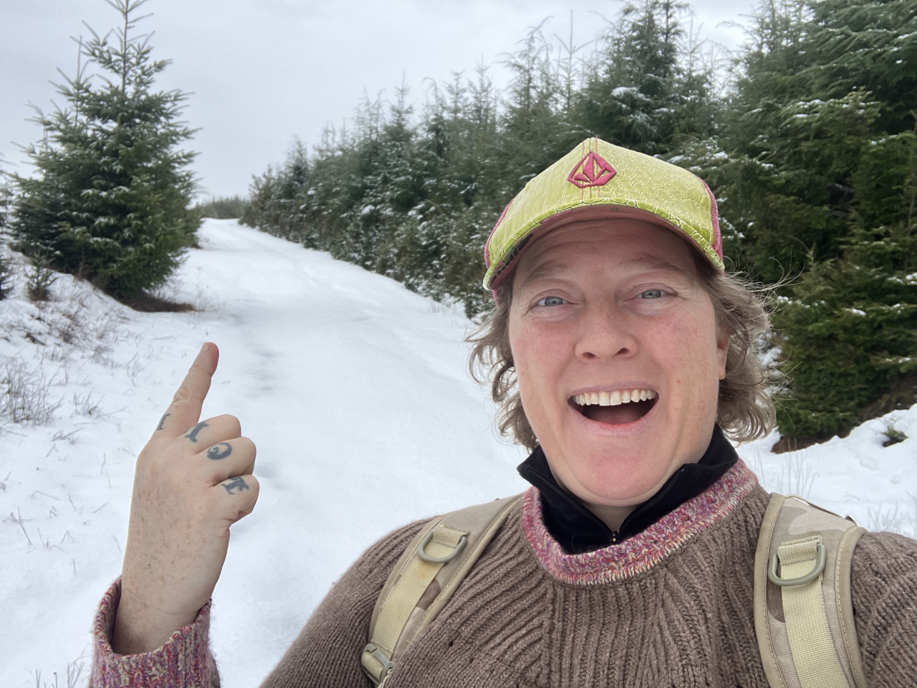
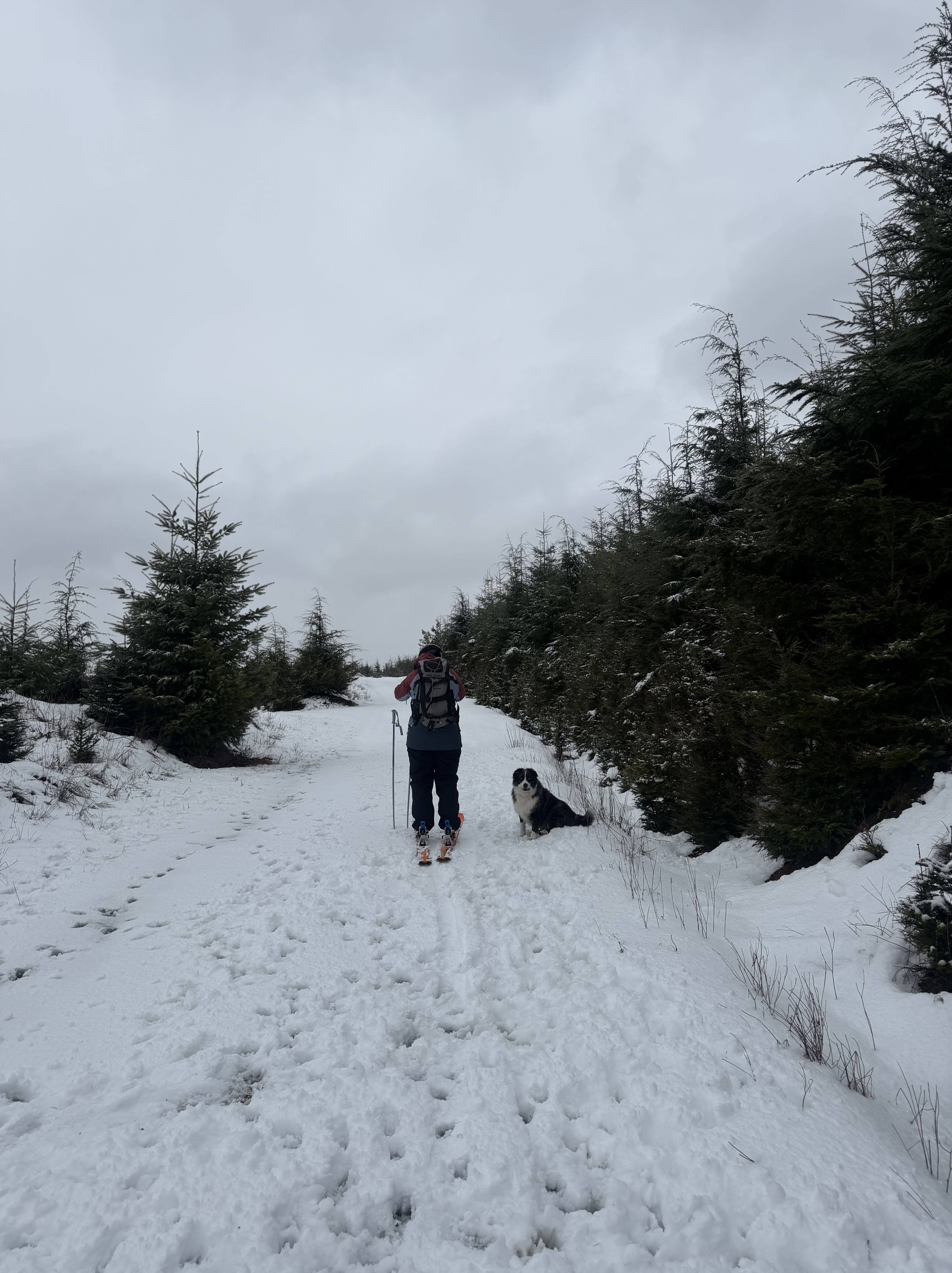
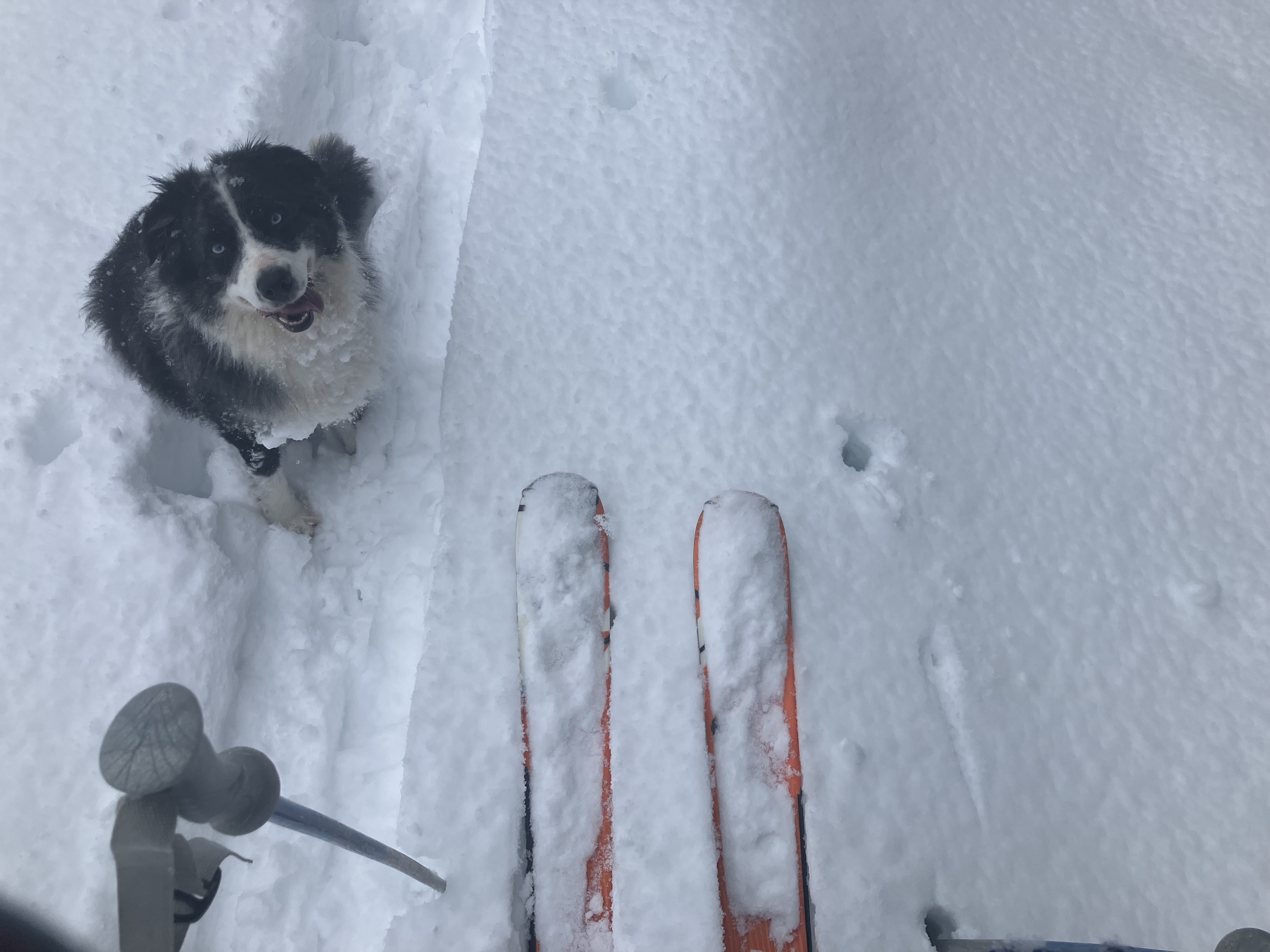
A new front of snow was moving in over the mountains to our north, and soon, the clouds banked against the slopes, releasing a new powder coating for our trail. Over 4500′ the deeper snow became a challenge for our pups, and Valentine was collecting some epic snowballs on her belly fur. My feet were also reminding me of why I don’t do a lot of skinning up hill any more. At the point where I lost complete circulation in my right foot, I called it, and my ski buddy and I turned back towards the truck and took off our skins for the fun ride back down. Admittedly, the pain in my feet made it hard to revel in the ski down, and I’ll be sure to snowshoe up next time. My back country snow gear is also a bit outdated, with a pair of big powder skies I bought a decade and a half ago. The kit worked well though, my aging feet just didn’t take to the tight boot without an orthotics, something my podiatrist had warned me about in recent years. An old fútbol americano injury from high school has created some limitations to my extreme sport activity. It does not prevent me from enjoying a bit of winter sport from time to time. Fresh powder can be limited here in The Pacific Northwest, so when it’s here, go for it.
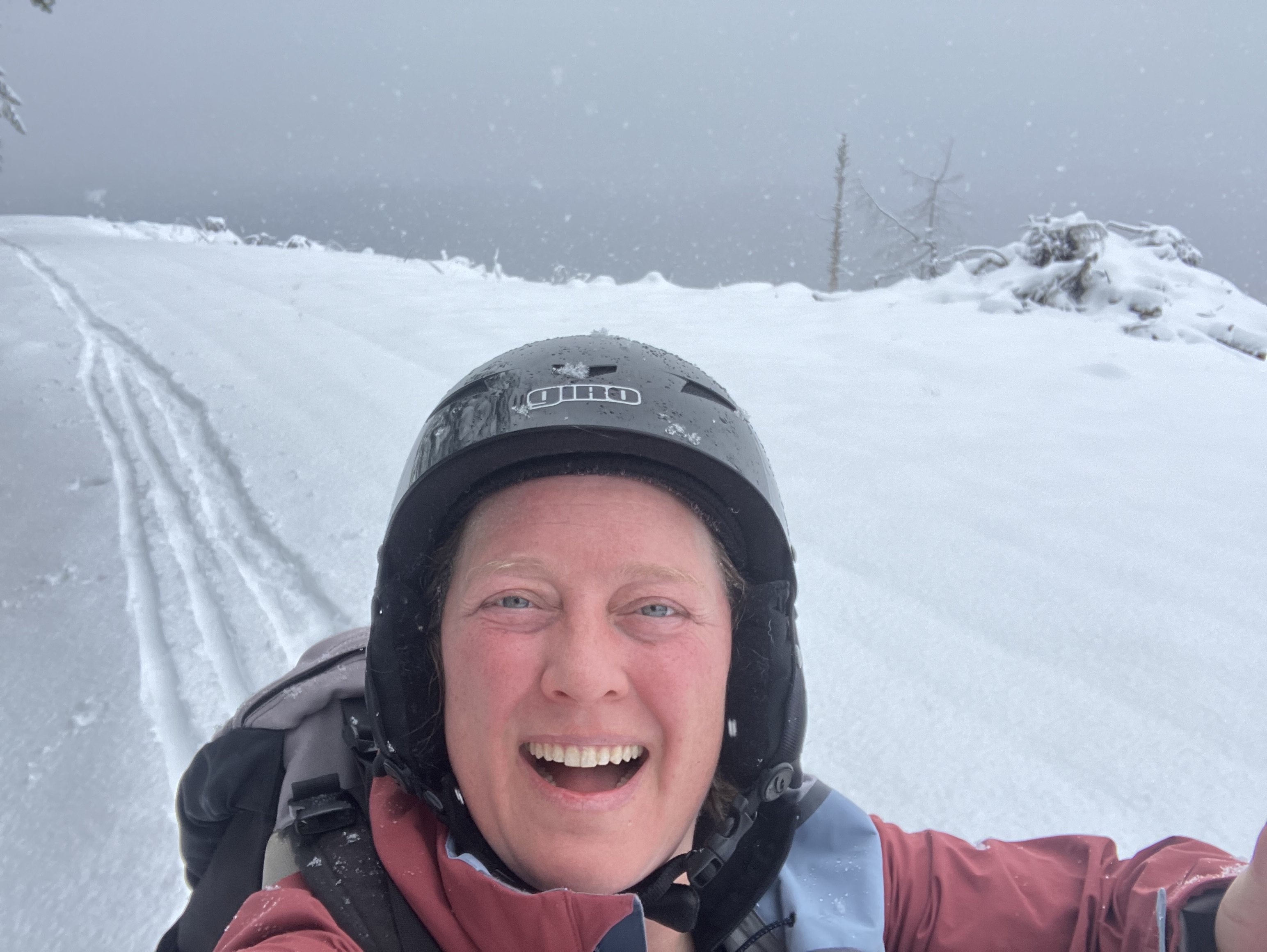
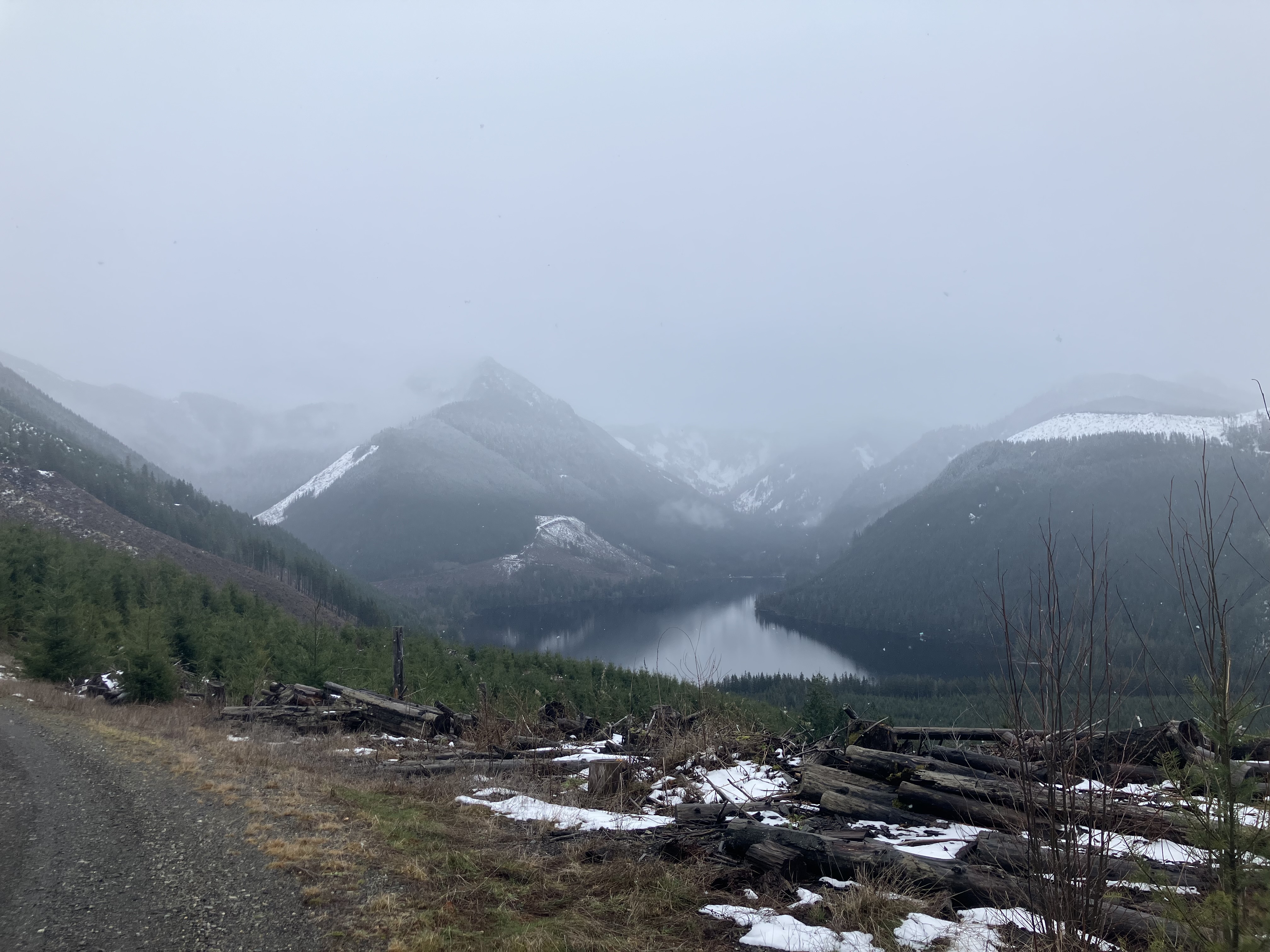
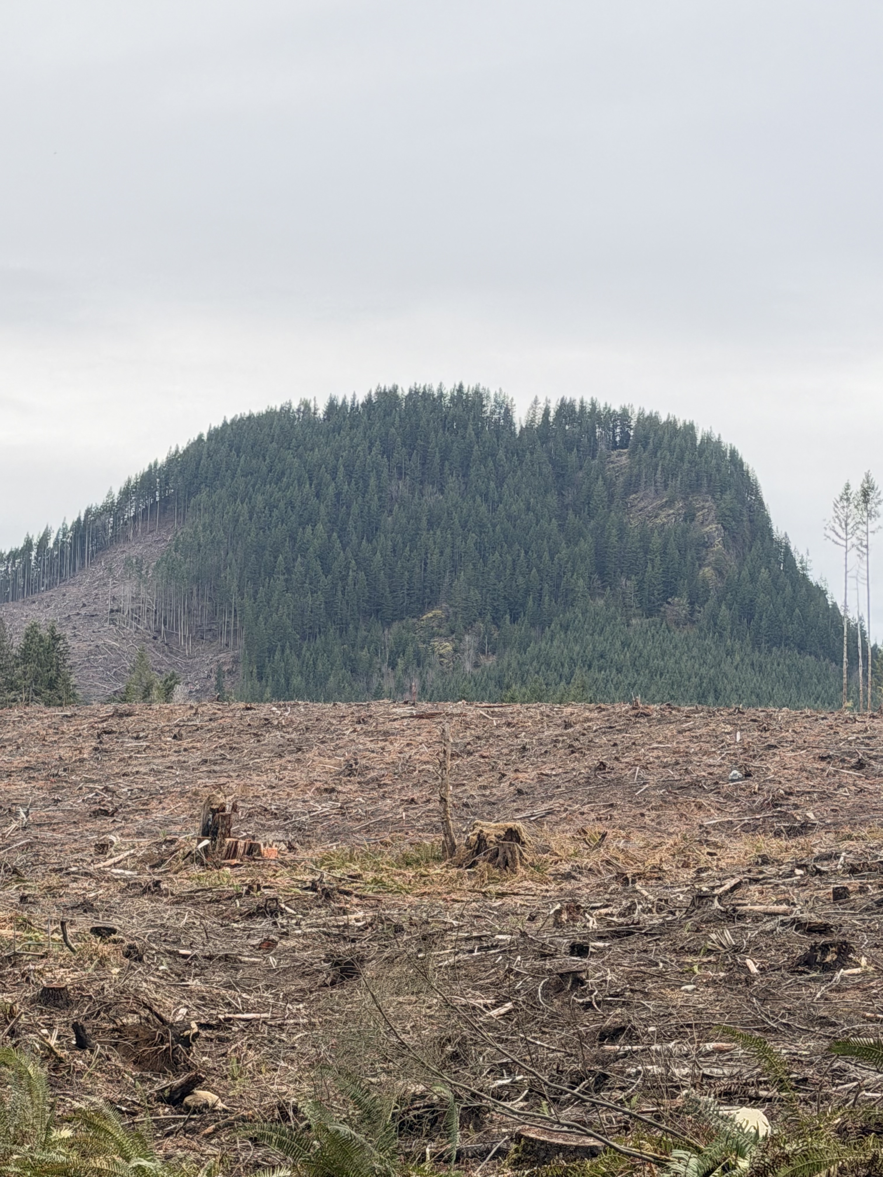
Our heads got a dusting as the elevation weather continued to bring snow. Our cruise back down the mountain a success, we packed up and headed back down, below cloud level. Timing had been perfect, we got in a good run before the weather socked in, and had enough time after our physical endurance tour to drive casually and take note of the beautiful evergreen scenery where temperate weather held the snow at bay. It was not raining at lower elevations, which was a little bit of a surprise, but inversions like this are common in winter. We could have packed a couple of fishing poles with us and wet a line, but instead, we saved some of the fun for another overcast day. Our time in the snow had wiped us just enough to enjoy the lookie-loo journey. As we headed back the the gate, our horizon opened up with a dramatic aspect of Mt. Fuller. It’s part of the traditional lands of The Snoqualmie People, in a region they call, The cək’ʷdup ʔə tiił sdukʷalbixʷ (Valley of the Snoqualmie). You can look at the regional map with place names made by the tribe here.
It’s good to know places, and their histories, especially ancient lineages of people who have lived here and thrived for tens of thousands of years. A special thanks to The Snoqualmie Tribe, as they continue to educate and help us new visitors about their sacred lands. When we recreate as guests in these places, it is good to give thanks to the people who have stewarded this land, lived with wilderness in deep connection, and continue to practice their relationship to the land to this day. By recognizing the strong ancestral histories of places we inhabit, we can become more closely connected too.
I’d also like to remind readers that back-country skiing is not something to do on a whim, without any knowledge of where you are going, potential threat to safety, and the proper gear. Not only do I have ski gear, I also have avalanche gear- like a probe, shovel, and beacon. I made a plan, shared it with a trusted contact back home, with clear timing on how long I’d be gone, and when I would return. I went with a buddy, who is avalanche trained, and also familiar with back-country skiing and safety protocol. We knew there was a mid-level threat of avalanche danger in our area, and took precautions in choosing our rout and access to avoid high danger areas. There are maps online to help you check before you go. Always have a plan and take a buddy if you can!
