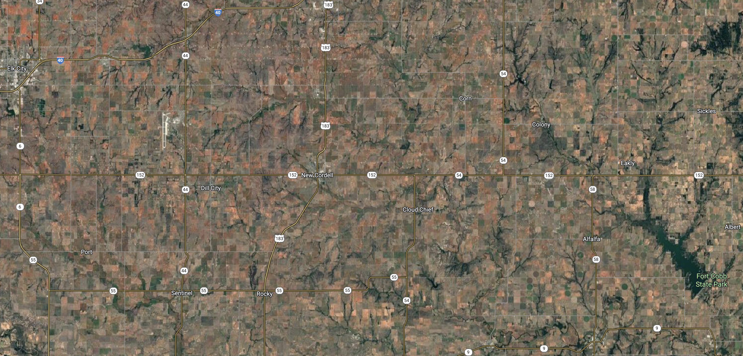
Satellite mapping is incredible. It’s been a great way for me to visually grasp landscapes, ecosystems, and terrains on a level only recently possible to modern humans. I’ve always looked out the window on flights- when lucky enough to get the seating, and have a strong familiarity with central plains farmland, as pictured above. The 160 acre squares are common in Oklahoma, and many other states where land allotments were granted in the late 1800s–early 1900s. Why 160 acres? The National Park System can answer that-
Homestead claims were made based on the rectangular survey system, which is still used in the United States today. This system surveys and organizes land based on the 640-acre section, also known as one square mile. The 160 acre homestead comprised one quarter-section of a square mile. When Congress passed the Homestead Act in 1862, the technology of the day was still primitive enough that 160 acres was thought to be the maximum amount of land a family could realistically farm. As time went by and more settlers came searching for land to claim, homesteaders had to go further west to find plots still available. This forced them to go to areas where the climate made farming much more difficult and 160 acres was not enough for a viable homestead. As a result, Congress passed several additional homestead laws allowing claimants in certain parts of the country to acquire more than 160 acres.
Even the property of EEC Forest Stewardship is marked out on the title and legal description based on the surveyed quadrant. All land in The United States is labeled this way, so we’re already grided out, even in The National Parks. I think there is a pristine fantasy in our minds about the wilds of America, most of which are pictured in The West of the country. Yes, the west is wilder than the east in The USA, but that’s more topographic than anything else. Just look at west vs. east from satellite:
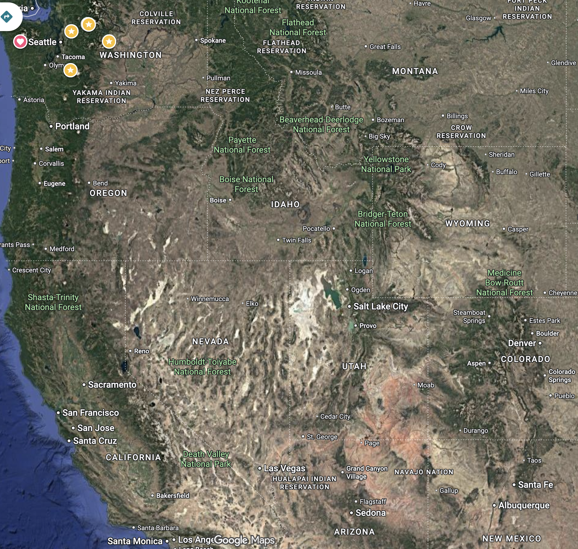

It may still be hard for you to see this, but there is an extremely different terrain and ecology on each side of our continent. Yes, our county spans a continent, which is not normal for most countries, we have a heck of a land mass we’re working with, which felt to settlers like an endless plane after they came over the Appalachian Mountains by the millions post Revolutionary War. England had not allowed it’s colonies to expand further west, understanding that Tribal People owned what was on the other side, but then General Washington promised troops 100 acres of Indian land as payment for service in the war- let’s not forget all the land already claimed by colonial powers was taken in the first place, so why not expand and have the rest? Manifest destiny right? Wrong! Manifest Pest is more like it. Oklahoma was homesteaded after it served as reservation lots for tribal people pushed out of the east and starved into submission. Tribes had been pushed out so many times by then, America thought nothing of taking what was left and squaring it out for settlement, because there was so much space, why not?
Even back in New England, the land was carved time and time again to suit development. In New York State, where once Patroons ruled 16 mile stretches of river, yeoman farmers plowed up 60, 80, and 100 acre parcels for family farming. These more elongated grids are still visible from above.

Then in that post revolution era, the 160 acre homestead lot took shape, and in The Ohio River Valley, a wave of colonial gridlock appeared- nearly overnight.

Down in Southeaster America, the pine lands were a little more hilly and wet, but carving apart the landscape is still clearly evident, our scabs netted across the earth, cutting apart the natural environment to fuel expansion and abuse of our finite resources that has proven madness.

During The Dust Bowl, more waves of humanity fled their own undoing in my home state, to the sugar bowl in California, Oregon and Washington. The Sunshine State is grided out in a very familiar pattern, and we’re back to bottom land agricultural dominance. This time woven in with fracking industry, which also dots the landscape of oil rich portions of our nation.

Those undeveloped flanks of The Central Valley are craggy desert hillsides, not suitable for grazing or planting. But these grids somewhat pale in comparison to the checkerboard system embraced by northern California, Oregon, and Washington States.


By then, the railroads were connecting the coasts with transportation to ship all the wonderful, endless natural resources out of the inland and into the pockets of investors, a few already wealthy white men, who took this whole continent, including Canada and Mexico- not to mention Central and South America, into complete exploitation for personal greed. That’s so vast, I know you’re still trying to figure out this pattern, but it’s as plain at a cleared checkered board- consumption.
Washington likes to call it’s self The Evergreen State, but the pimples are showing through. We blight our forests with continual cutting, monoculture replanting, and the application of both “treated” biosolids (human shit), and chemicals like herbicides and pesticides to keep the trees growing up while the native flora and fauna are killed off in mass genocide. When a Native Person once pointed out to me that their people have been surviving apocalypses since White Men first came to these shores, the message starts to ring true.
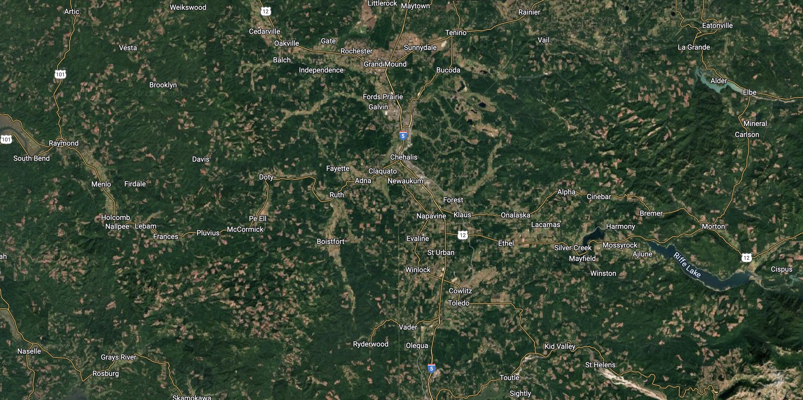
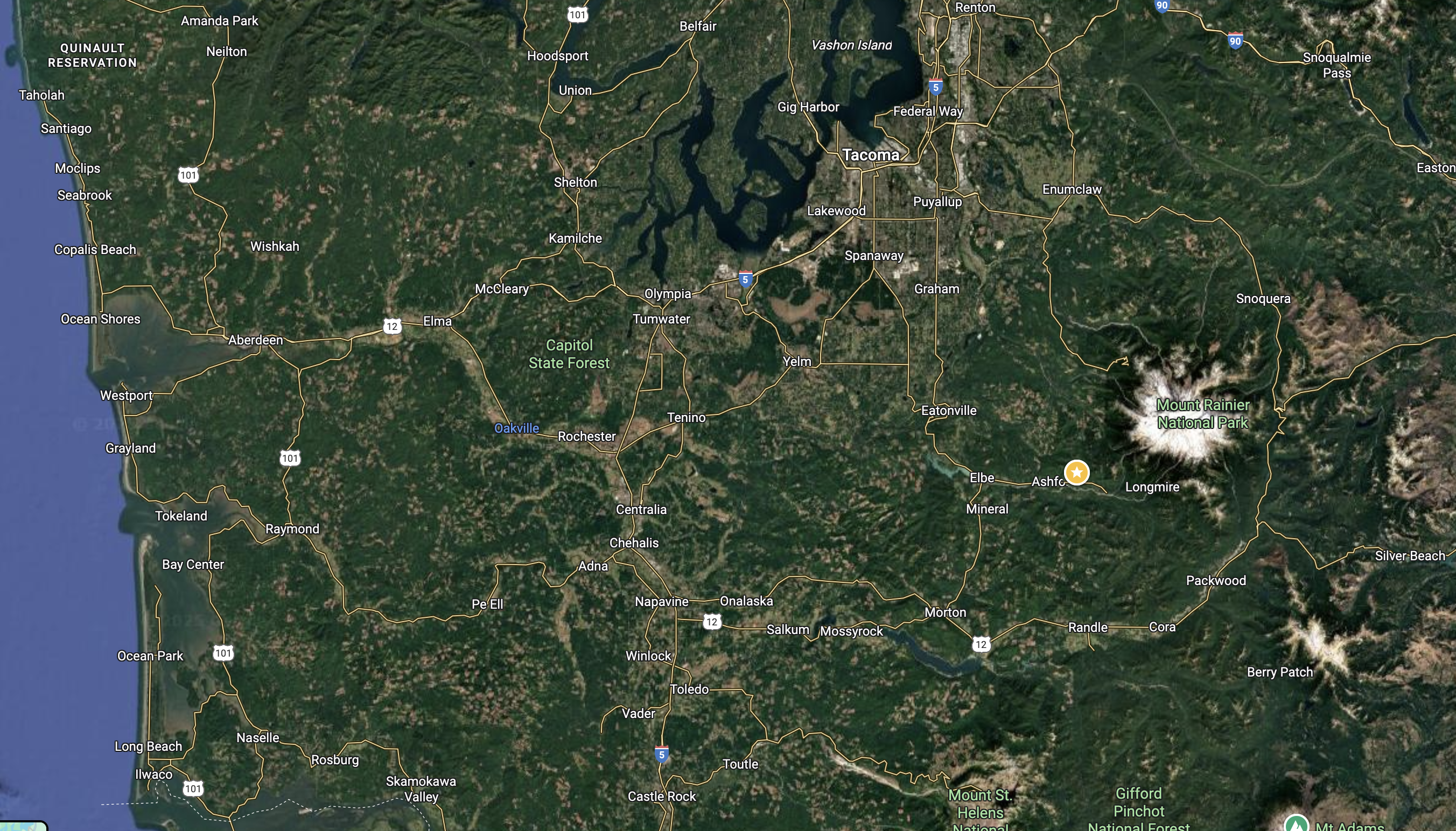
I’m still trying to help us see the vastness of colonial and colonial legacy settlement in America. Below is a satellite photo of south-central Washington State. It’s an area comparable to Massachusetts, Connecticut, and Rhode Island combined. You can still easily see all the clear cutting pockmarks across the landscape, and don’t think the green areas are pristine woodlands- they are monoculture plantations with no wilderness left for most of the mega fauna that once roamed in the millions throughout this landscape. White settlers came and cut it, burned it, lay track, bulldozed, fenced, and mined the skin of this earth in a similar way men abuse woman to this day. I’m calling it out, that’s for sure. Drill baby drill? Grab em’ by the Pussy? Anyone?
This legacy of consumption, conspicuous consumption, is written across our landscape, and EEC Forest Stewardship folds right in. The dairy farms of The Snoqualmie Valley, the logging camps, railroad, removal of First Nation People- it’s all here in much the same way it is on The East Coast, and that visual scar of gridded insanity lives on in the shape of all our square homes, square rooms, square screens, and square boxes we eagerly await at our doors. Just in time for the holidays!

P.S.
The day after completing this writing, NPR had a story about actual gridlock and how traffic is at a record high, leading to more commuting hours in our lives. I’ve experienced this personally living in King County, even at the furthest reaches of its boarders. Duvall is a bedroom community for workers in and around Seattle, including Bellevue and Redmond, the cities built by Microsoft. The tech industry put Seattle on the map, along with timber and mining. We’re about 45 min from the city by car with no traffic, but because of the congestion that continues to build, it can be a commute of 2-3 hours. Yes, there is an effort to expand more public transit, like light rail and ride share vehicles, the fact that there are too many of us continues it’s shockingly absent stint in our collective consciousness. When do we say “enough!”? When do we draw our own boundaries around consumerism? When do we stop? Then I ask, “What can I produce?”. Rather than always assuming another generation is the most important thing for each of us to produce, we’re getting the memo that many of us just should not breed, and instead, grow ourselves in other gifts to help the generations to come- and not just humans. What if the old adage, “for my family, for the future generations, and for those to come” actually embraced all the future life on earth, not just one species? Perhaps gauging to that measurement would help with solving most of our current social, economic, and psychological challenges today.
